Map Information:
|
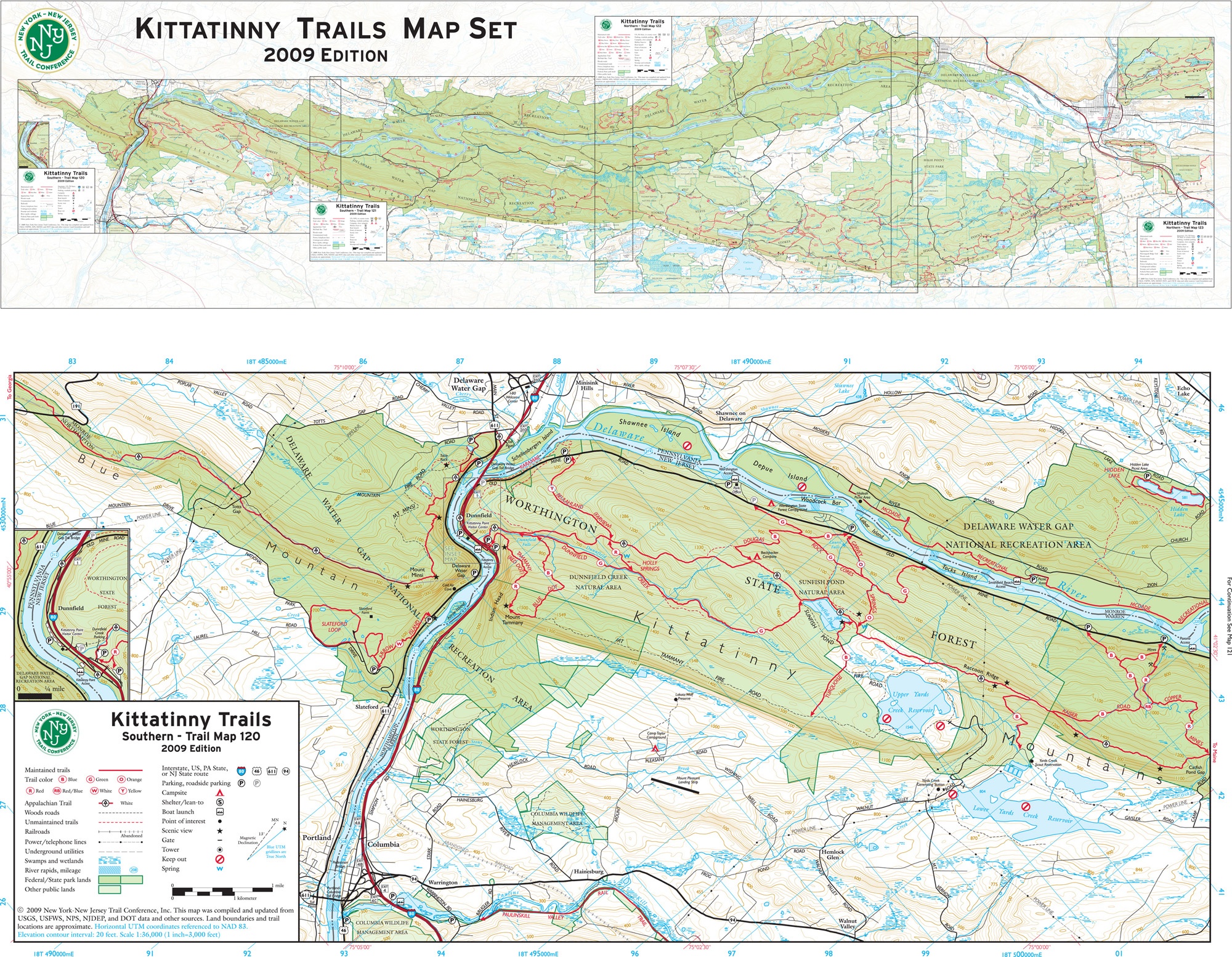
Map Title: |
Kittatinny Trails Map Set 2009 Edition |
|
Name(s) of Author(s): |
Jeremy Apgar |
|
Organization: |
New York-New Jersey Trail Conference |
|
Email Address: |
apgar@nynjtc.org |
|
Software Used to Make Map: |
ESRI ArcGIS, Adobe Illustrator, Avenza MAPublisher |
|
Data Sources: |
USGS, National Park Service, US Fish & Wildlife, NJ DOT, PA DOT, NY Office of Cyber Security and Critical Infrastructure, Delaware River Basin Commission, NJ DEP, Sussex County Office of GIS |
|
Map Description: |
"Kittatinny Trails" is a four-map set showing trails along the Kittatinny Ridge in northwestern New Jersey. More than 50 miles of the Appalachian Trail are included, along with sources of drinking water, shelters, side trails, viewpoints, parking areas, and much more. New York-New Jersey Trail Conference volunteers spent nearly 500 hours walking the trails to collect accurate trails data. The base map data were organized in ESRI's ArcView 9.2, but the final maps were produced entirely in Adobe Illustrator using Avenza's MAPublisher plug-in. The Trail Conference produces similar maps for other major parks in the New York metropolitan area. |