Map Information:
|
Map Title: |
Model Builder Application to Estimate Future Wastewater Flows and Septic Units |
|
Name(s) of Author(s): |
Dave DuMont |
|
Organization: |
NJDEP |
|
Email Address: |
H.David.DuMont@dep.state.nj.us |
|
Software Used to Make Map: |
ArcMAP |
|
Data Sources: |
NJDEP, Municipal Data |
|
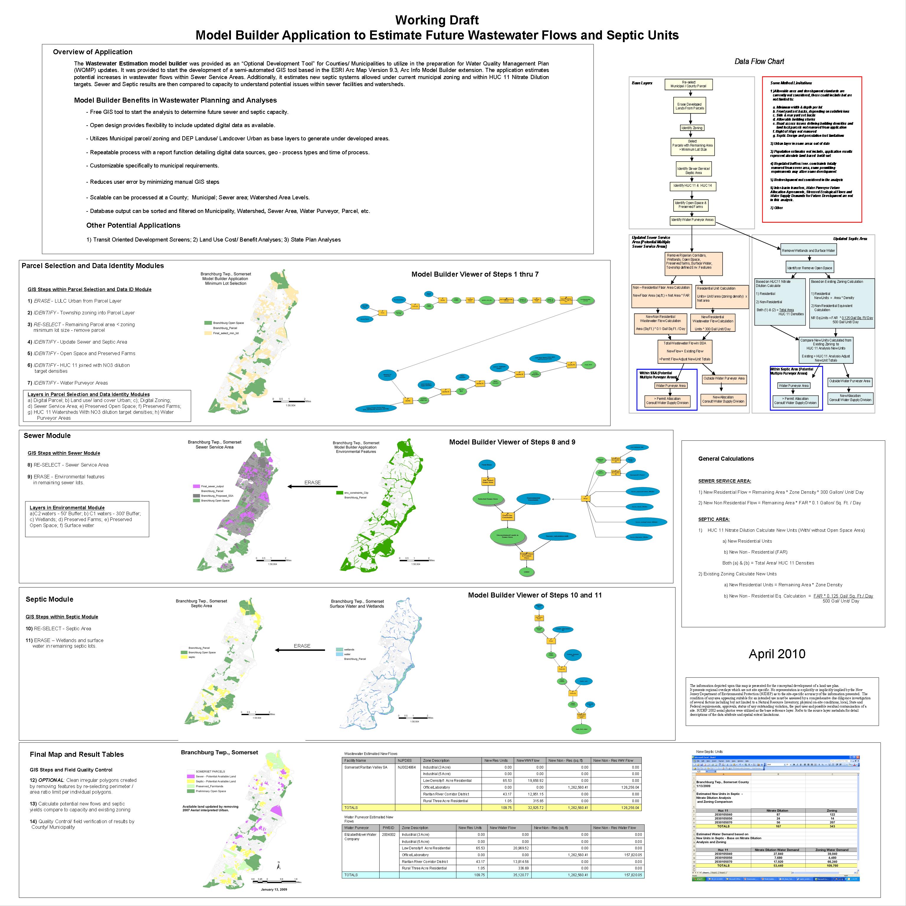
Map Description: |
The Wastewater Estimation model builder was provided as an “Optional Development Tool” for Counties/ Municipalities to utilize in the preparation for Water Quality Management Plan (WQMP) updates. It was provided to start the development of a semi-automated GIS tool based in the ESRI Arc Map Version 9.3, Arc Info Model Builder extension. The application estimates potential increases in wastewater flows within Sewer Service Areas. Additionally, it estimates new septic systems allowed under current municipal zoning and within HUC 11 nitrate dilution targets. Sewer and Septic results are then compared to capacity to understand potential issues within sewer facilities and watersheds. |