Map Information:
|
Map Title: |
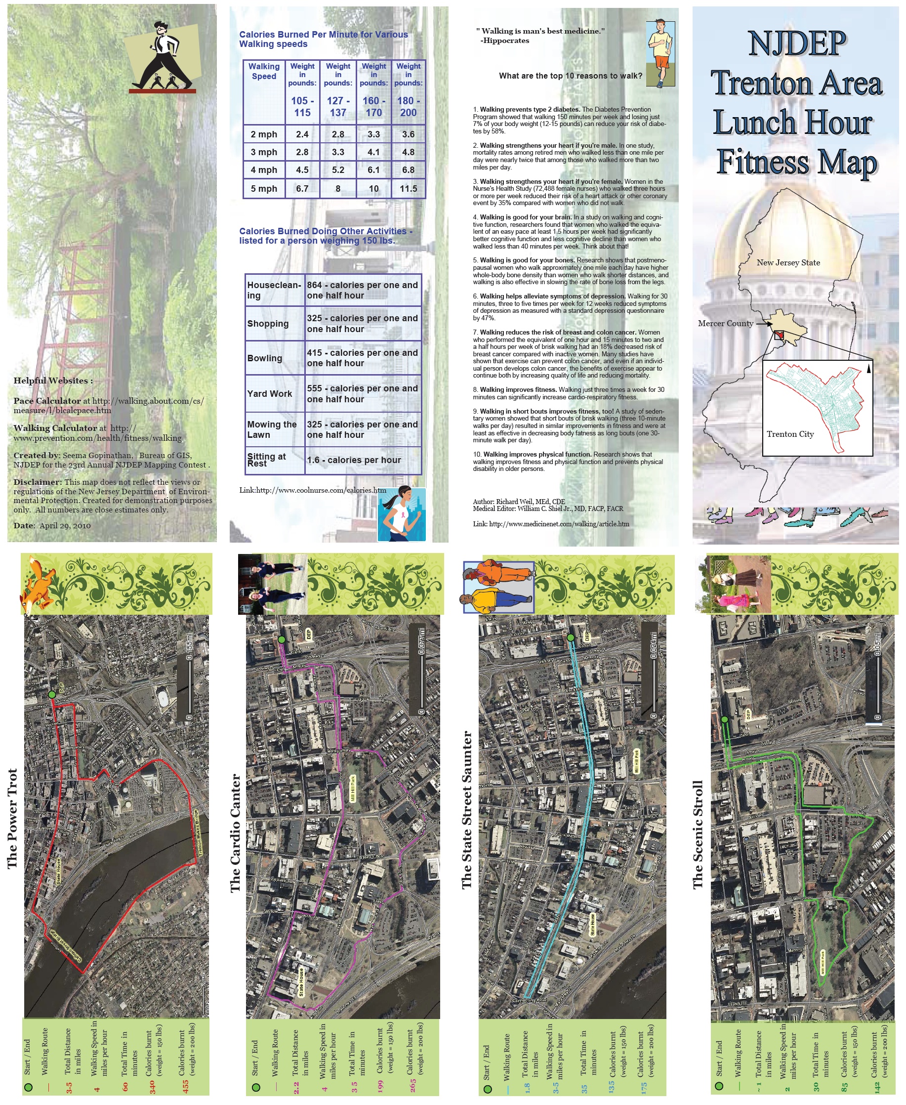
NJDEP Trenton Area Lunch Hour Fitness Map |
|
Name(s) of Author(s): |
Seema Gopinathan |
|
Organization: |
NJDEP Bureau of GIS |
|
Email Address: |
seema.gopinathan@dep.state.nj.us |
|
Software Used to Make Map: |
NJ-GeoWeb, ArcMap, Publisher 2003, PowerPoint, Word2003, Pace Calculator app, Calorie Calculator app |
|
Data Sources: |
NJDEP, NJOIT, Internet sites |
|
Map Description: |
The NJDEP Trenton Area Lunch Hour Fitness Map is a local interest map in the form of a pamphlet meant for the employees of the New Jersey Department of Environmental Protection depicting the four most popular lunch hour walking routes around Trenton. Each of the routes begins and ends at the DEP building. Depending on the walker’s fitness level and time available, they can determine which route to take. The map shows how long each route is (in miles), the time it would take for an average walker to complete the walk, and the approximate number of calories burned based on a given pace and the weight of the individual. Also included are helpful charts and websites for walkers and a list of the many benefits of walking regularly. |