Map Information:
|
Map Title: |
Cape May County Inventory |
|
Name(s) of Author(s): |
Hany Hanafy |
|
Organization: |
Rutgers Junior Landscape Architecture Studio |
|
Email Address: |
hany31087@hotmail.com |
|
Software Used to Make Map: |
GIS, Photoshop, Illustrator |
|
Data Sources: |
NJDEP, USGS, US Census |
|
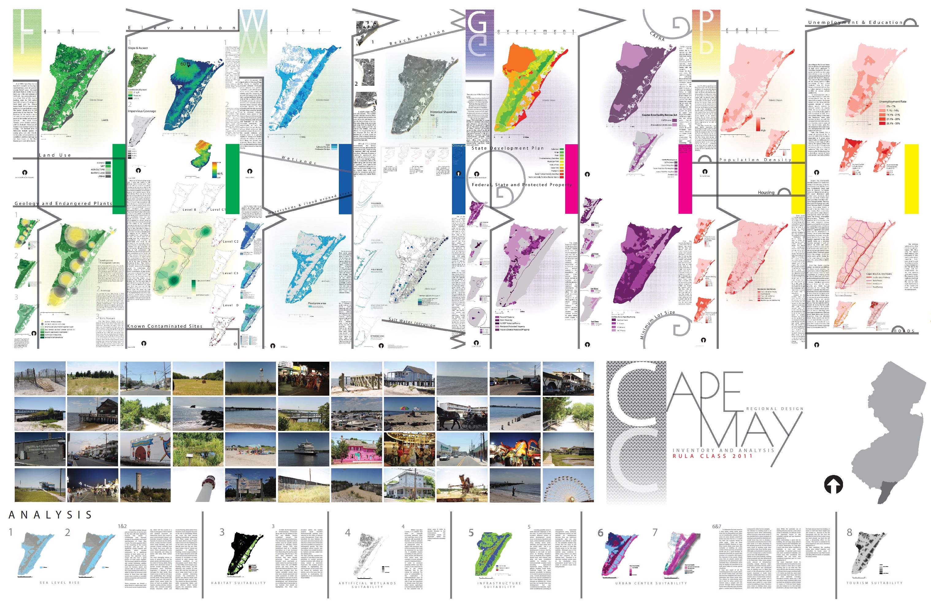
Map Description: |
In the fall of 2009 the Rutgers University Landscape Architecture class of 2011 explored multiple design interventions that addressed climate change and sea level rise scenarios in Cape May County, New Jersey. This poster illustrates the initial inventory and analysis completed early in the semester as we collected research on the region. The concept for the poster was based off a retro 1980’s summer beachwear theme that attempted to structure the information gathered in a method that moved gradually from the interconnected inventory to the combined analysis. The final board was 16’ by 10‘. |