Map Information:
|
Map Title: |
Foreclosure Crisis in The Capital City |
|
Name(s) of Author(s): |
Anne Marie Kappus |
|
Organization: |
City of Trenton Dept of Housing and Economic Development |
|
Email Address: |
akappus@trentonnj.org |
|
Software Used to Make Map: |
ArcView |
|
Data Sources: |
The City of Trenton and Mercer County Sheriff Department |
|
Map Description: |
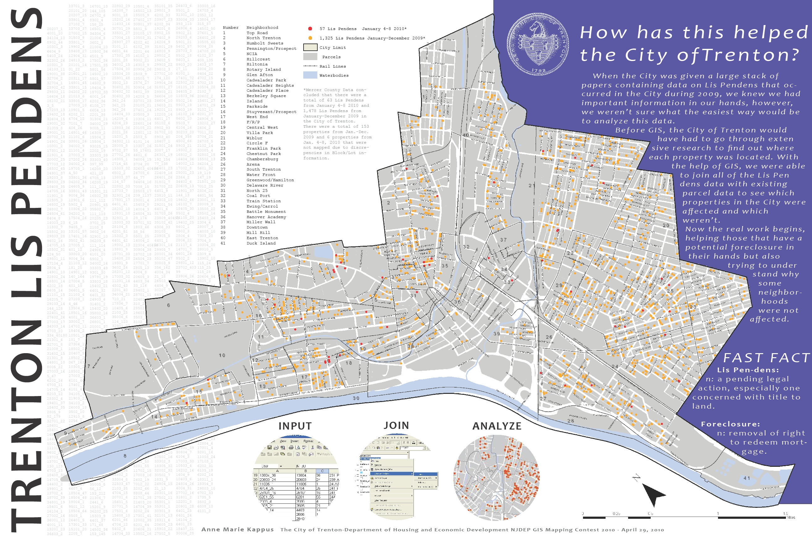
When the Mercer County Clerks office gave Trenton’s City Hall a stack of papers of Lis Pendens (Latin for suit pending) from 2009 to January 2010, we knew we had important information in our hands and that we had to act quickly to understand who was being affected by this potential foreclosure epidemic. After inputting the data (all 1,541), we joined it with an existing parcel point data layer and were then able to begin the analysis. We were then able to see where the Lis Pendens are and began asking questions that we would not have been able to if it wasn’t for the map making software. Why are some neighborhoods affected more than others? Why are there tight clusters in one area and not in another? With the help of GIS, we were able to begin to understand the data in a way we would not have otherwise have been able to and begin the work towards building the Capital City back up to its full potential. |