Map Information:
|
Map Title: |
Greater Philadelphia Food System |
|
Name(s) of Author(s): |
Kimberly Korejko |
|
Organization: |
DVRPC |
|
Email Address: |
kkorejko@dvrpc.org |
|
Software Used to Make Map: |
ArcMap, Adobe Illustrator, Microsoft Excel |
|
Data Sources: |
USDA NRCS, USGS, DVRPC, ESRI, BLS, USDA NASS |
|
Map Description: |
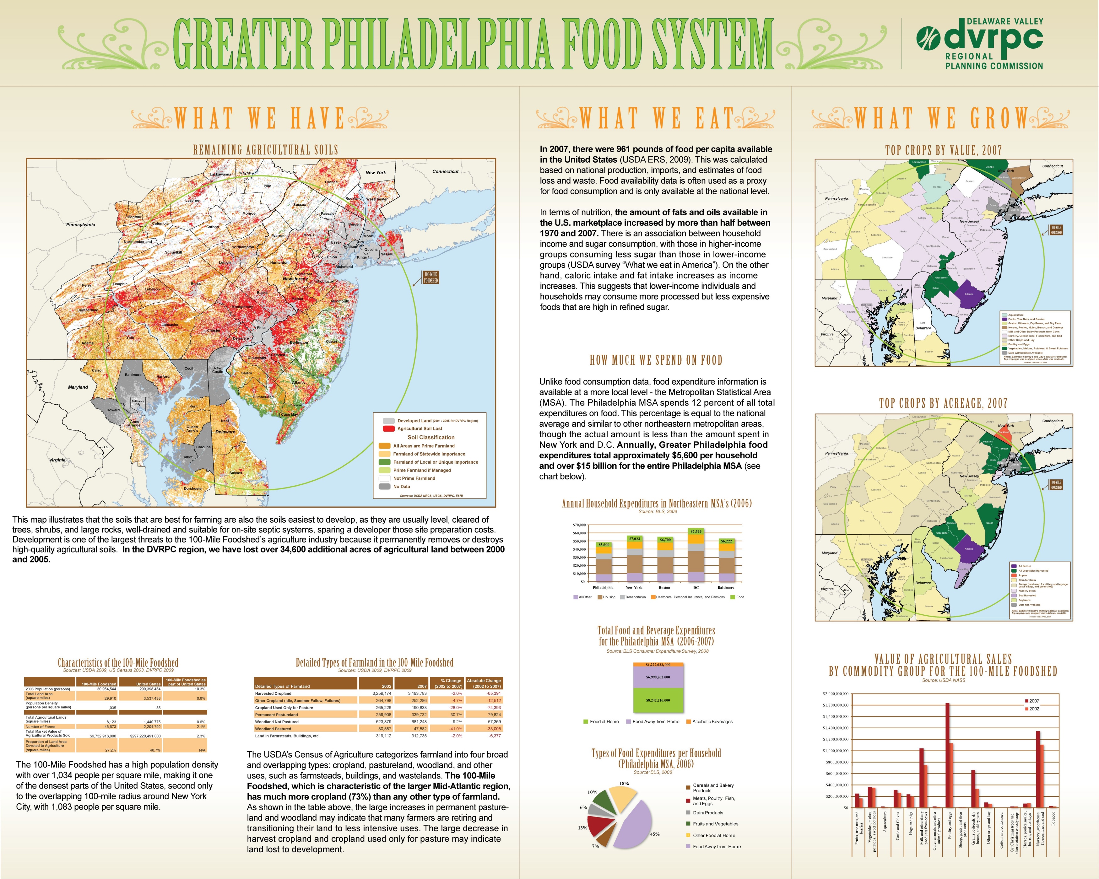
DVRPC recently completed a study that evaluates the Greater Philadelphia Food System. This study looks at a broad range of food supply issues, such as agricultural production trends, natural resource constraints, the origins and destinations of food imports and exports, and the significance of the food economy. For the purposes of this study, DVRPC defined the study area as a 100-Mile radius from a center point in downtown Philadelphia as the "foodshed" - the area in which Greater Philadelphia could theoretically source local food. The Greater Philadelphia Food System map highlights a portion of the findings from this study. ArcMap and Adobe Illustrator were used to create the end result. |