Map Information:
|
Map Title: |
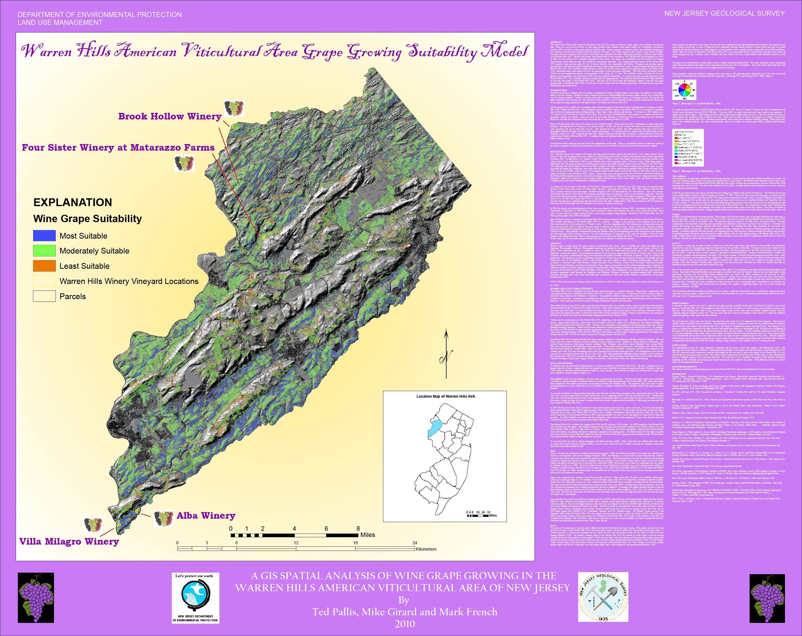
A GIS Spatial Analysis Of Wine Grape Growing In The Warren Hills American Viticultural Area of New Jersey |
|
Name(s) of Author(s): |
Ted Pallis |
|
Organization: |
NJDEP |
|
Email Address: |
ted.pallis@dep.state.nj.us |
|
Software Used to Make Map: |
ArcMAP |
|
Data Sources: |
NJDEP, NJGS |
|
Map Description: |
This map is based on elevation, slope, aspect, solar radiation and land use raster data. These five major physical factors of wine grape growing were modeled using a weighted overlay spatial analysis in a Geographic Information Systems (GIS) to produce a wine grape growing suitability map. The model provides an inventory of land suitability for growing wine grapes in the Warren Hills AVA. This data can be used by new and established vintners to find the best grape growing areas of the Warren Hills AVA. It could also be used to target areas for farmland preservation. Seven commercial vineyard locations were identified belonging to four wineries, all seven were located on land favorable for viticulture. Five of the vineyards were located on land classed as highly favorable while two vineyards were located on land which was moderately favorable. It is one of three AVA’s federally recognized in New Jersey. The region was recognized as an AVA because of its unique characteristics which make the area very suitable for wine grape cultivation. The complex geological history of the Warren Hills AVA shaped a wine growing region by way of diverse bedrock, soils, topography and climate. This map presents input data, methodology and model results. |