Map Information:
|
Map Title: |
Jitney Rider Map with Routes |
|
Name(s) of Author(s): |
Alex Grennor |
|
Organization: |
Rowan University Student |
|
Email Address: |
grenno41@students.rowan.edu |
|
Software Used to Make Map: |
ArcGIS, ArcMap, and Adobe Illustrator |
|
Data Sources: |
Tiger for Roads, Aerial Photography, and NJDEP Layer |
|
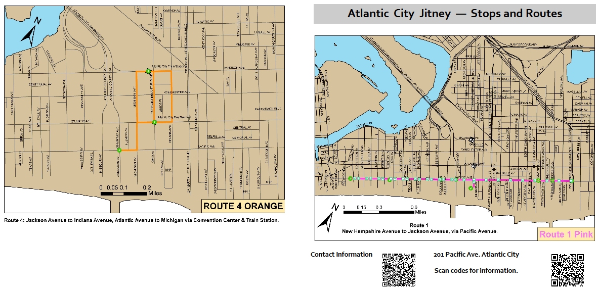
Map Description: |
If you Google Atlantic City Jitney, the websites shown have minimal information regarding bus stops.
The information appears as written information, not a rider map which is similar to what Patco Speedlines has for each stop. |