Map Information:
|
Map Title: |
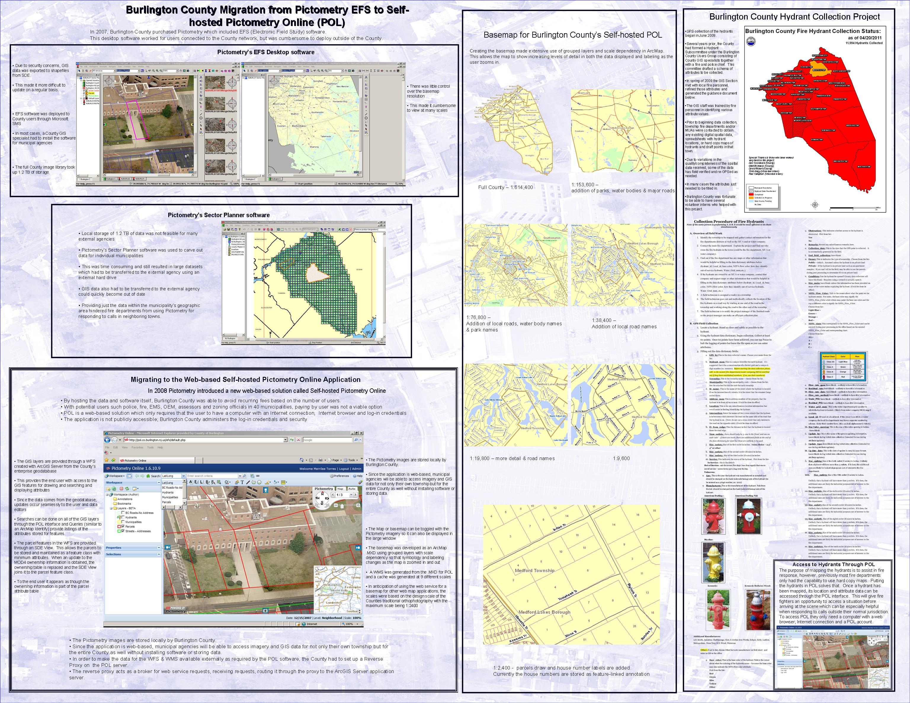
Burlington County Migration to Self-hosted Pictometry Online (POL) |
|
Name(s) of Author(s): |
Merrilee Torres |
|
Organization: |
County of Burlington, IT Department, GIS Section |
|
Email Address: |
mtorres@co.burlington.nj.us |
|
Software Used to Make Map: |
ArcGIS 9.3.1, ArcGIS Server 9.3, Trimble Terrasync, Trimble Pathfinder Office, Pictometry Online, Pictometry EFS, PowerPoint, MS Word, Adobe Acrobat |
|
Data Sources: |
State of NJ, OIT, OGIS - municipal boundaries; NJDEP - rivers, streams, lakes, open space; Burlington County - parcels, GPSed roads, fire hydrants |
|
Map Description: |
This poster shows software integration for both this display and overall set up of the Self-Hosted Pictometry OnLine (POL) application. It shows the EFS software and POL applications that we respectively migrated from and to. ArcMap and ArcGIS Server supply the GIS data layers overlaying the POL aerials (WFS) & the POL Basemap (WMS). Hydrants were GPSed using Trimble’s Terrasync software and processed with Pathfinder Office. The poster was made in PowerPoint using a POL aerial as a transparent background. The Hydrant collection methodology was originally a 7 page Word document, converted to PDF and then saved as 7 individual Jpg files for cleaner insertion into PowerPoint. |