Map Information:
|
Map Title: |
New Jersey's Large Scale Wind Turbine Siting Map |
|
Name(s) of Author(s): |
Patrick Woerner |
|
Organization: |
NJDEP, Division of Fish and Wildlife, Endangered and Nongame Species Program |
|
Email Address: |
patrick.woerner@dep.state.nj.us |
|
Software Used to Make Map: |
ArcGIS 10, Adobe Photoshop CS3, MS PowerPoint |
|
Data Sources: |
NJDEP LULC, NJ Biotics Database, NJDEP Cafra Boundary |
|
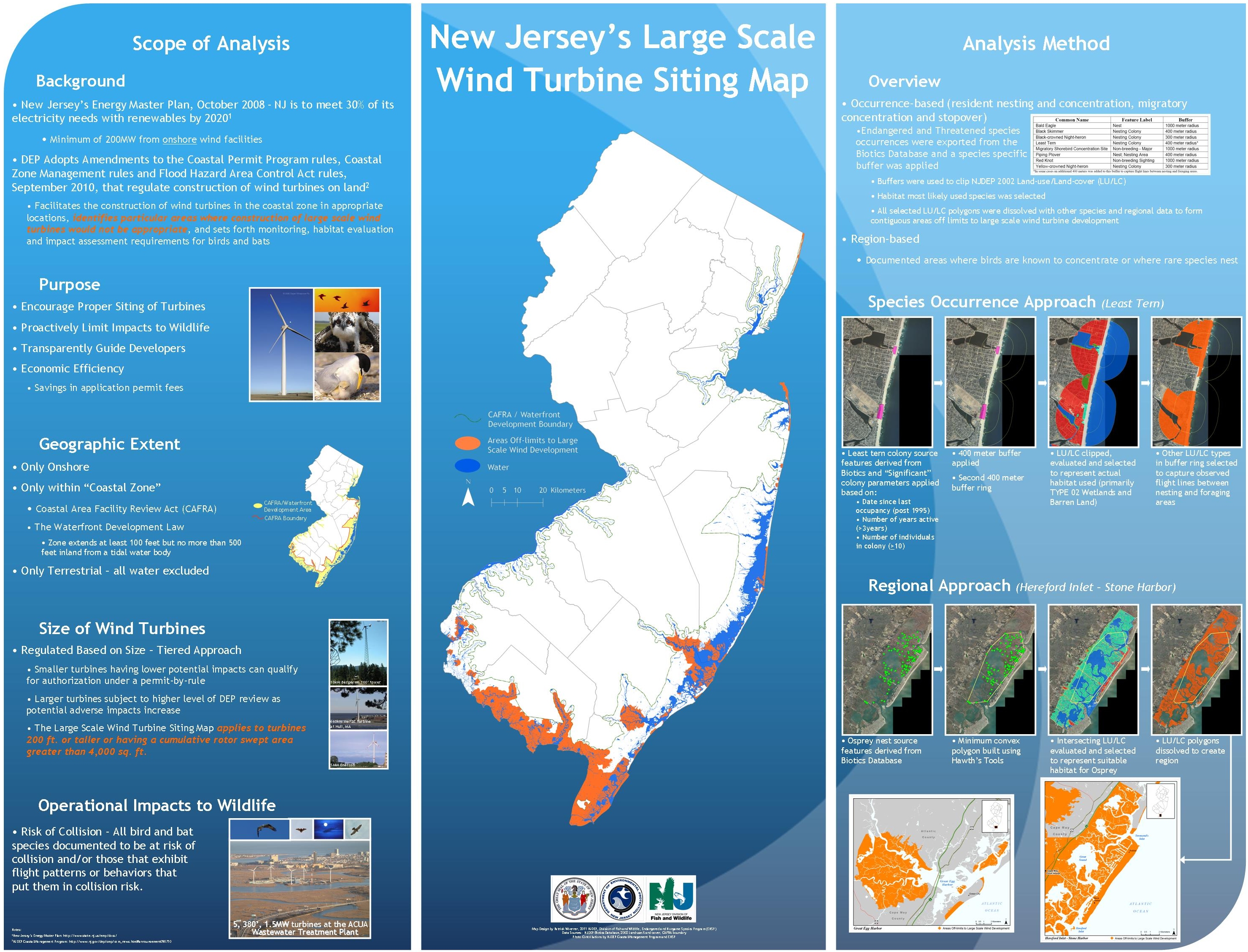
Map Description: |
DEP’s Endangered and Nongame Species Program evaluated land in the coastal zone and prepared the Large Scale Wind Turbine Siting Map to address the development and permitting of wind turbines. As the height and size of wind turbines increase, so does the potential for adverse impacts to both birds and bats due to the operation of the turbines. The Large Scale Wind Turbine Siting Map identifies specific areas where wind turbines 200 feet in height or taller or having a cumulative rotor swept area of greater than 4,000 square feet are unacceptable due to the operational impacts of the turbines on birds and bats. The species considered when delineating these areas were those documented to be at risk of colliding with wind turbines and/or those that exhibit flight patterns or behaviors that put them in collision risk. |