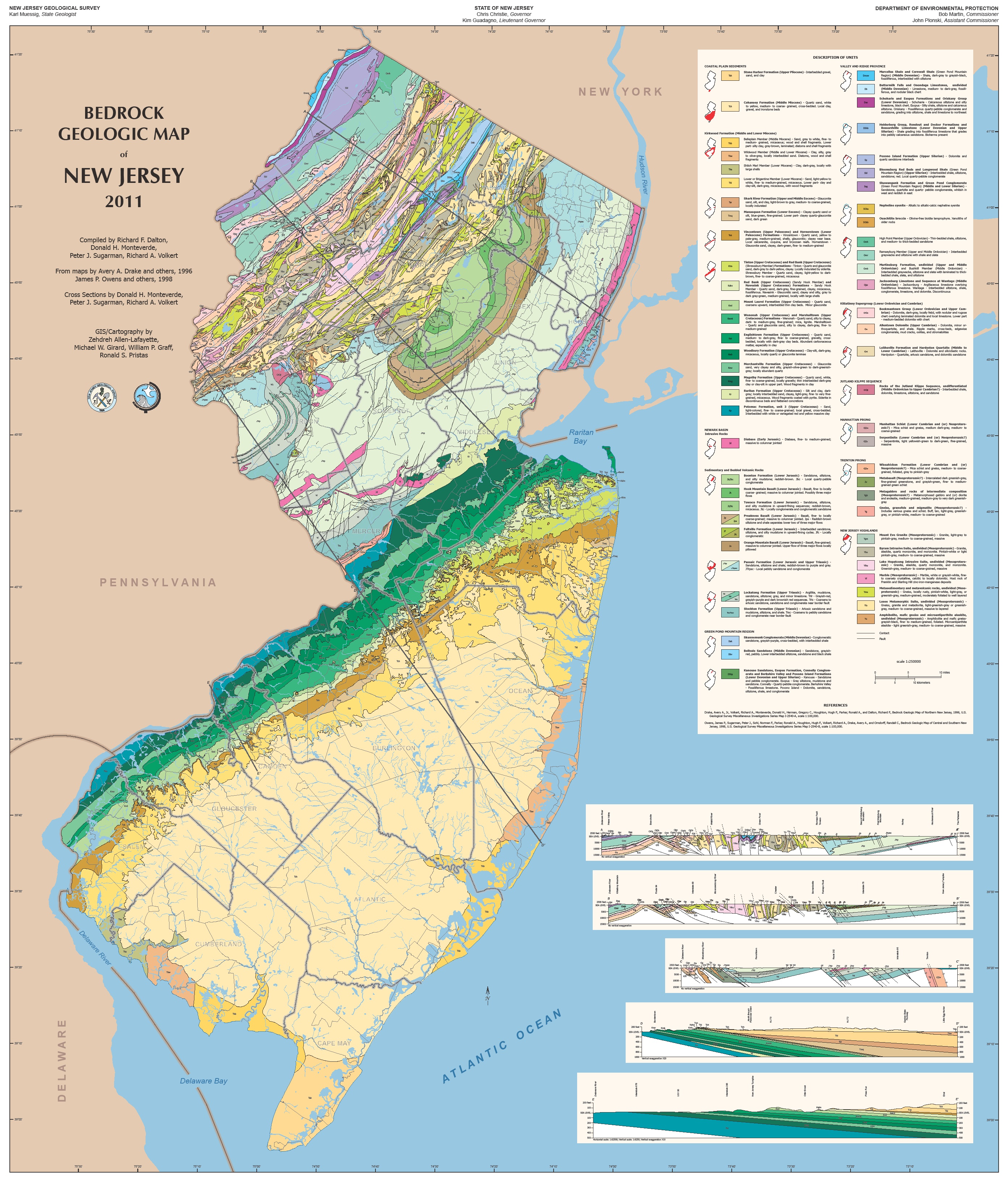
Map Information:
|
Map Title: |
Bedrock Geologic Map of New Jersey 2011 |
|
Name(s) of Author(s): |
Zehdreh Allen-Lafayette, Mike Girard & Ron Pristas |
|
Organization: |
NJDEP, New Jersey Geological Survey |
|
Email Address: |
Zehdreh.Allen-Lafayette@dep.state.nj.us |
|
Software Used to Make Map: |
ArcInfo, ArcMap, Adobe Illustrator, Adobe InDesign and WordPerfect |
|
Data Sources: |
The geologists (field work) and arial maps. |
|
Map Description: |
The New Jersey Geological Survey first published the 1:250000 Bedrock Geologic Map of New Jersey in 1835. It was so popular we rushed out a second edition in 1912, and now our third edition is being issued one-year ahead of the 1912 centennial and one-year after our 175th anniversary. |