Map Information:
|
Map Title: |
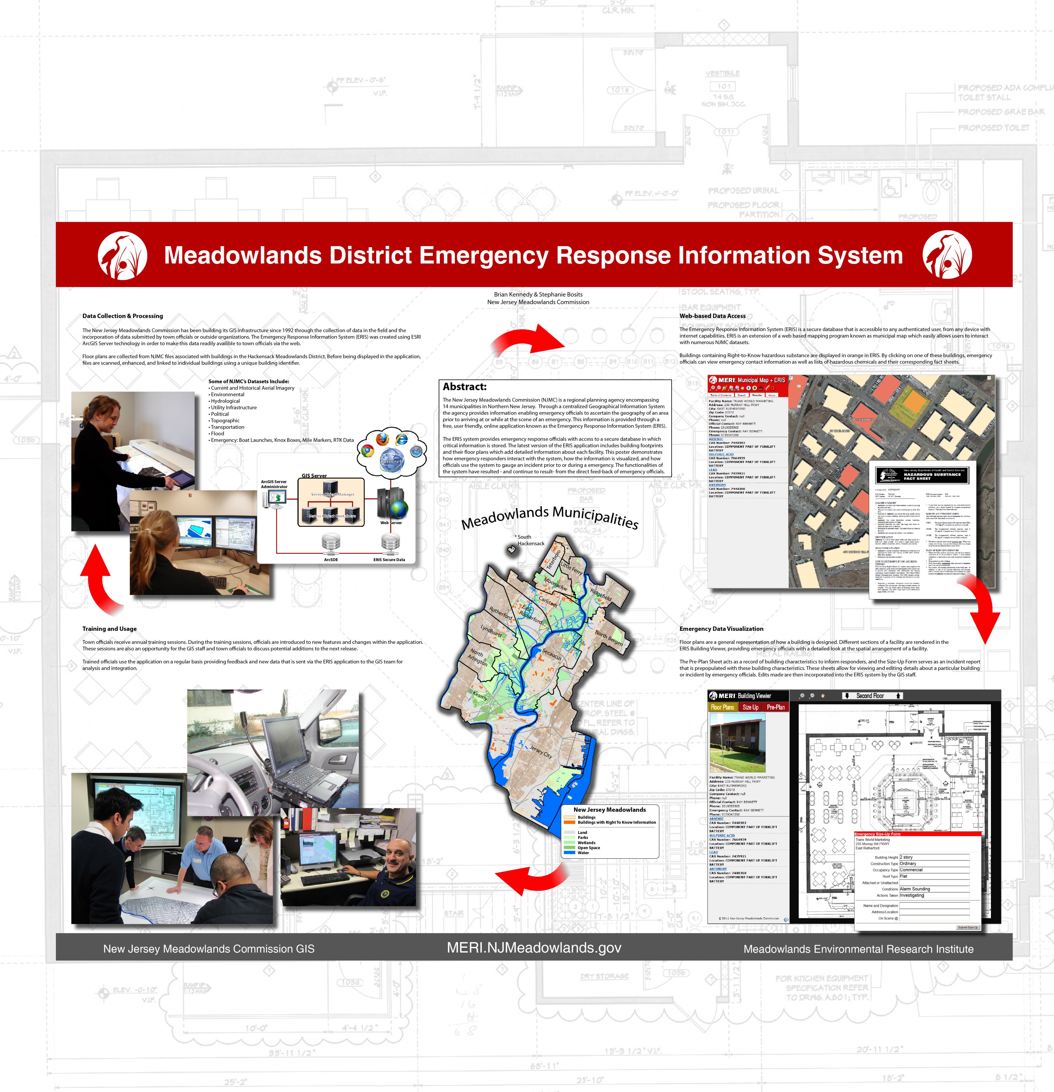
Meadowlands District Emergency Response Information System |
|
Name(s) of Author(s): |
Stephanie Bosits, Brian Kennedy |
|
Organization: |
New Jersey Meadowlands Commission |
|
Email Address: |
Stephanie.Bosits@njmeadowlands.gov |
|
Software Used to Make Map: |
ArcGIS and Adobe Illustrator |
|
Data Sources: |
New Jersey Meadowlands Commission datasets |
|
Map Description: |
The Emergency Response Information System (ERIS) is a free, online application that allows emergency officials to ascertain critical information about an area prior to or while at the scene of an emergency. Through a centralized Geographical Information System the New Jersey Meadowlands Commission (NJMC) provides ERIS users with complete data for 14 municipalities in Northern New Jersey. This poster demonstrates how NJMC datasets are incorporated into the application, how the information is visualized, and how emergency responders interact with the system. |