Map Information:
|
Map Title: |
Historic Boundaries of Camden County |
|
Name(s) of Author(s): |
Matt Lashendock |
|
Organization: |
Burlington County NJ GIS |
|
Email Address: |
mlashendock@co.burlington.nj.us |
|
Software Used to Make Map: |
ArcGIS 10.0, Adobe Acrobat 7.0 Professional, MS Excel and Internet Explorer |
|
Data Sources: |
Burlington County GIS, Rutgers Special Collections and Archives, Tele Atlas North America, & NJGIN Web Map Service |
|
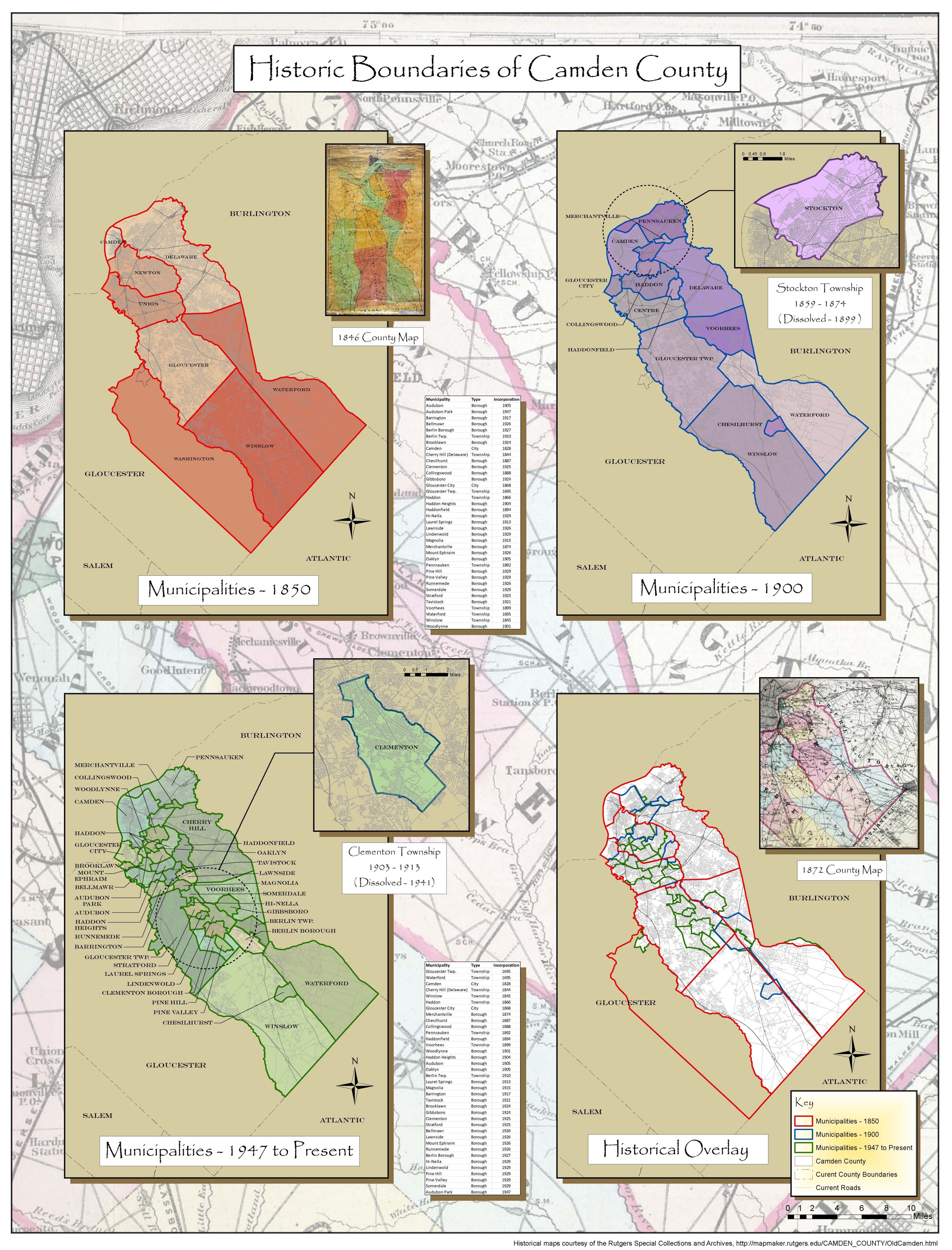
Map Description: |
During the late 19th and early 20th Centuries Camden County townships fragmented into ever smaller municipalities as small boroughs broke away from their parent townships. Three main maps here show snapshots in time during this transformation, in 1850 near the beginning of the process, in 1900, and in 1947, when the last new municipality was incorporated. Washington Township returned almost entirely to Gloucester County. The last of the main maps shows the various historical boundaries overlaid for comparison. Current streets are shown on all maps for modern day reference. Insets show two townships that were created and dissolved during this time. |