Map Information:
|
Map Title: |
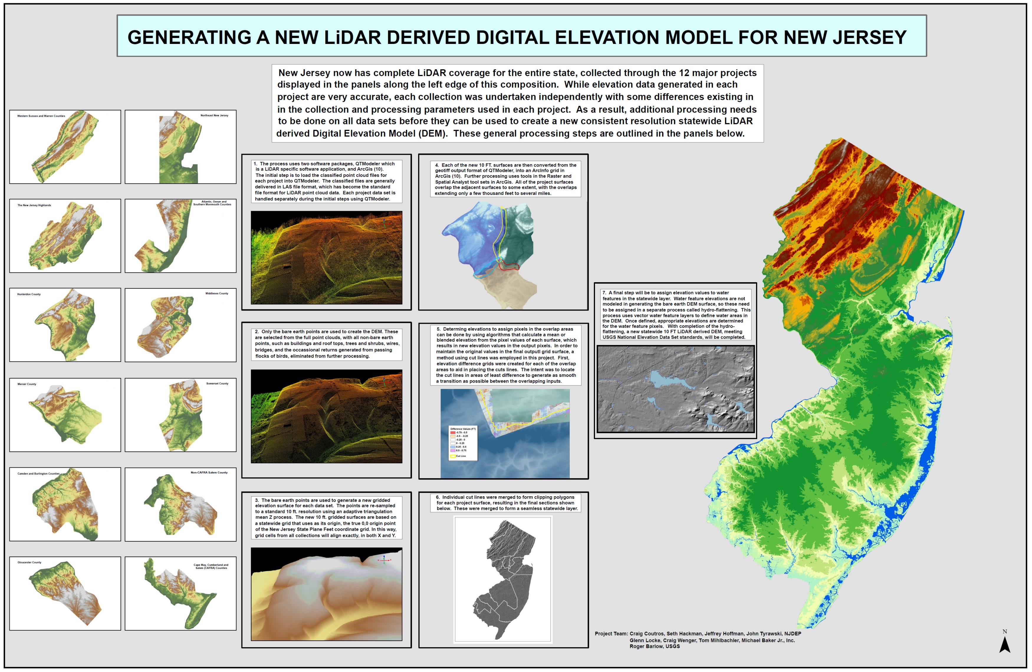
Generating a New LiDAR Dirived Digital Elevation Model for New Jersey |
|
Name(s) of Author(s): |
John Tyrawski, Craig Coutros, Seth Hackman |
|
Organization: |
NJDEP |
|
Email Address: |
john.tyrawski@dep.state.nj.us |
|
Software Used to Make Map: |
QTModeler, ArcGis (10) |
|
Data Sources: |
Classified Point Cloud Files for the 12 Major New Jersey LiDAR Collection Projects |
|
Map Description: |
New Jersey now has complete LiDAR coverage for the entire state, collected through 12 major projects which were undertaken over the last several years. Ever since the first major collection was undertaken, it has been the intent of the geospatial community in New Jersey to use the LiDAR derived elevation data to create an accurate, up-to-date Digital Elevation Model (DEM) for the state. While the data generated in each separate project are very accurate and suitable for use in generating this new model, each collection was undertaken independently with some differences existing in the collection and processing parameters used in each project. As a result, additional processing needs to be done on each separate LiDAR data set before it can be used to develop the new model. This composition highlights the major steps being undertaken to first standardize the individual LiDAR data sets, and then to create this new consistent resolution, LiDAR derived DEM from combining these standardized LiDAR data sets. |