Map Information:
|
Map Title: |
Land Cover and Land Use Effect on Hydrologic Response in the Great Egg Harbor Watershed |
|
Name(s) of Author(s): |
Robert Adams, Dr. Tracy J. Baker |
|
Organization: |
The Richard Stockton College |
|
Email Address: |
adams910@gmail.com |
|
Software Used to Make Map: |
ArcGIS |
|
Data Sources: |
NJDEP |
|
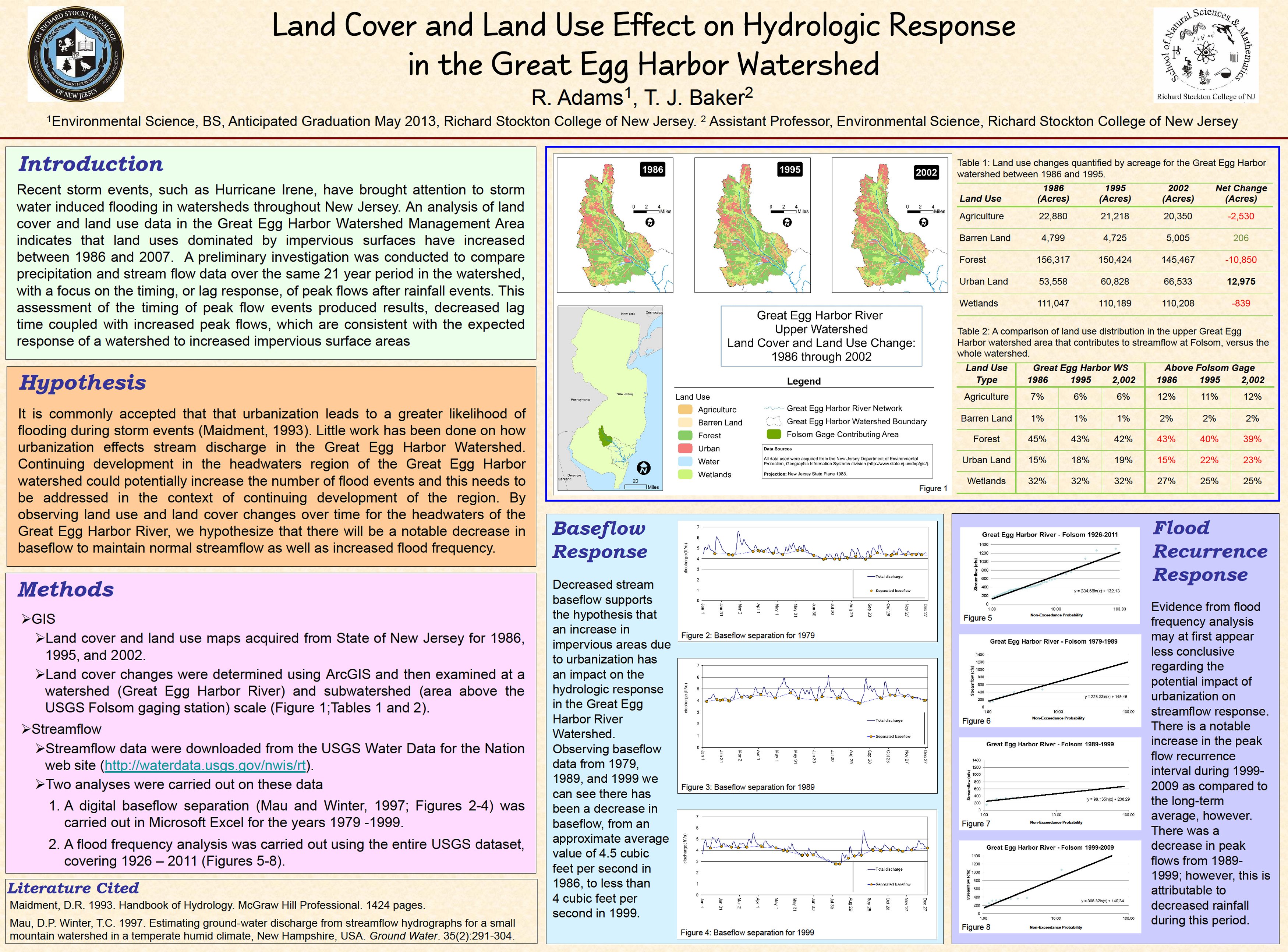
Map Description: |
Recent storm events, such as Hurricane Irene, have brought attention to storm water induced flooding in watersheds throughout New Jersey. An analysis of land cover and land use data in the Great Egg Harbor Watershed Management Area indicates that land uses dominated by impervious surfaces have increased between 1986 and 2007. A preliminary investigation was conducted to compare precipitation and stream flow data over the same 21 year period in the watershed, with a focus on the timing, or lag response, of peak flows after rainfall events. This assessment of the timing of peak flow events produced results, decreased lag time coupled with increased peak flows, which are consistent with the expected response of a watershed to increased impervious surface areas. |