Map Information:
|
Map Title: |
Hurricane Sandy Waterway Debris Removal Project |
|
Name(s) of Author(s): |
Ed Apalinski |
|
Organization: |
NJDEP Bureau of GIS |
|
Email Address: |
edward.apalinski@dep.state.nj.us |
|
Software Used to Make Map: |
ArcGIS 10.x |
|
Data Sources: |
NJDEP/PWTA |
|
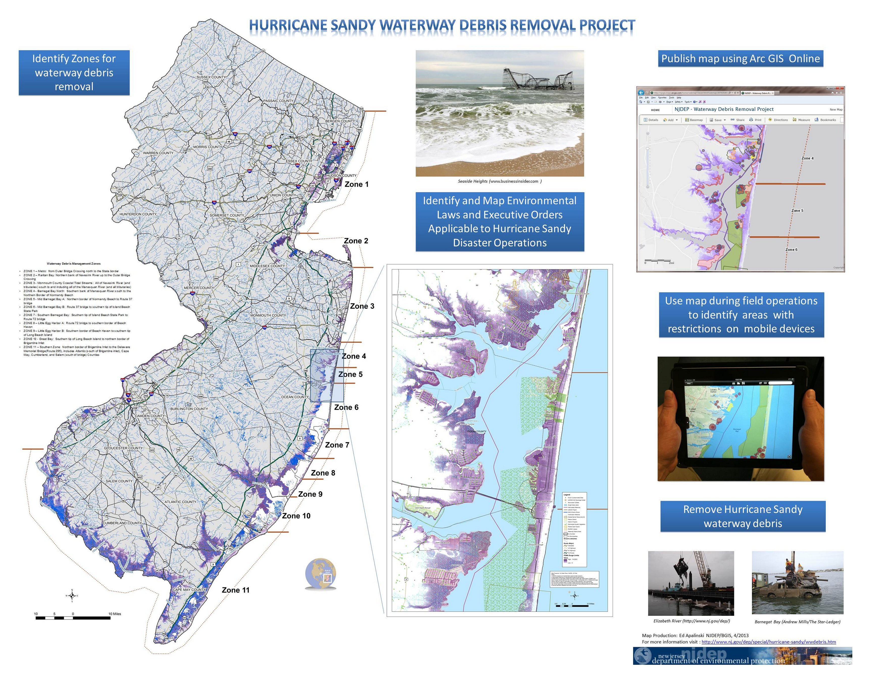
Map Description: |
This map summarizes GIS efforts for the Hurricane Sandy Waterway Debris Removal.
The first effort was to organize the effected waterways into zones for debris removal contract bidding. |