Map Information:
|
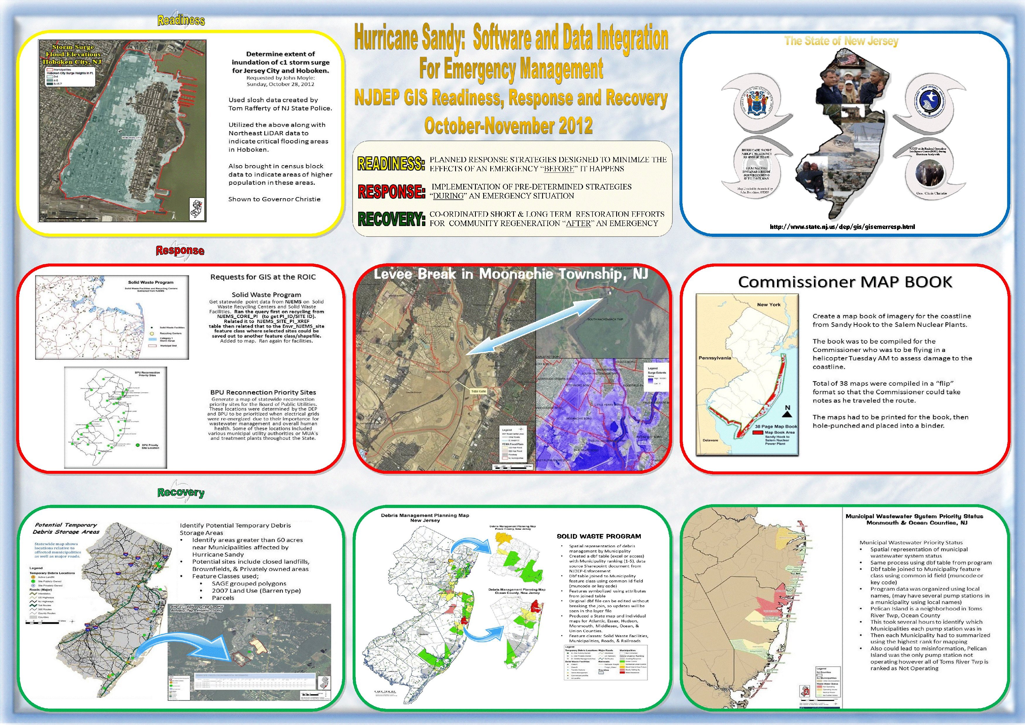
Map Title: |
Hurricane Sandy: Software and Data Integration for Emergency Management NJDEP GIS Readiness, Response and Recovery October-November 2012 |
|
Name(s) of Author(s): |
John Bocchino, Ed Apalinski, Seth Hackman, Dnyanada Bhide, Seema Gopinathan |
|
Organization: |
NJDEP Bureau of GIS |
|
Email Address: |
John.Bocchino@dep.state.nj.us |
|
Software Used to Make Map: |
Excel, Microsoft Powerpoint 2010, Microsoft Publisher 2010, ArcCatalog, ArcMap, PDF |
|
Data Sources: |
NJDEP, NJEMS, Census 2010, LiDAR, 2007 Orthophotography, County/Municipality boundaries, Transportation Data, Slosh Model/SURGE Extents for Category 1, FEMA Flood, NJ Stream Gages, Solid Waste, Waste Water Sites |
|
Map Description: |
Hurricane Sandy was the deadliest and most destructive hurricane of the 2012 hurricane
season in the Atlantic. It was also the second-costliest hurricane in United States history. In New Jersey,
GIS played an important role in dealing with devastation caused by Hurricane Sandy and continues to be a
critical decision-making tool in the state's recovery process. The NJDEP's Bureau of GIS coordinated with
many different programs and agencies before, during and after the storm. |