Map Information:
|
Map Title: |
Beer in New Jersey |
|
Name(s) of Author(s): |
Raymond Inzitari |
|
Organization: |
Rowan University |
|
Email Address: |
raymond_255@yahoo.com |
|
Software Used to Make Map: |
ArcGIS |
|
Data Sources: |
Rowan University, beerinstitute.org/br, brewersassociation.org |
|
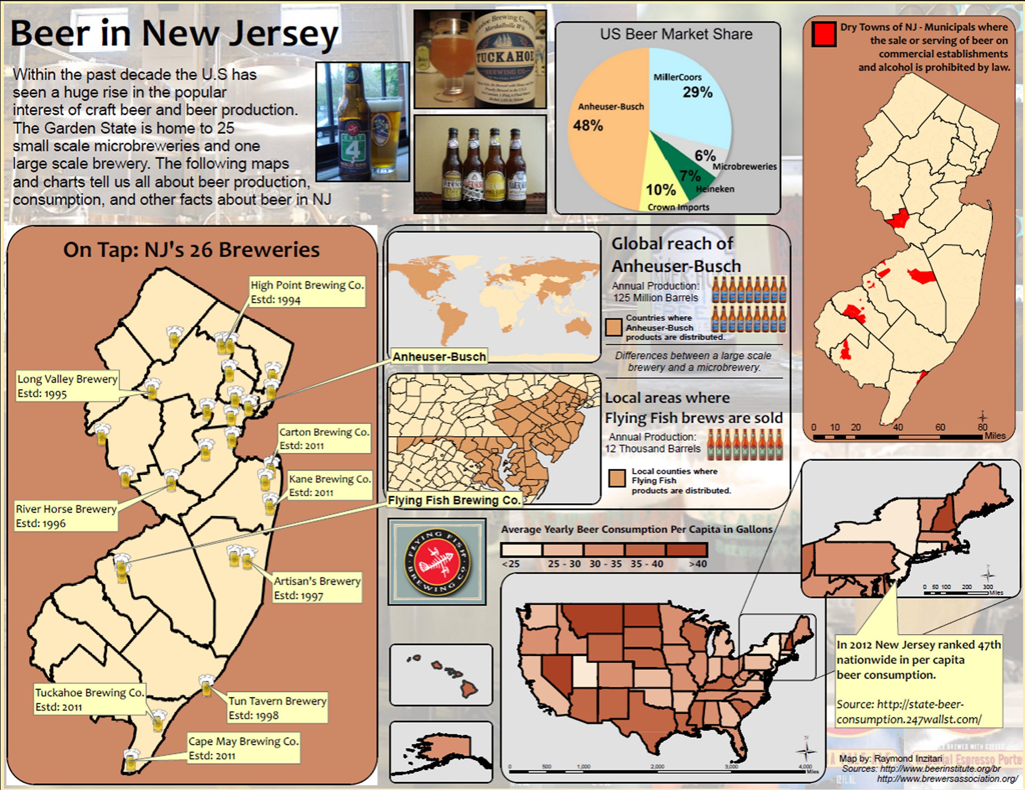
Map Description: |
The concept of this map is to give people an overview about the growing beer industry in NJ including its production, consumption, brewing locations, and more. The main piece is the large map titled "On Tap: NJ's 26 Breweries." This map shows the location of all 26 breweries in NJ. Noted are the locations, names, and years of establishment of a few breweries in NJ. The Flying Fish and Anheuser-Busch callouts direct attention to the right towards the two smaller maps titled "Global Reach of Anheuser-Busch" and "Local Areas Where Flying Fish Brews are Sold." These two smaller maps display areas colored in brown where each respective company distribute their products. The idea is to compare & contrast the difference between a large scale brewery and a microbrewery. The map just below is a simple choropleth map with a self-explanatory title "Average Yearly Beer Consumption Per Capita in Gallons." An inset map with contextual information is included about NJ's beer consumption last year. And the final map in the top right shows the municipals or townships colored in red known as "dry towns." These are places where the sale or serving of alcohol/beer is prohibited by law. |