Map Information:
|
Map Title: |
Cape May County |
|
Name(s) of Author(s): |
Ashley Reardon |
|
Organization: |
Rowan University |
|
Email Address: |
ash_reardon@yahoo.com |
|
Software Used to Make Map: |
ArcMap |
|
Data Sources: |
NJDEP, NJGIN, www.thejerseycape.com, Google Maps, DOT |
|
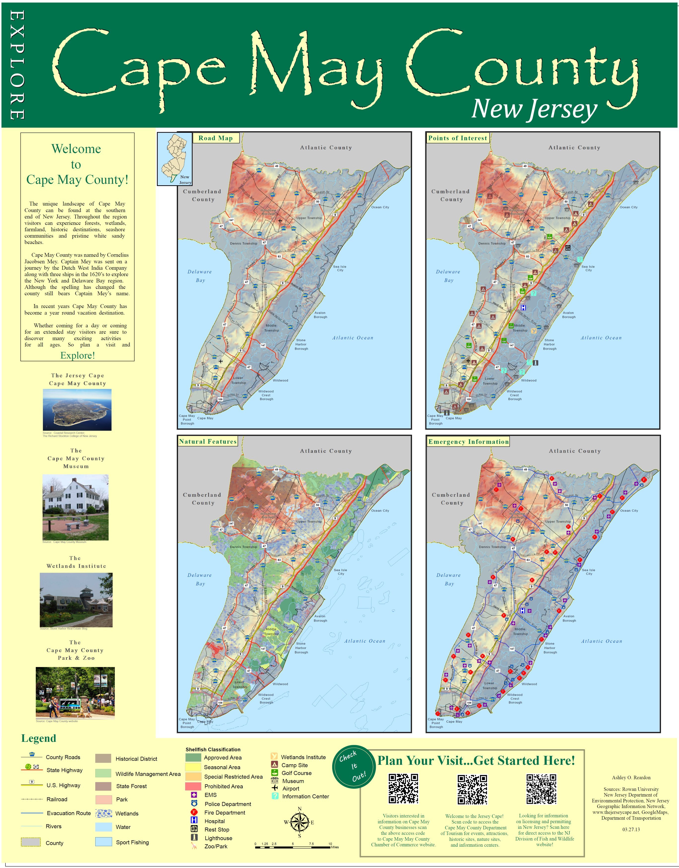
Map Description: |
This map is an informational map for people who are visiting Cape May County, New Jersey and are unfamiliar with the county. It has been designed as a one stop map, showing a little bit of everything for a quick reference. The top left map is a basic road map, the top right is of points of interest in the area such as campgrounds, gulf courses, museums, and information centers. The bottom left map is of outdoor recreational features such as sport fishing areas, shellfish classification areas, parks and state forests. The bottom right is a map of emergency information, including evacuating routes, fires departments, police stations and EMS squads. The QR codes at the bottom, for those of you who have mobile devices or smart phones, can be scanned and will direct you to the different websites such as the Cape May County Chamber of Commerce, Department of Tourism and the New Jersey Fish and Wildlife website for permitting and licensing for hunting and fishing. |