Map Information:
|
Map Title: |
Hurricane Sandy: Storm surge affects on AMNET Biological Monitoring Sites |
|
Name(s) of Author(s): |
Sarah Staab |
|
Organization: |
NJDEP - Division of Water Monitoring and Standards |
|
Email Address: |
sarah.staab@dep.state.nj.us |
|
Software Used to Make Map: |
ArcGIS and Power Point |
|
Data Sources: |
ESRI, NJDEP DATA |
|
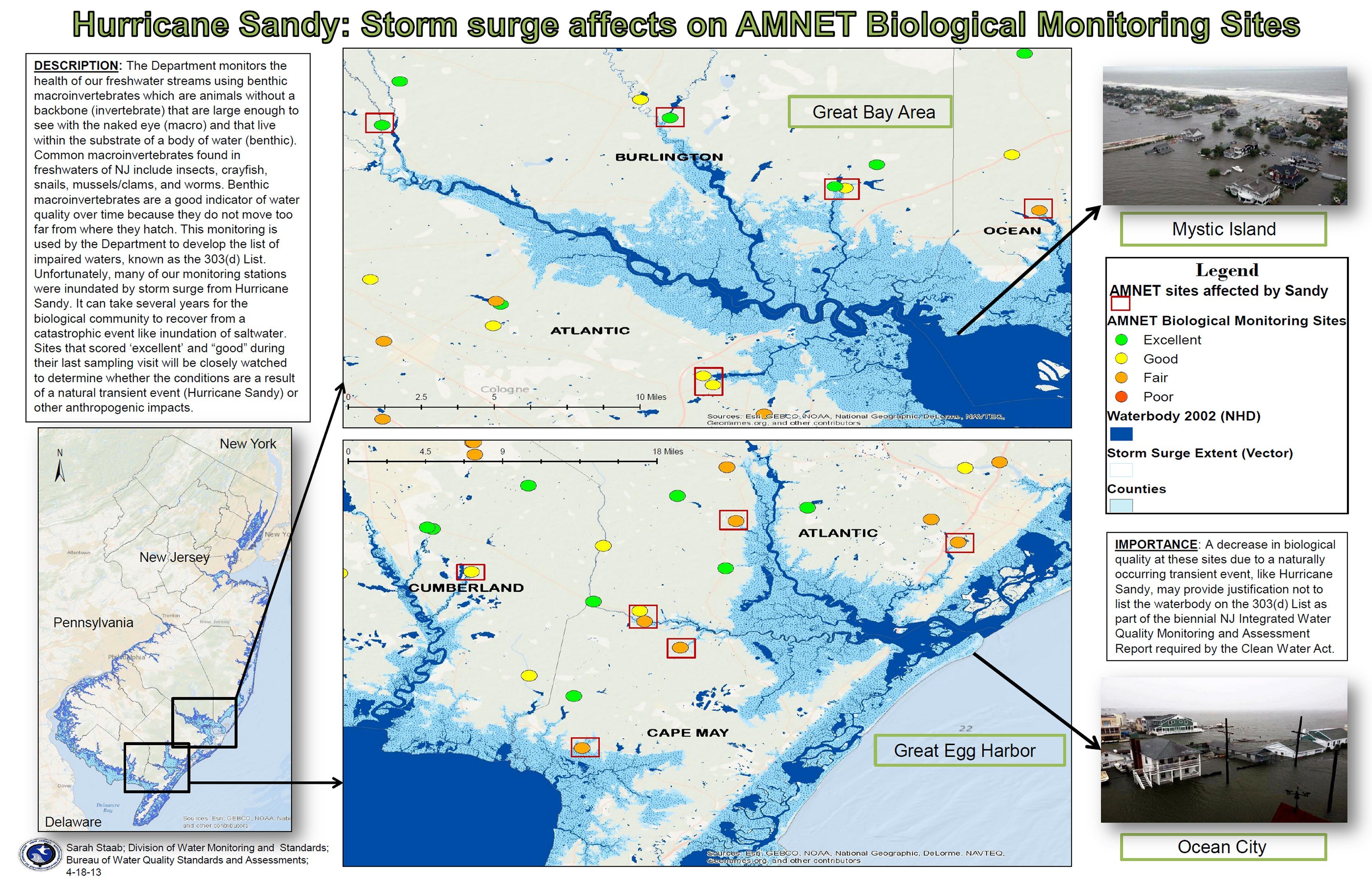
Map Description: |
AMNET Biological Monitoring is used by the Department of Environmental
Protection to determine the health of freshwater streams. Highlighted are areas in the
state where, prior to Hurricane Sandy, AMNET Biological Sites had the most scores of
"excellent" and "good." Furthermore, these sites experienced the greatest saltwater intrusion.
It can take a freshwater biological community several years to recover from a catastrophic
event such as inundation of saltwater. |