Governor Phil Murphy • Lt. Governor Tahesha Way
  NJ Home | Services A to Z | Departments/Agencies | FAQs
NJDEP
NJGWS Home | DWSG Home | DEP Home  
New Jersey Geological and Water Survey
What's New at NJGS About NJGS NJGS Programs Publications Digital Geodata Environmental Education Links Contact NJGS

Borehole Geophysical Methods

The various borehole geophysical tools used for logging wells employ the same geophysical principles as for the surface methods. The most common tools include natural gamma ray, self potential, resistivity, induction, porosity/density, and caliper devices.

Borehole geophysics is used for mapping the hydrogeologic framework of an aquifer, locating concentrated plumes of ground-water contamination, and identifying other subsurface features such as natural-occurring voids and radioactive horizons.

Sample of a geophysical log
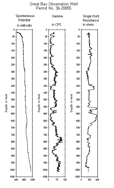
Geophysical Log

For more information on borehole geophysical methods, please refer to Chapter 8 (Geophysical Techniques) of the NJDEP's Field Sampling Procedures Manual, 2005.


NJGS HOME contact us privacy notice legal statement accessibility statement

Geological and Water Survey: Home | Directions | NJ-GeoWeb
Department: NJDEP Home | About DEP | Index by topic | Programs/Units | DEP Online
Statewide: NJHome | Services A to Z | Departments/Agencies | FAQ's

Copyright © State of New Jersey, 1996-
Department of Environmental Protection
Geological and Water Survey
P. O. Box 420
Mail Code:29-01
Trenton, NJ 08625-0420

Phone: (609) 292-1185
FAX: (609) 633-1004