|
Using the AHRS Deer Hunting Location Viewer |
|
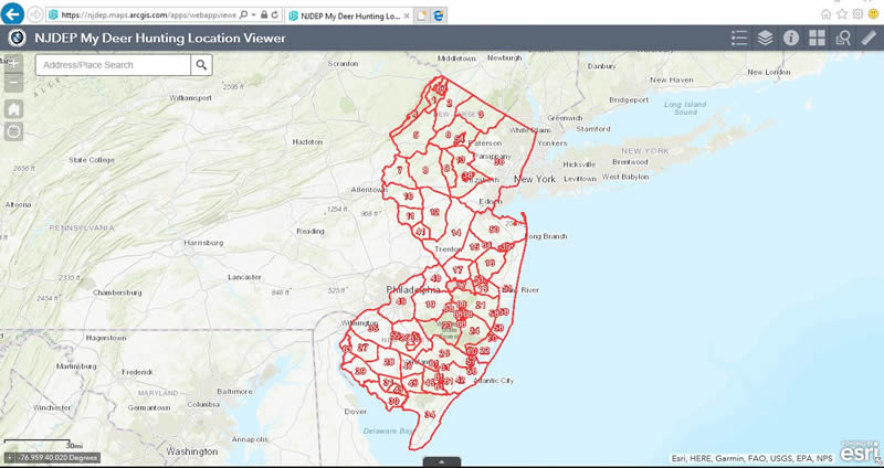
 The Deer Hunting Location Viewer can be used to locate and identify your deer hunting spot to obtain harvest location information (DMZ, Unit, County, Township). This data is requested when reporting deer via the Division's Automated Harvest Report System. The map can also be used to identify properties that may be open for deer hunting.
NOTE: The viewer map is for reference only. Not all state, county, municipal and federally-owned open space is open for hunting. Consult the property owner/manager for any restrictions. Federal and municipal open space is not identified on the map.
USING THE VIEWER
The Basics:
- Zoom in (double-click, use the mouse wheel or click the (+) button in upper left corner)
- Click, hold and drag to center your location on map, zoom in more if necessary.
- A single click on the map pinpoints your hunting location.
- A box with your location information will appear with the Deer Management Unit number, County and Township information, or Deer Management Zone information, depending on the level of zoom. Clicking the arrow in the box will advance to the next box of location information.
Map Features
The Map Header (below) includes the following icons which enable various tools.
| Icon |
Description |
 |
Home View: Clicking this icon returns the map to the original view. |
 |
Location: This feature allows you to get closer to your current location without the address, but may not take you to your actual location. The accuracy of this feature depends on your GPS locations services and/or internet services provider. |
 |
Legend: Clicking this icon allows you to toggle between the map Legends and Details information boxes. Zooming in accesses available layers on the map and shown in the Legend box. |
 |
Layers: This feature lets you uncheck layers that are built in to the Deer Location Viewer Map. For instance, you can uncheck the '2012 NJ Imagery (Natural)' layer and show the Deer Management Zones, Deer Management Units over your chosen base layer.
|
 |
Base Map Gallery: You can choose from imagery, street views, topographic, terrain, grey scale canvases, and more. As you zoom in, the default 2012 NJ imagery (Natural) layer appears. This can be unchecked in the layers feature button (above) to show only your chosen base layer. |
 |
Measurements: This feature includes area calculations, linear distance measurements, and latitude/longitude for your chosen location. |
 |
Details: You can choose from imagery, street views, topographic, terrain, grey scale canvases, and more. As you zoom in, the 2012 NJ imagery (Natural) layer appears. This can be unchecked in the layers feature button (above) to show only your chosen base layer. |
 |
Sharing: This feature allows sharing with social networking programs and e-mailing links of map views to your contacts. |
Start using the Deer Hunting Location Viewer
Back to AHRS page
|