  |
Living Shoreline Created at Sedge Island |
|
June 26, 2019
Updated August 19, 2020
|
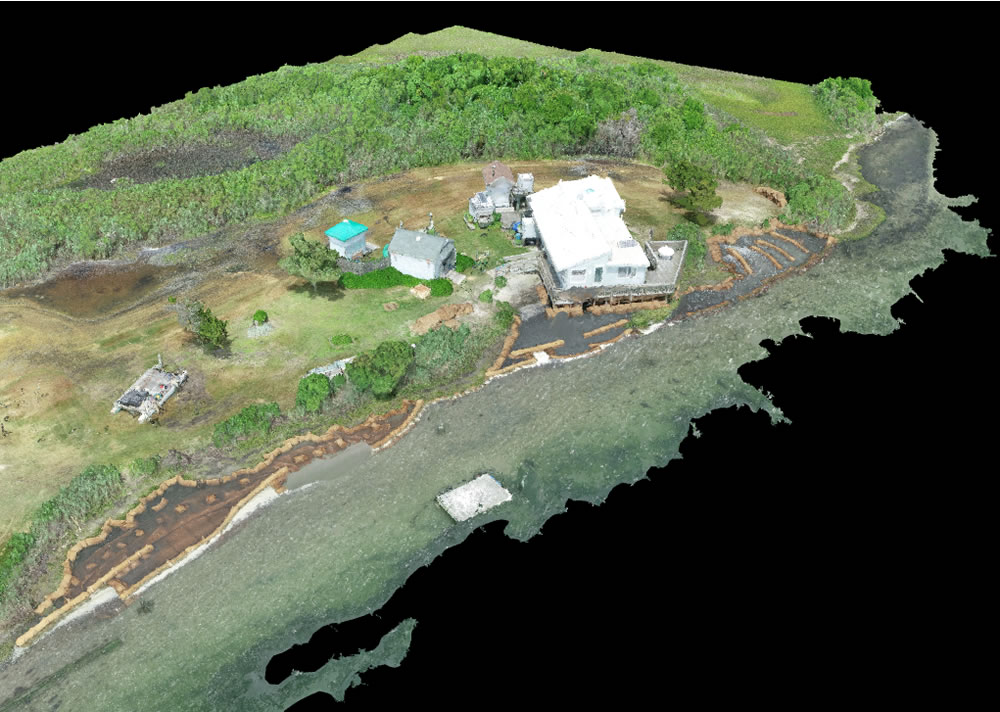
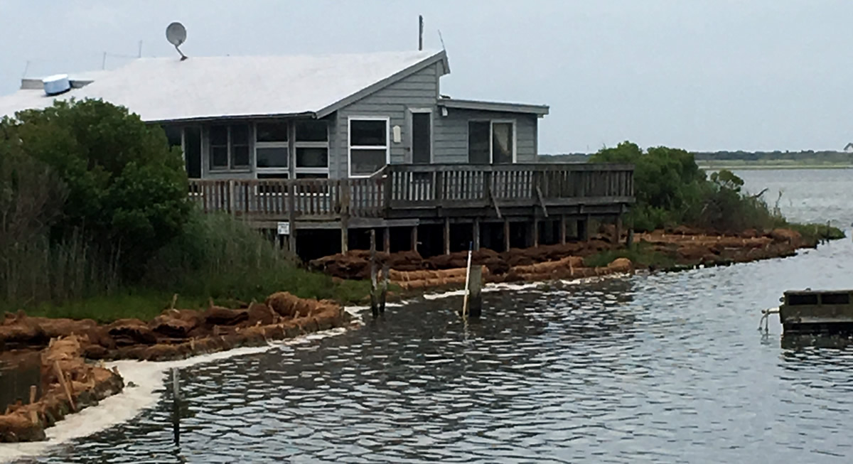
Staff from NJDEP, the Barnegat Bay Partnership, and Partnership for the Delaware Estuary, completed installation of a Living Shoreline near the caretaker's house at the Sedge Island Natural Resource Education Center. The project's goal is to slow post-Superstorm Sandy erosion and promote natural accretion of the coastal wetland.
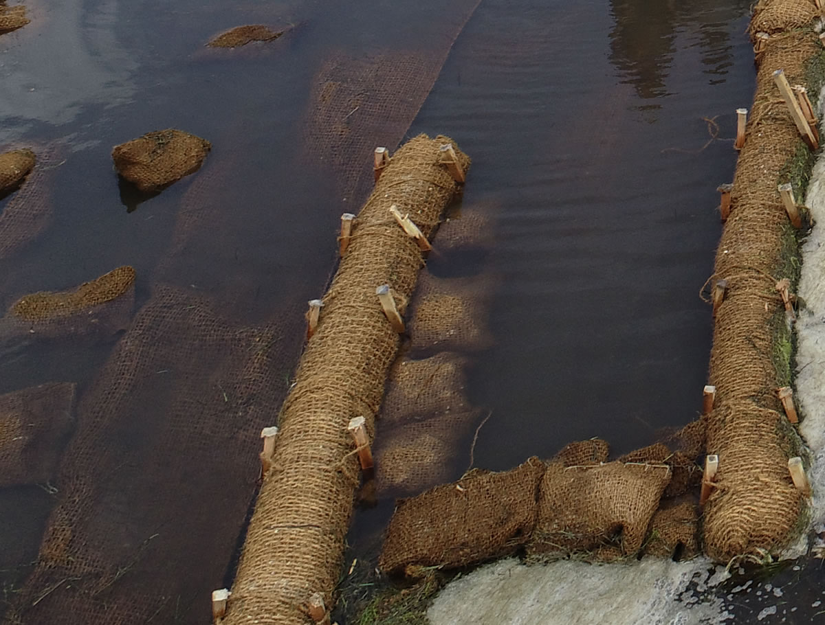
Living shorelines may include rock, concrete, and other material; this project used only biodegradable materials and an innovative method of rolling coir log (made from the outer husk of the coconut), in fiber matting to improve durability (photo). Partners in the project will be involved with monitoring and adaptive management to assess the viability of these techniques and possible application in other estuaries.
Sincere appreciation and thanks to our partners at BBP (www.barnegatbaypartnership.org) and PDE (www.delawareestuary.org), and the DEP Bureau of GIS, for their critical roles in bringing this ongoing project to fruition.
Learn about the process of designing, installing and monitoring this project:
Sedge Island Living Shoreline Story Map
|
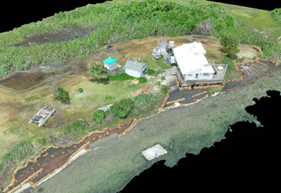
Aerial view of project location
Click to enlarge
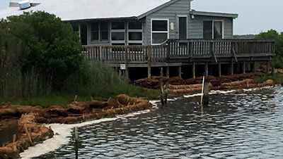
Living shoreline in place protecting caretaker's house
Click to enlarge
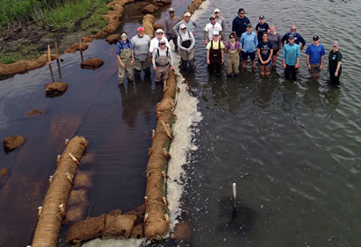
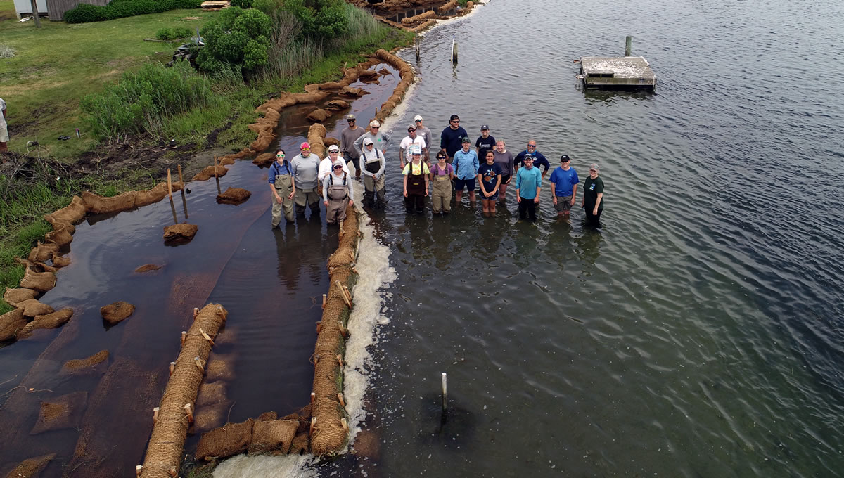
Staff from DEP, the Barnegat Bay Partnership, and Partnership for the Delaware Estuary with newly installed living shoreline.
Click to enlarge
|
|
