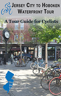
Jersey City to Hoboken Waterfront Tour
This 14.6 mile loop takes you through the historic and diverse neighborhoods, lively downtowns and spectacular waterfronts of Jersey City and Hoboken. The route is easy and flat and mostly utilizes on-street bike lanes and off-road paths.
Starting in the 1,212 acre Liberty State Park in Jersey City, the tour heads north along the scenic and family-friendly Hudson River Waterfront Walkway. Along the way you will pass the Statue of Liberty and Ellis Island, marinas filled with yachts, two historic rail terminals, new skyscrapers and some of the best urban parks in the country.
The ride south through western Hoboken travels along Grand and Monroe Streets where new high- and low-rise condominiums mingle with 19th century row homes. The route then goes off-road again along a shared-use path parallel to the Hudson Bergen Light Rail tracks from 2nd Street Station to the border of Jersey City.
After passing under the elevated Route 139, the tour enters the historic Hamilton Park neighborhood with brownstones and a Victorian-era park. Going further south into Jersey City, you will pass the Harsimus Stem Embankment, a massive, segmented stone structure that parallels Sixth Street for six blocks, outstanding murals, eclectic restaurants and the beautiful Van Vorst Park before returning to Liberty State Park.
Washington Street
Washington Street is the "Main Street" and Central Business District for the City of Hoboken. In 2010 it was designated as a Great Street by the American Planning Association. Lined with numerous dining and shopping options, it is a great place to rest and relax while enjoying one of New Jersey's most unique and vibrant urban environments.
Pier A and Pier C Parks
A source of civic pride for Hoboken, both Pier A and Pier C Parks, provide a temporary escape from an urban setting and offer some of the best views of Manhattan. Until the mid-20th century, Hoboken's waterfront was largely industrial and inaccessible to the public. Today, docks and factories have been replaced by parks and promenades. Pier A Park, located just north of Hoboken Terminal, has plenty of lawn space for picnicking and sunbathing. Pier C Park is a tiny island oasis accessible by a curving walkway and includes a water play area, playground and fishing pier.
Jersey City Historic Downtown
Jersey City's Historic Downtown is the city's cultural center, housing restaurants, shops, galleries, and wonderfully preserved brownstones and row homes. Commercial activity is centered on Grove Street and Newark Avenue. Grove Street is where you will find City Hall, completed in 1896 and the PATH station. The PATH station plaza is also the site of monthly artist festivals, a weekly music series and a weekly farmer's market.
Harsimus Stem Embankment
The Harsimus Stem Embankment is a half-mile-long historic railroad embankment, now abandoned and largely overgrown with foliage, parallel to Sixth Street in Jersey City. This elevated stone structure once carried seven Pennsylvania Railroad tracks to the Hudson River, where they met ferries to Manhattan at the Exchange Place Terminal. The Embankment is listed on the New Jersey State Register of Historic Places.
| File Formats |
Instructions for using these files formats is available. |