Over 600 TMDLs are covered in 50 TMDL documents that have been developed in New Jersey. The pollutants addressed by these TMDLs include pathogens, total phosphorus, mercury, PCBs, and various other pollutants described below and in the New Jersey TMDLs table.
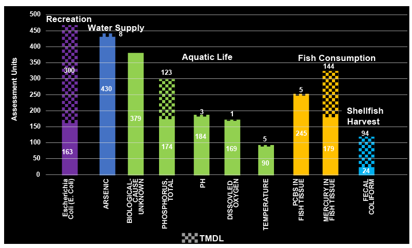
The top ten causes of water quality impairment in 2020 are shown in the chart below. Of all causes of impairments, five of the top ten are associated with the aquatic life designated use, including total phosphorus. TMDLs have been established for 68% of the pathogens, 65% of the mercury and 41% of the total phosphorus causing impairment.
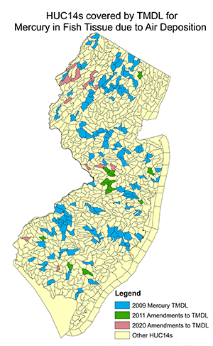
Pathogen TMDLs have been developed for most of the watersheds assessed as not supporting the shellfish harvest for consumption use (79%). See the maps below for additional information.
2020 Top Ten Causes of Use Impairment
*Footnote: Use impairment is explained further HERE.
Click on map to enlarge
To find out what TMDLs are in your area use the TMDL look-up tool and enter the county and municipality of interest.
To view a map of areas covered by a TMDL use the DEPs NJ-GeoWeb. Select the TMDL layers found in the table of contents.
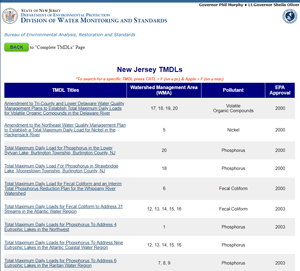
CLICK HERE to access the New Jersey TMDLs List and Reports.
*To FIND a specific TMDL click Crtl+F (for pc) Apple+F (for mac)
A TMDL Look-Up Tool is also available that allows the user to quickly identify if an approved TMDL is associated with surface waters within or bordering their municipality. This tool was developed to help municipal stormwater coordinators implement requirements of municipal separate storm sewer (MS4) permits but may be used by anyone with an interest in water quality in New Jersey.