| No. |
Caption |
Image |
1.
|
Morris
Canal and Banking Company office, Phillipsburg - side view
[2 copies].
Date: 1923.
Location: 24.21.4.4.1.
Negative No.: 1162 |
|
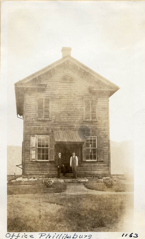
2.
|
Morris
Canal and Banking Company office, Phillipsburg - front view,
Mr. Metz in doorway [2 copies].
Date: 1923
Location: 24.21.4.4.1.
Negative No.: 1163 |
|
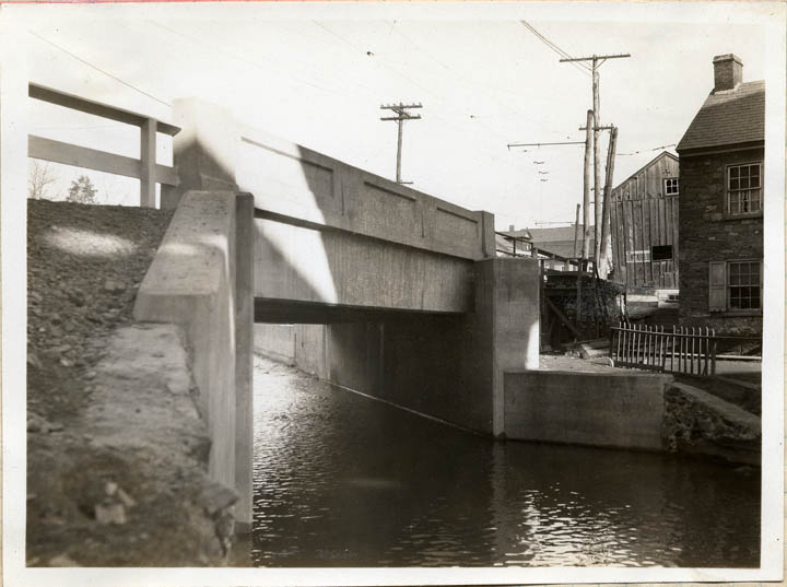
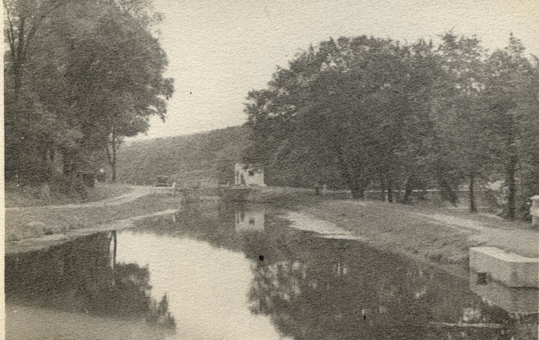
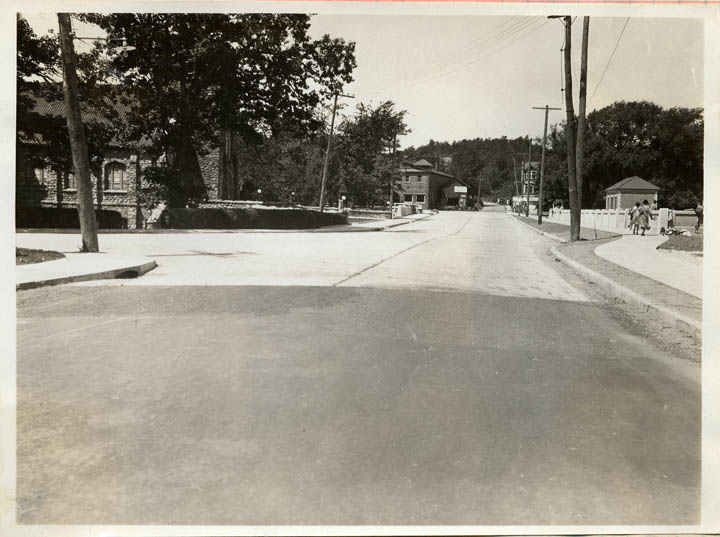
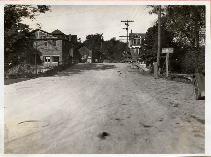
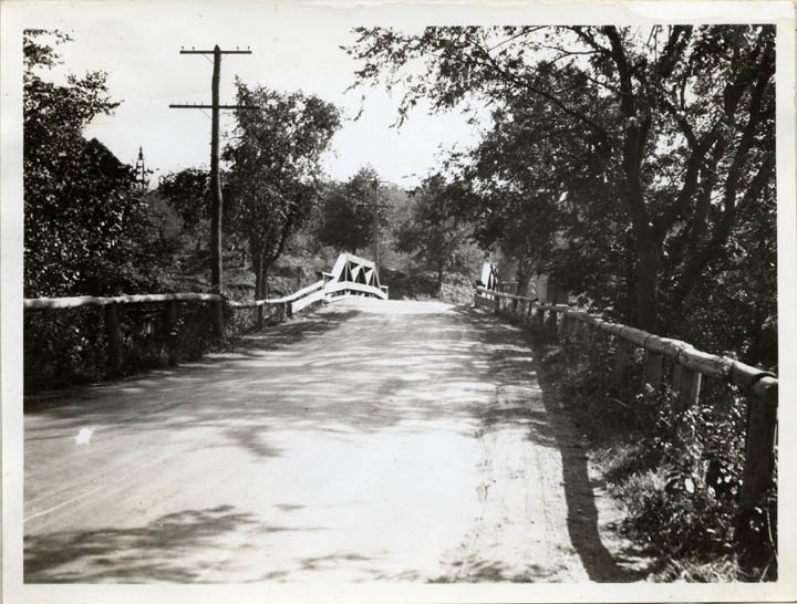
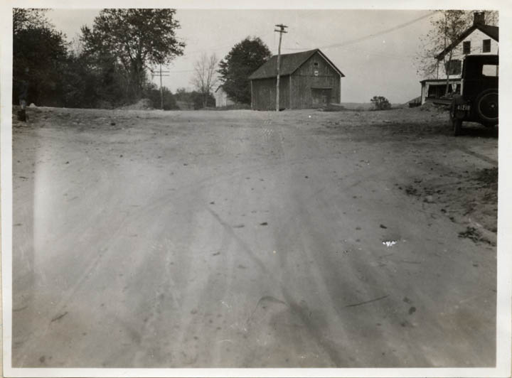
3.
|
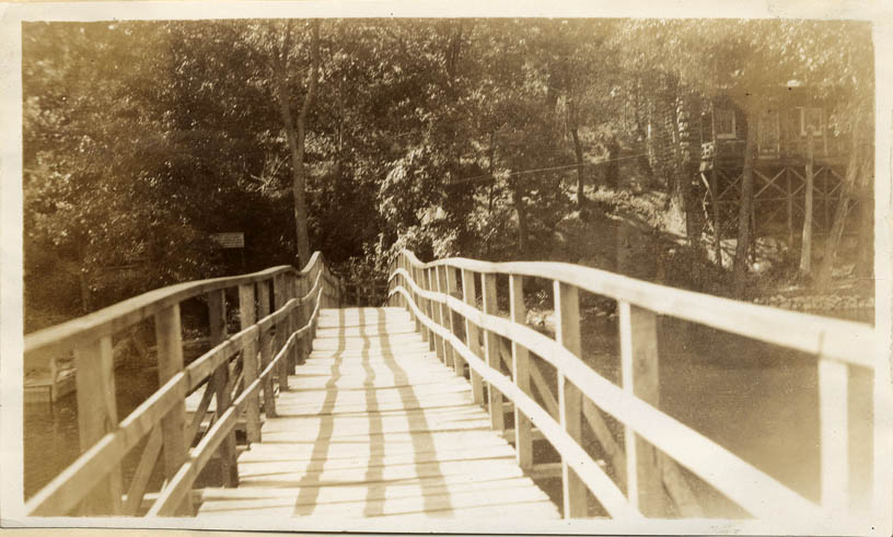
New
bridge replacing Bridge MC #2, Phillipsburg.
Date: 1927
Location: 24.21.4.9.2.
Negative No.: --
|
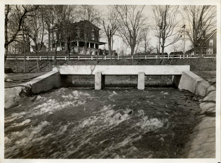
|
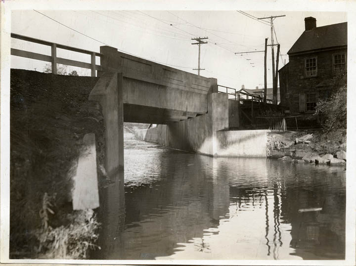
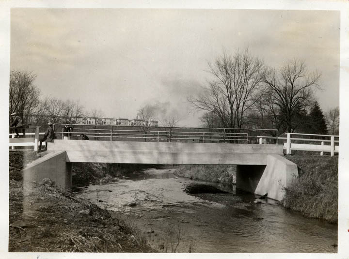
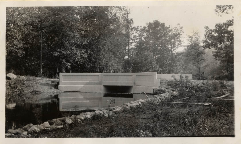
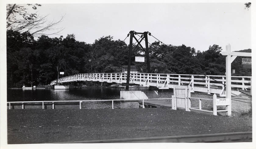
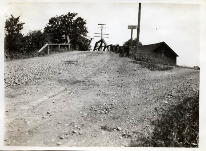
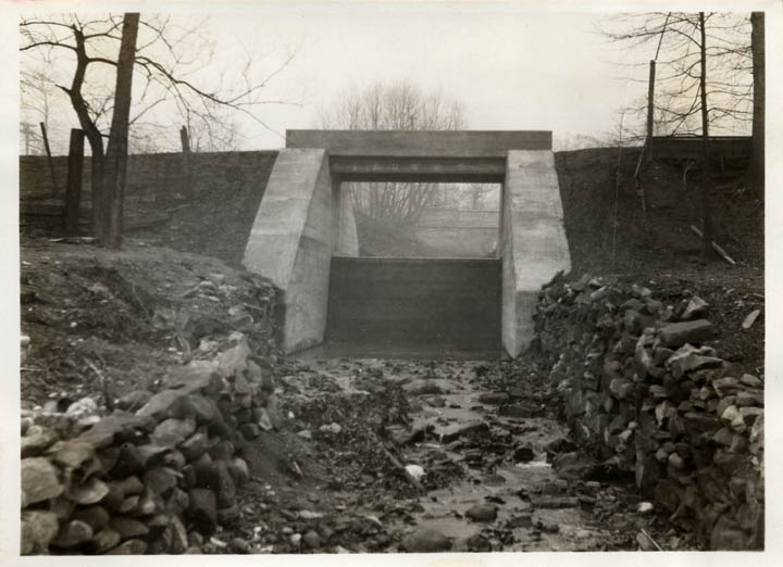
4.
|
Bridge
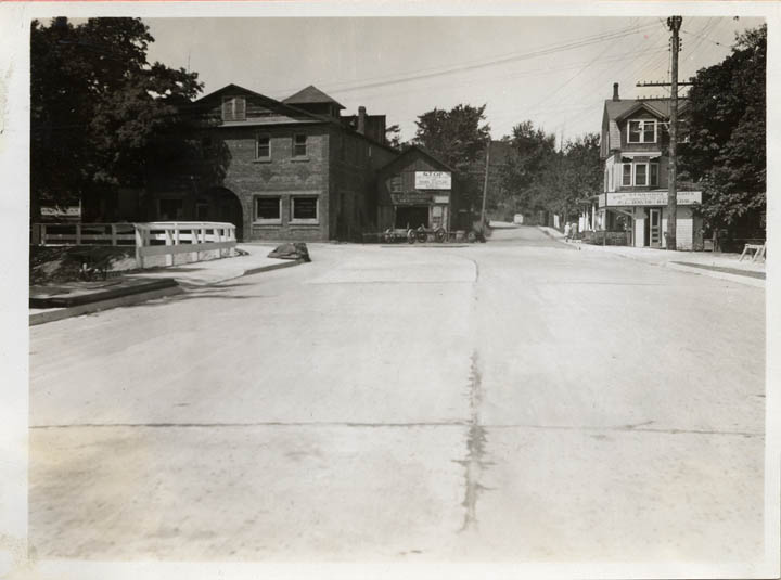
MC #2, Phillipsburg - new concrete bridge.
Date: [1927]
Location: 24.21.4.9.2.
Negative No.: -- |
|
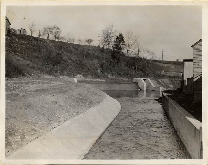
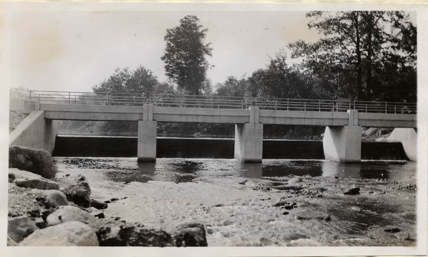
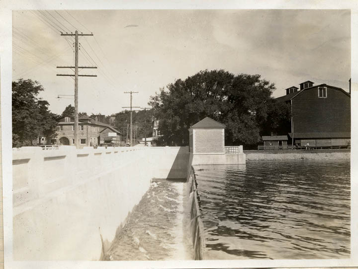
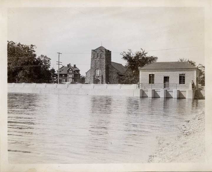
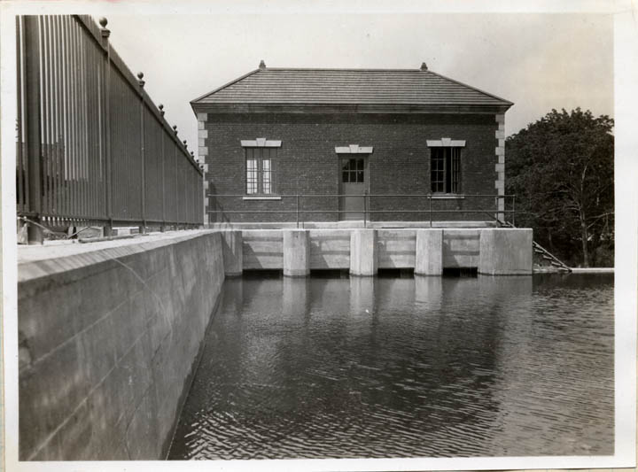
5.
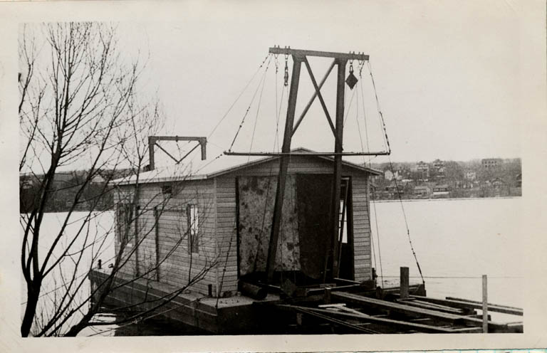
|
Lopatcong
Spillway, Phillipsburg.
Date: 1928
Location: --
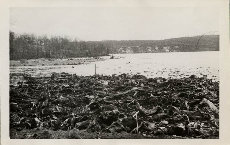
Negative No.: -- |
|
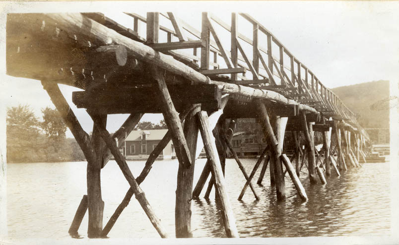
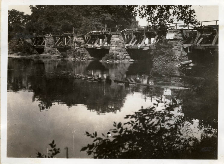
6.
|
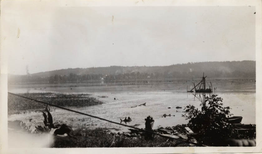
Bridge
MC #3, Phillipsburg - "before."
Date: 1927
Location: 24.21.5.4.7.
Negative No.: --
|
|
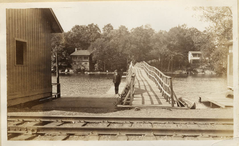
7.
|
Bridge
MC #3, Phillipsburg - "after."
Date: 1927
Location: 24.21.5.4.7.
Negative No.: -- |
|
8.
|
New
bridge replacing Bridge MC #4, Phillipsburg.
Date: 1927
Location: 24.21.5.4.8.
Negative No.: -- |
|
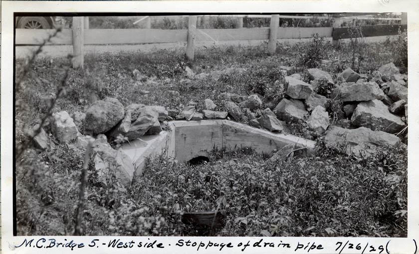
9.
|
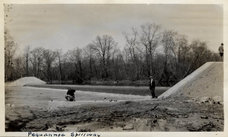
Bridge
MC #5 - stoppage of drain pipe; also, handwritten description of complaint
of Charles Apgar.
Date: 7/26/1929
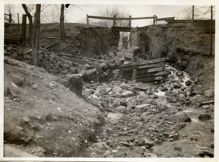
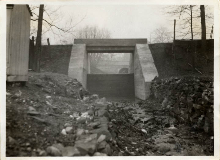
Location: --
Negative No.: -- |
|
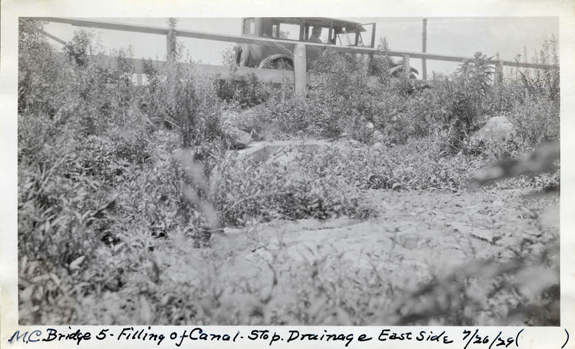
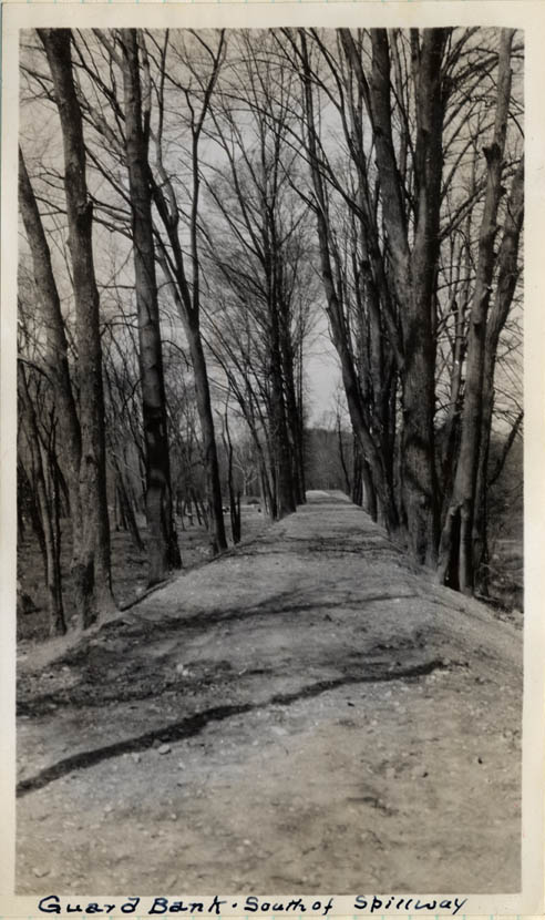
10.
|
Bridge
MC #5 - filling of canal - stopping drainage, east side.
Date: 7/26/1929
Location: --
Negative No.: -- |
|
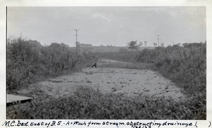
11.
|
Canal
bed east of Bridge MC #5. Wash from stream, obstructing
drainage, marked "A."
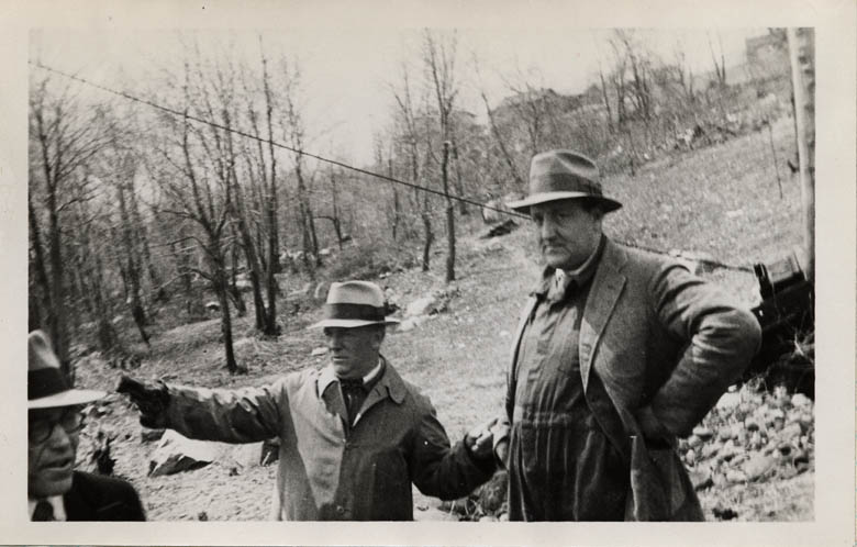
Date: 7/26/1929
Location: --
Negative No.: -- |
|
12.
|
Bridge
MC #8, Stewartsville - "before."
Date: 1927
Location: 24.21.6.2.2.
Negative No.: -- |
|
13.
|
Bridge
MC #8, Stewartsville - "after."
Date: 1927
Location: 24.21.6.2.2.
Negative No.: -- |
|
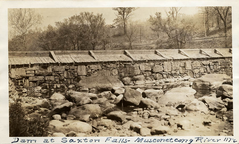
14.
|
Dam
at Saxton Falls - Musconetcong River [2 copies].
Date: 1923
Location: 24.4.6.6.1.
Negative No.: 1172 |
|
15.
|
Guard
lock, Saxton Falls [2 copies].
Date: 1923
Location: 24.4.6.6.1.
Negative No.: 1173 |
|
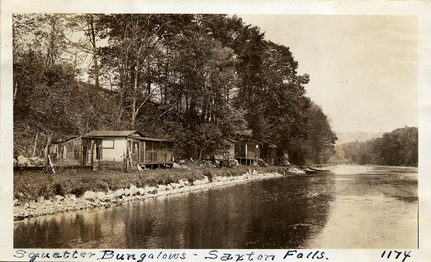
16.
|
Bungalows
along canal (squatters), Saxton Falls [2 copies].
Date: 1923
Location: 24.4.6.6.1.
Negative No.: 1174 |
|
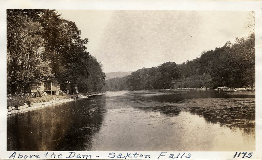
17.
|
Above
the dam at Saxton Falls [2 copies].
Date: 1923
Location: 24.4.6.6.1.
Negative No.: 1175 |
|
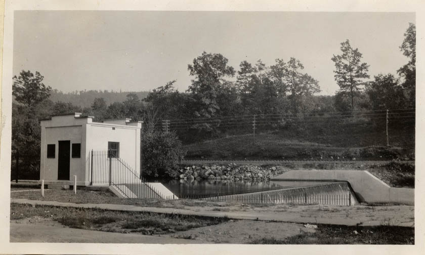
18.
|
Dam/gate
house, Saxton Falls.
Date: 1928
Location: 22.25.4.3.3.
Negative No.: -- |
|
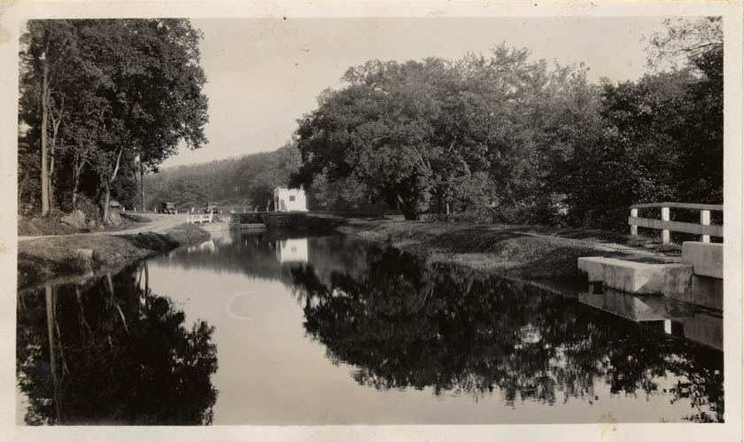
19.
|
Lock
and pool, Saxton Falls.
Date: 10/3/1928
Location: 24.4.6.6.1.
Negative No.: -- |
|
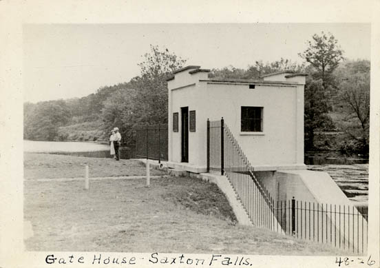
20.
|
Gate
house, Saxton Falls.
Date: --
Location: --
Negative No.: 48-26 |
|
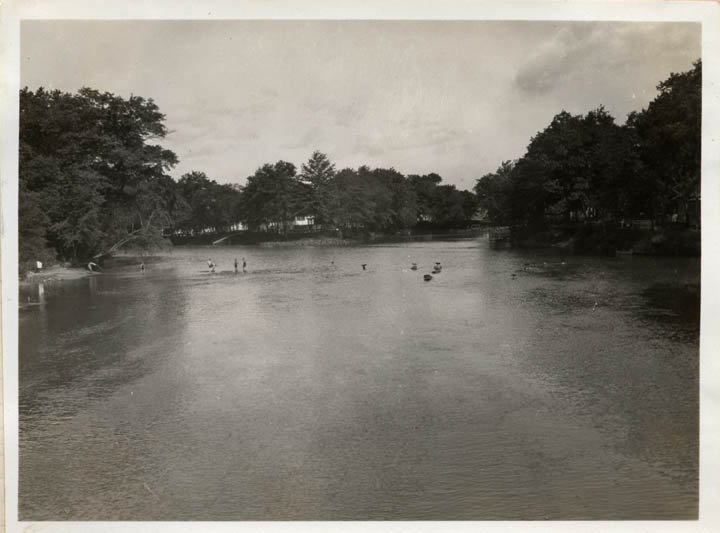
21.
|
Swimming
pool, Saxton Falls.
Date: --
Location: --
Negative No.: 48-27 |
|
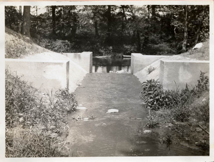
22.
|
South
spillway, Cranberry Lake.
Date: 1928
Location: 22.41.4.9.1.
Negative No.: -- |
|
23.
|
Old
bridge across Cranberry Lake - replaced by suspension bridge, October
1930.
Date: --
Location: --
Negative No.: -- |
|
24.
|
Bridge
at Cranberry Lake - replaced by new suspension bridge, October 1930.
Date: --
Location: --
Negative No.: -- |
|
25.
|
Old
bridge across Cranberry Lake - replaced by new suspension bridge,
October 1930.
Date: --
Location: --
Negative No.: -- |
|
26.
|
Old bridge across Cranberry Lake - replaced by new suspension bridge,
October 1930.
Date: --
Location: --
Negative No.: -- |
|
27.
|
Bridge
at Cranberry Lake, showing new warning signs.
Date: 1937 print
Location: --
Negative No.: 1720 |
|
28.
|
Cranberry
Lake, showing footbridge.
Date: 1937 print
Location: --
Negative No.: 1721 |
|
29.
|
Lower
spillway, Stanhope.
Date: 1928
Location: 25.1.2.8.9.
Negative No.: -- |
|
30.
|
Spillway
through canal towpath, Stanhope.
Date: 1927
Location: 25.1.2.9.7.
Negative No.: -- |
|
31.
|
Lake
Musconetcong (Stanhope Reservoir) Dam - before removal of icehouse
[2 copies].
Date: 1930
Location: 25.1.2.9.8.
Negative No.: C.C.V. |
|
32.
|
Lake
Musconetcong (Stanhope Reservoir) Dam and gate house [2 copies: 1
labeled 1927, the other labeled 1930].
Date: 1927/1930
Location: 25.1.2.9.8.
Negative No.: C.C.V. |
|
33.
|
New
concrete pavement, Ledgewood Ave., Netcong.
Date: 1927
Location: 25.1.2.9.8.
Negative No.: -- |
|
34.
|
Bridge
MC #57, Stanhope-Netcong - "before."
Date: 1927
Location: 25.1.2.9.8.
Negative No.: -- |
|
35.
|
Bridge
MC #57, Stanhope-Netcong - "after."
Date: 1927
Location: 25.1.2.9.8.
Negative No.: -- |
|
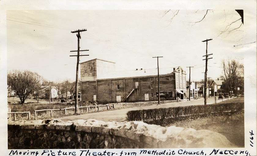
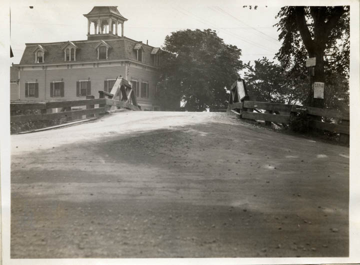
36.
|
Moving
picture theater - from Methodist Church, Netcong [2 copies].
Date: 1923
Location: 25.1.2.9.8.
Negative No.: 1164 |
|
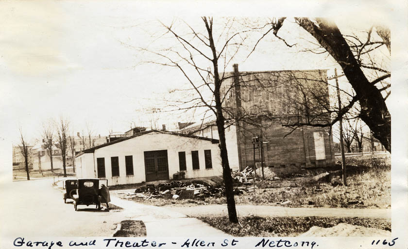
37.
|
Garage
and theater, Allen St., Netcong [2 copies].
Date: 1923
Location: 25.1.2.9.8.
Negative No.: 1165 |
|
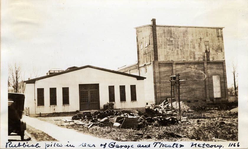
38.
|
Rubbish
piles in rear of garage and theater, Allen St., Netcong [2 copies].
Date: 1923
Location: 25.1.2.9.8.
Negative No.: 1166 |
|
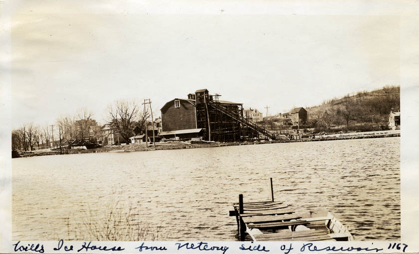
39.
|
Wills'
Ice House, Stanhope Reservoir [2 copies].
Date: 1923
Location: 25.1.2.9.8.
Negative No.: 1167 |
|
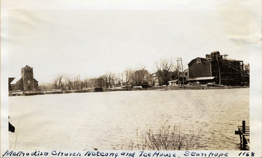
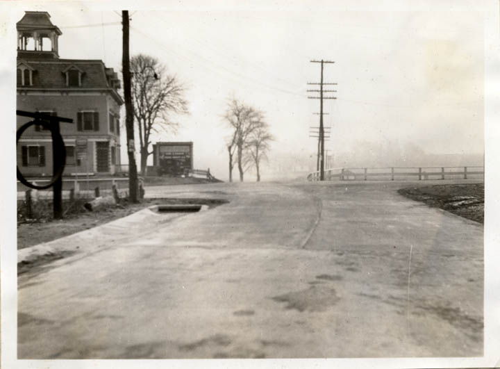
40.
|
Stanhope
Reservoir - Methodist Church, Netcong, and Ice House, Stanhope [2
copies].
Date: 1923
Location: 25.1.2.9.8.
Negative No.: 1168 |
|
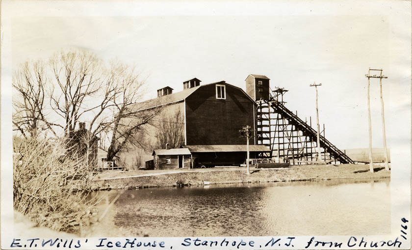
41.
|
Stanhope
- E. T. Wills' Ice House from church [2 copies].
Date: 1923
Location: 25.1.2.9.8.
Negative No.: 1169 |
|
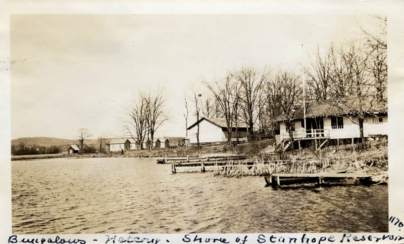
42.
|
Shore
of Stanhope Reservoir - bungalows in Netcong [2 copies].
Date: 1923
Location: 25.1.2.9.8.
Negative No.: 1170 |
|
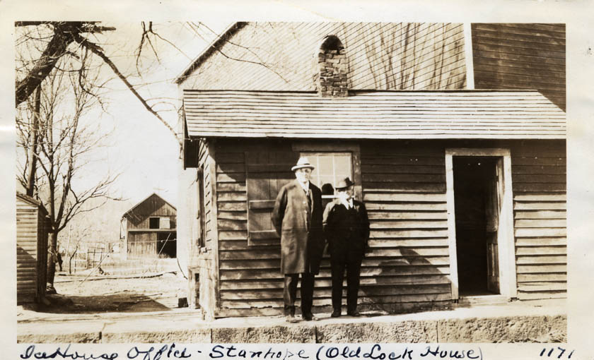
43.
|
Ice
House Office, Stanhope (old lock house) - S. P. Leeds and Mr. Bissell,
Manager [2 copies].
Date: 1923
Location: 25.1.2.9.8.
Negative No.: 1171 |
|
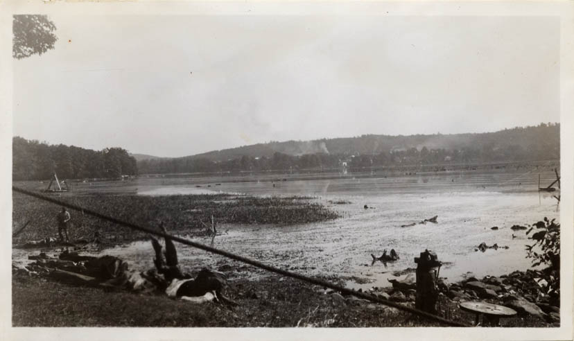
44.
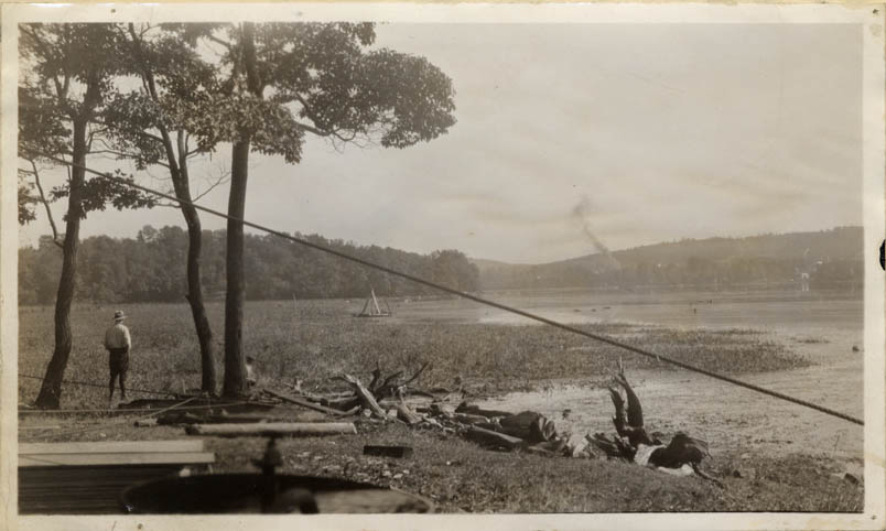
|
Central
Cove, Lake Musconetcong, showing candocks and snags in foreground
(used in report of C. C. Vermuele, Jr.).
Date: 1930
Location: 25.1.2.9.8.
Negative No.: -- |
|
45.
|
Lake
Musconetcong - Stanhope Reservoir (used in report of C. C. Vermuele,
Jr.).
Date: 1930
Location: 25.1.2.9.8.
Negative No.: -- |
|
46.
|
Lake
Musconetcong Improvement.
Date: 4/12/1932
Location: --
Negative No.: 15-3 |
|
47.
|
Lake
Musconetcong Improvement.
Date: 4/12/1932
Location: --
Negative No.: 15-4 |
|
48.
|
Lake
Musconetcong Improvement - stumps pulled ashore, Central Cove.
Date: 4/12/1932
Location: --
Negative No.: 15-5 |
|
49.
|
Lake
Musconetcong Improvement - Central Cove stumps.
Date: 4/12/1932
Location: 25.1.2.9.8.
Negative No.: 15-6 |
|
50.
|
Lake
Musconetcong Improvement.
Date: [1932]
Location: --
Negative No.: 15-7 |
|
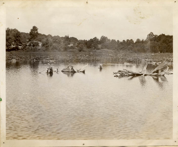
51.
|
Lake
Musconetcong (Stanhope Reservoir) - snags and weed growth in lake.
Date: 1930
Location: 25.1.2.9.8.
Negative No.: C.C.V. |
|
52.
|
Lake
Musconetcong (Stanhope Reservoir) - snags and weeds to be removed.
Date: 1930
Location: 25.1.2.9.8.
Negative No.: C.C.V. |
|
53.
|
Lake
Musconetcong (Stanhope Reservoir) - weed removal operations.
Date: 1930
Location: 25.1.2.9.8.
Negative No.: C.C.V. |
|
54.
|
Lake
Musconetcong (Stanhope Reservoir) - showing snags.
Date: 1930
Location: 25.1.2.9.8.
Negative No.: C.C.V. |
|
55.
|
Lake
Musconetcong Improvement - part of old towpath.
Date: 1932
Location: --
Negative No.: 20-1 |
|
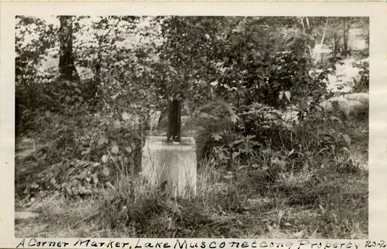
56.
|
Lake
Musconetcong Improvement - a corner marker, Lake Musconetcong property.
Date: 1932
Location: --
Negative No.: 20-2 |
|
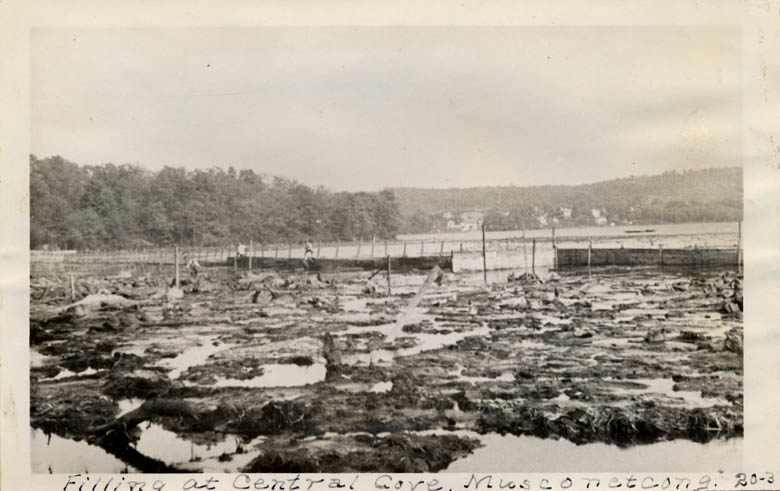
57.
|
Lake
Musconetcong Improvement - filling at Central Cove.
Date: 1932
Location: --
Negative No.: 20-3 |
|
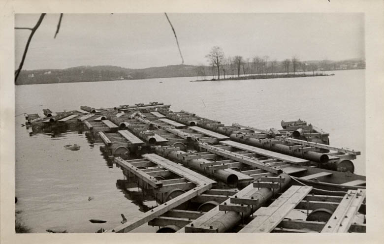
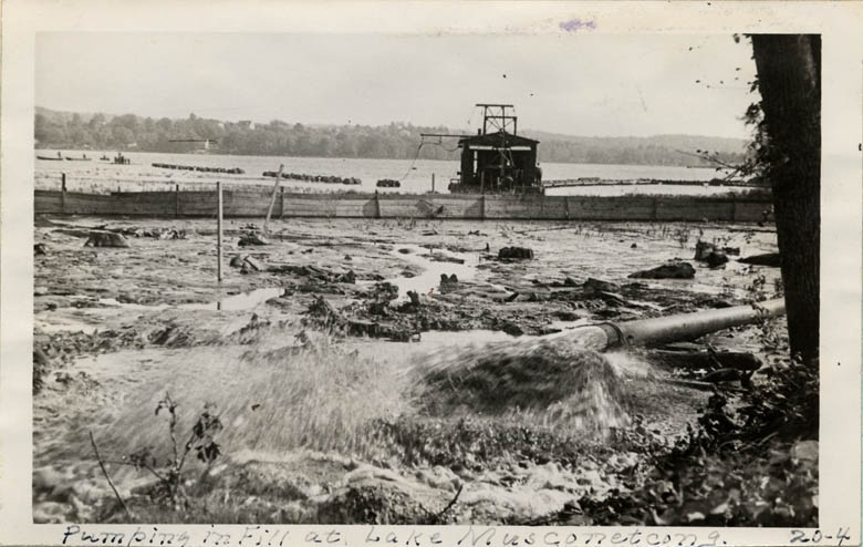
58.
|
Lake
Musconetcong Improvement - pumping in fill at Lake Musconetcong.
Date: 1932
Location: --
Negative No.: 20-4 |
|
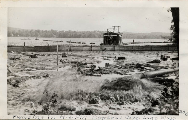
59.
|
Lake
Musconetcong Improvement - pumping in fill, Central Cove [2 copies].
Date: 1932
Location: --
Negative No.: 20-5 |
|
60.
|
W[est?]
E[nd?] Hopatcong - [shows dam].
Date: 9/16/1933
Location: --
Negative No.: -- |
|
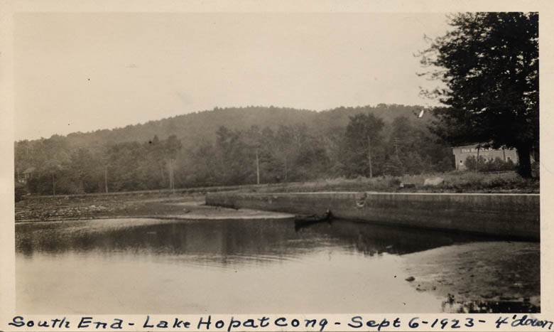
61.
|
South
End - Lake Hopatcong - 4' down.
Date: 6/6/1923
Location: --
Negative No.: -- |
|
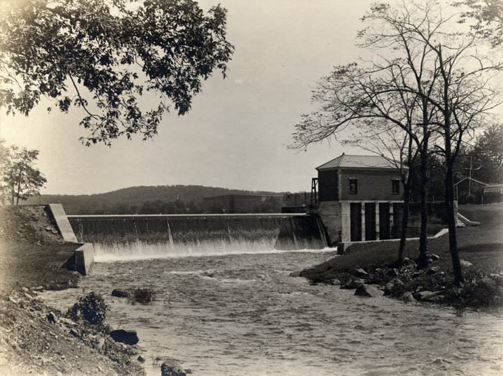
62.
|
Lake
Hopatcong Dam.
Date: 1927
Location: 25.2.1.7.4.
Negative No.: -- |
|
63.
|
Lake
Hopatcong Dam.
Date: --
Location: 25.2.1.7.4.
Negative No.: -- |
|
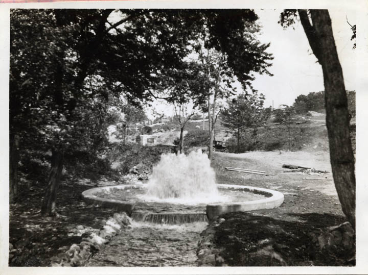
64.
|
Fountain
at Lake Hopatcong Dam.
Date: --
Location: 25.2.1.7.4.
Negative No.: -- |
|
65.
|
Bridge
MC #60 below Lake Hopatcong - "before."
Date: 1927
Location: 25.2.1.7.4.
Negative No.: -- |
|
66.
|
Bridge
MC #60 [below] Lake Hopatcong - "after."
Date: 1927
Location: 25.2.1.7.4.
Negative No.: -- |
|
67.
|
Bridge
MC #79, Peer's Lock, Denville - "before."
Date: 1927
Location: 25.4.1.7.7.
Negative No.: -- |
|
68.
|
Bridge
MC #79, Peer's Lock, Denville - "after."
Date: 1927
Location: 25.4.1.7.7.
Negative No.: -- |
|
69.
|
Pompton
River Aqueduct, Mountain View - before removal.
Date: 1927
Location: 26.1.2.6.8.
Negative No.: -- |
|
70.
|
Pompton
River - after removal of aqueduct.
Date: 1927
Location: 26.1.2.6.8.
Negative No.: -- |
|
71.
|
Open
cut north of Bridge MC #108, Mountain View.
Date: 1927
Location: 26.1.2.6.5.
Negative No.: -- |
|
72.
|
Drainage
cut south of Bridge MC #114, Pompton Feeder.
Date: 1927
Location: 23.41.5.2.6.
Negative No.: -- |
|
73.
|
Pequannock
Spillway.
Date: --
Location: --
Negative No.: C.C.V. |
|
74.
|
Guard
bank south of Pequannock Spillway.
Date: --
Location: --
Negative No.: C.C.V. |
|
75.
|
Dam
at Greenwood Lake.
Date: 1937 print
Location: --
Negative No.: 1718 |
|
76.
|
Greenwood
Lake Dam.
Date: 1928
Location: 22.25.4.3.3.
Negative No.: -- |
|
77.
|
Weasel
Brook waste gates - "before."
Date: 1927
Location: 26.2.5.9.3.
Negative No.: -- |
|
78.
|
Weasel
Brook waste gates - "after."
Date: 1927
Location: 26.2.5.9.3.
Negative No.: -- |
|
79.
|
Weasel
Brook waste gates - "after."
Date: 1927
Location: 26.2.5.9.3.
Negative No.: -- |
|
80.
|
Bridge
MC #130, Clifton - "before."
Date: 1927
Location: 26.2.5.9.9.
Negative No.: -- |
|
81.
|
Bridge
MC #130 - "after."
Date: 1927
Location: 26.2.5.9.9.
Negative No.: -- |
|
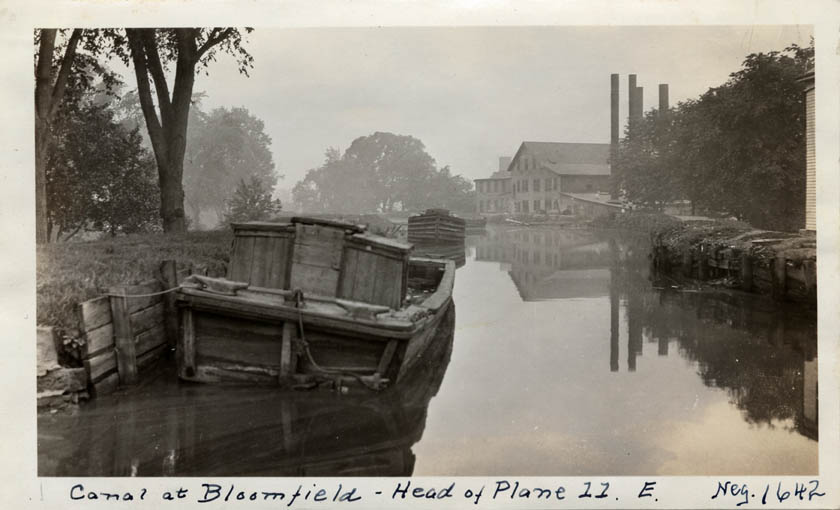
82.
|
Canal
at Bloomfield - Head of Plane 11 East.
Date: --
Location: --
Negative No.: 1642 |
|
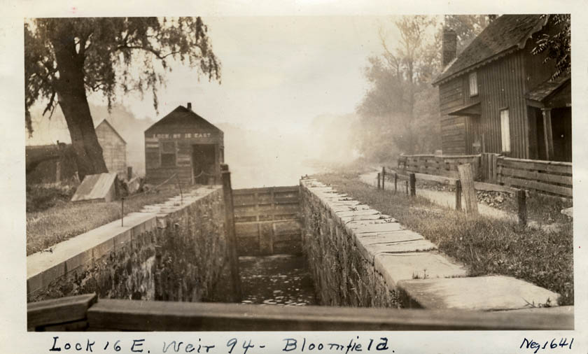
83.
|
Lock
16 East, Weir [tract] 94, Bloomfield.
Date: --
Location: --
Negative No.: 1641 |
|
84.
|
Head
of electric plane over Morris and Essex Railroad, Newark.
Date: --
Location: --
Negative No.: 1645 |
|
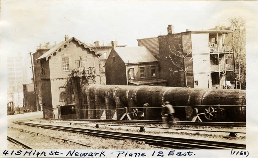
85.
|
415
High Street, Plane 12 East, Newark [2 copies].
Date: 1923
Location: 26.12.8.8.6.
Negative No.: 1160 |
|
86.
|
Canal
at Newark - Plane 12 East from Plane Street Bridge looking west [2
copies].
Date: 1923
Location: 26.12.8.9.4.
Negative No.: 1161 |
|
87.
|
Canal
east of Plane Street, Newark [2 copies].
Date: 1923
Location: 26.12.8.9.4.
Negative No.: 1159 |
|
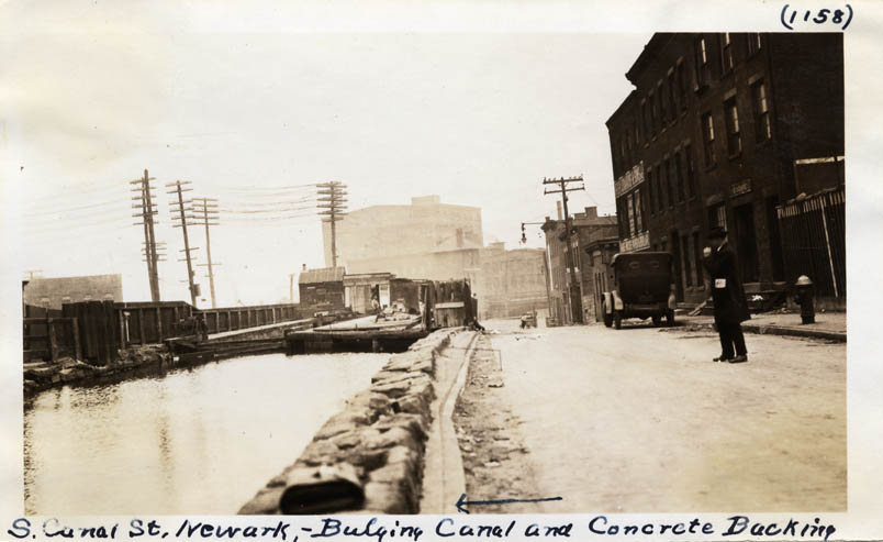
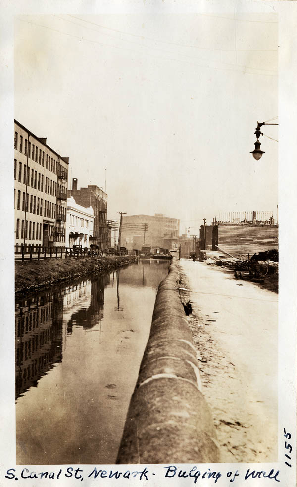
88.
|
South
Canal Street, Newark - bulging canal and concrete backing [2 copies].
Date: 1923
Location: 26.12.8.9.8.
Negative No.: 1158 |
|
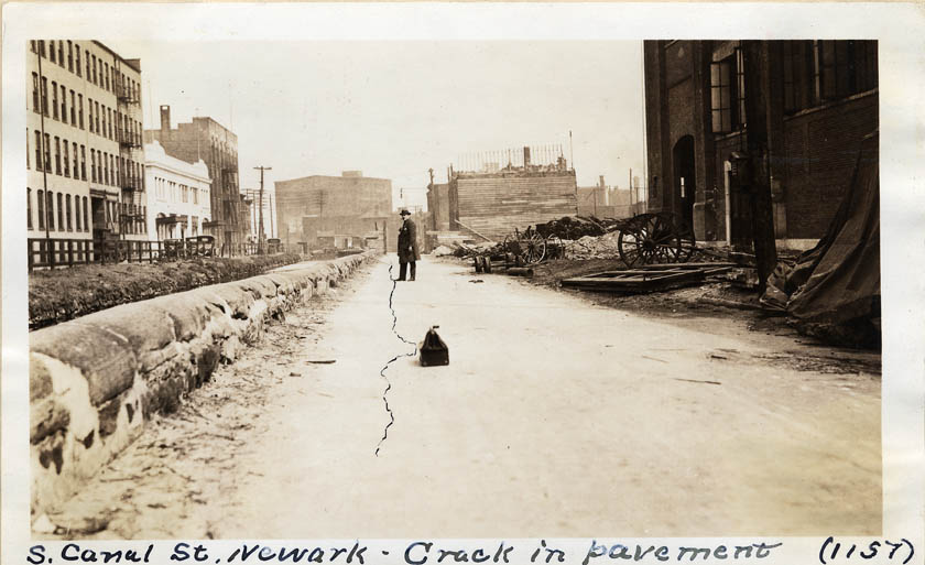
89.
|
South
Canal Street, Newark - crack in pavement [2 copies].
Date: 1923
Location: 26.12.8.9.8.
Negative No.: 1157 |
|
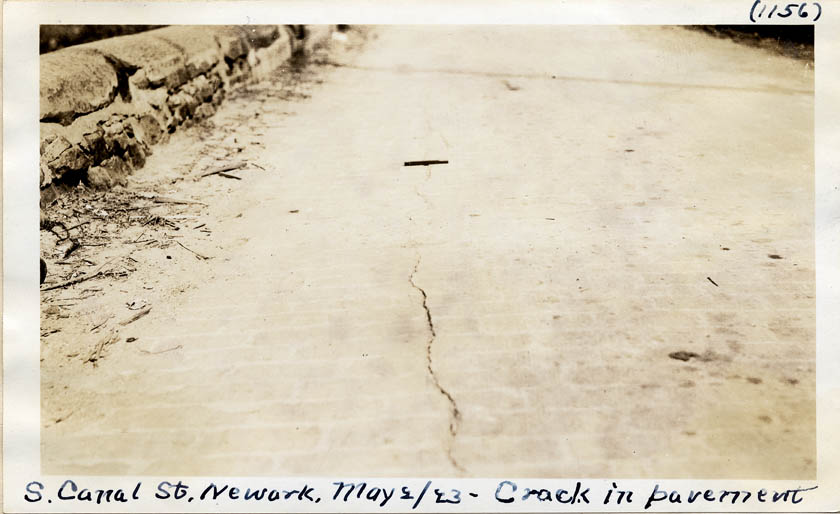
90.
|
South
Canal Street, Newark - crack in pavement [2 copies].
Date: 1923
Location: 26.12.8.9.8.
Negative No.: 1156 |
|
91.
|
South
Canal Street, Newark - bulging wall [2 copies].
Date: 1923
Location: 26.12.8.9.8.
Negative No.: 1155 |
|
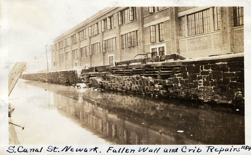
92.
|
South
Canal Street, Newark - fallen wall and crib repairs [2 copies].
Date: 1923
Location: 26.12.8.9.8.
Negative No.: 1154 |
|
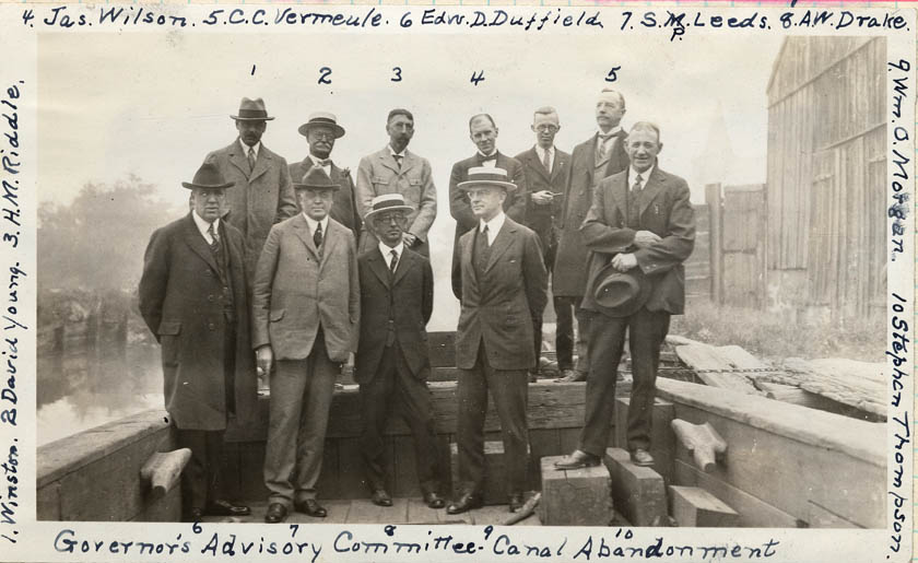
93.
|
Governor's
Advisory Committee - Canal Abandonment: Owen Winston, David Young,
Harry M. Riddle, James Wilson, Cornelius C. Vermeule, Edward D. Duffield,
S. P. Leeds, A. W. Drake, William O. Morgan, and Stephen Thompson.
Date: [1923]
Location: --
Negative No.: |
|
Consult the Reference services page
and/or the Guide to Reproduction and
Research Services, Policies and Fees for information on reproduction
of images included in this collection.
Created September
2003; Images added March 2008
|