Delaware • New Jersey • Pennsylvania
New York • United States of America
We all know that 2018 was wet, with record or near-record rainfall at several locations throughout the Delaware River Basin. Interestingly, despite the rainfall totals, no mainstem river flooding occured on the Delaware in 2018.
Here at the DRBC, one of our roles is to monitor and manage flow rates, primarily in the Delaware River. This is done to ensure there is enough freshwater flowing downstream to keep the ocean/bay salt water pushed back so that it does not endanger the drinking water intakes for Philadelphia and South Jersey.
Knowing that 2018 was a wet year, our operations and science staff looked at USGS flow data and discovered that last year's flow rates (measured in cubic feet per second) were record-breaking or near-record-breaking at the following locations:
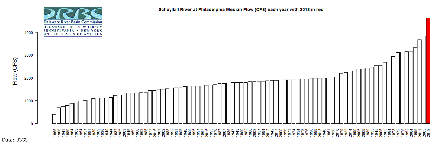 |
| Schuylkill River at Philadelphia, Pa.: The highest median flows were in 2018 (the measurement is taken about 150 feet upstream from the Fairmount Dam). Records go back to 1932. |
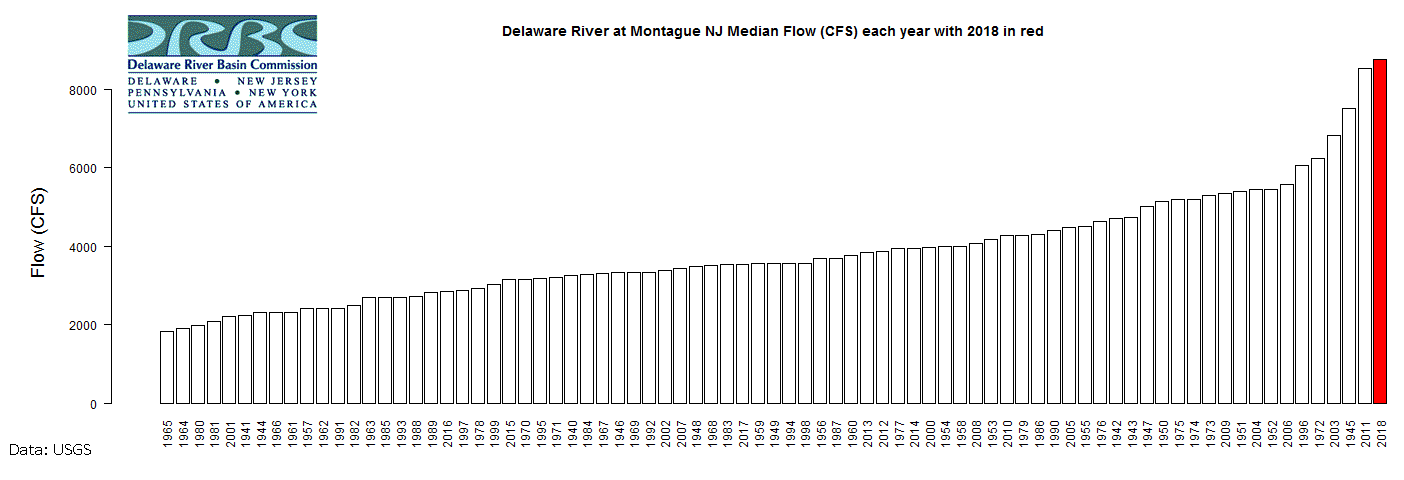 |
| Delaware River at Montague, N.J.: The highest median flows were in 2018 (the measurement is taken about 1500 feet upstream from the bridge connecting Montague, N.J. and Milford, Pa.). Records go back to 1940. |
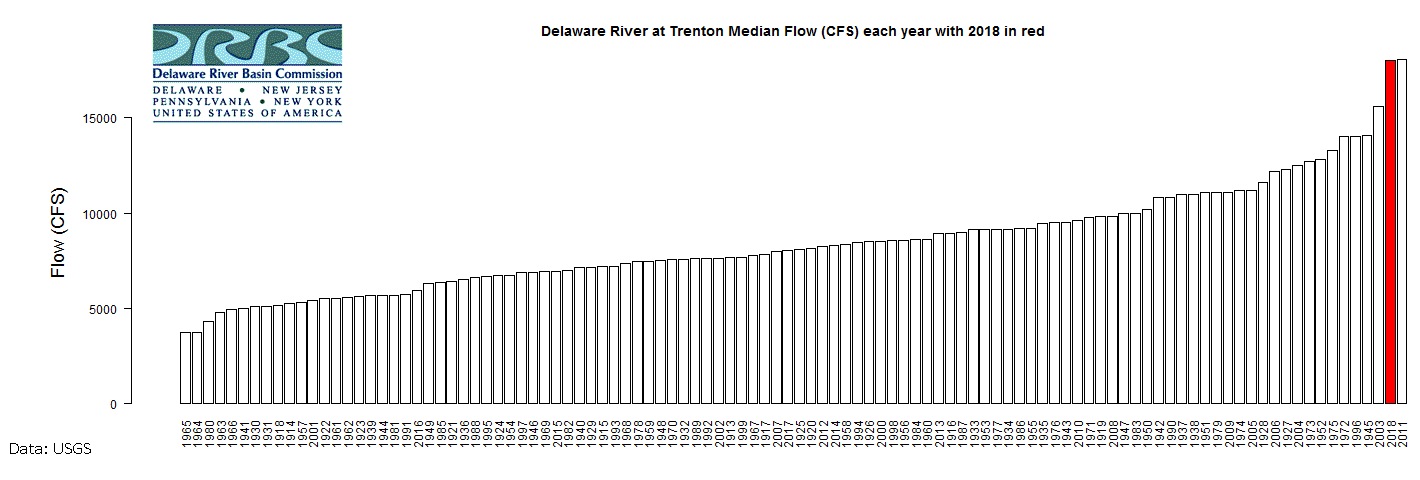 |
| Delaware River at Trenton, N.J.: The second highest median flows were in 2018 (the measurement is taken about 450 feet upstream from the Calhoun Street Bridge at Trenton, where the river is still non-tidal). Please note that the highest year was 2011, which included flows resulting from Hurricane Irene and Tropical Storm Lee. Records go back to 1913. |
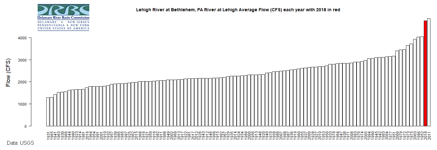 |
| Lehigh River at Bethlehem, Pa.: The second highest median flows were in 2018 (the measurement is taken on left bank 110 ft. upstream from bridge on New Street at Bethlehem, and 1,800 ft upstream from Monocacy Creek; records include flow of Monocacy Creek). Please note that the highest year was 2011, which included flows resulting from Hurricane Irene and Tropical Storm Lee. Data used for this chart go back to 1910. |