Delaware • New Jersey • Pennsylvania
New York • United States of America
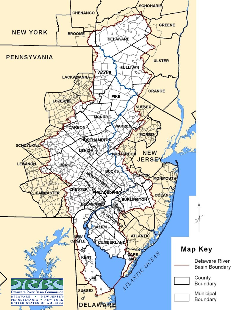 |
| Map of county & municipal boundaries in the Delaware River Basin. Click for larger version. |
The Delaware River Basin Commission was formed in 1961 by concurrent compact legislation among the four basin states (New York, Delaware, Pennsylvania and New Jersey) and the federal government.
The DRBC was created so the entire Delaware River Basin would be managed collectively by the five members, without regard to political boundaries. Before the DRBC, some 43 state agencies, 14 interstate agencies, and 19 federal agencies exercised a multiplicity of splintered powers and duties within the watershed, which stretches 330 miles from the Delaware River's headwaters near Hancock, N.Y., to the mouth of the Delaware Bay.
The Delaware River Basin Compact that created the DRBC is federal law and law in each Basin state. Today, more than six decades later, the Commission remains the only entity authorized to manage the Basin as a single hydrologic system, replacing fragmented state-by-state oversight with coordinated regional governance.
In addition to parts of four states, the Delaware River Basin includes all or portions of 42 counties, 836 municipalities and multiple government entities and jurisdictions.
Federal
• Federal Representation/Government Links
State
• Basin State Representation/Government Links
County/Municipal
• DRB County & Municipality Information
Regional Entities
• Christina Basin Clean Water Partnership
• Delaware River and Bay Authority
• Delaware River Basin Source Water Collaborative
• Delaware River Joint Toll Bridge Commission
• Delaware River Port Authority
• Delaware Valley Regional Planning Commission
- Mid-Atlantic Regional Association Coastal Ocean Observing System
- Partnership for the Delaware Estuary
- Schuylkill Action Network
- Upper Delaware Council
- Urban Waters Federal Partnership for the Delaware River (Camden, Chester, Philadelphia and Wilmington)
- Water Resources Association of the Delaware River Basin
Interstate Agencies/Organizations
- American Water Resources Association
- American Water Works Association
- Association of Clean Water Administrators
- Great Lakes Commission
- Interstate Commission on the Potomac River Basin
- Interstate Council on Water Policy
- Interstate Environmental Commission
- New England Interstate Water Pollution Control Commission
- Ohio River Valley Water Sanitation Commission
- Susquehanna River Basin Commission