Delaware • New Jersey • Pennsylvania
New York • United States of America
DRBC's ArcGIS Gallery
(click image to view the Gallery)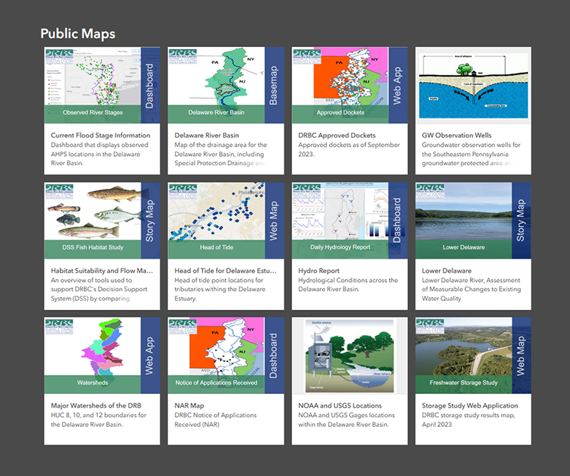
Featured Application: Hydrologic Conditions Across the Delaware River Basin
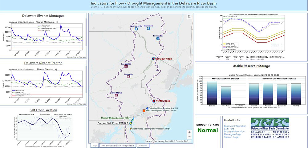 |
This ArcGIS dashboard of hydrologic data (click image to view) for the Delaware River Basin is updated daily every morning.
Please note that the conditions on this dashboard are only updated once daily and are not to be used for real-time observations.
• Additional DRBC hydrologic reports
• USGS Delaware River Dashboard
Featured Application: Map of DRBC Docket and Permit Holders
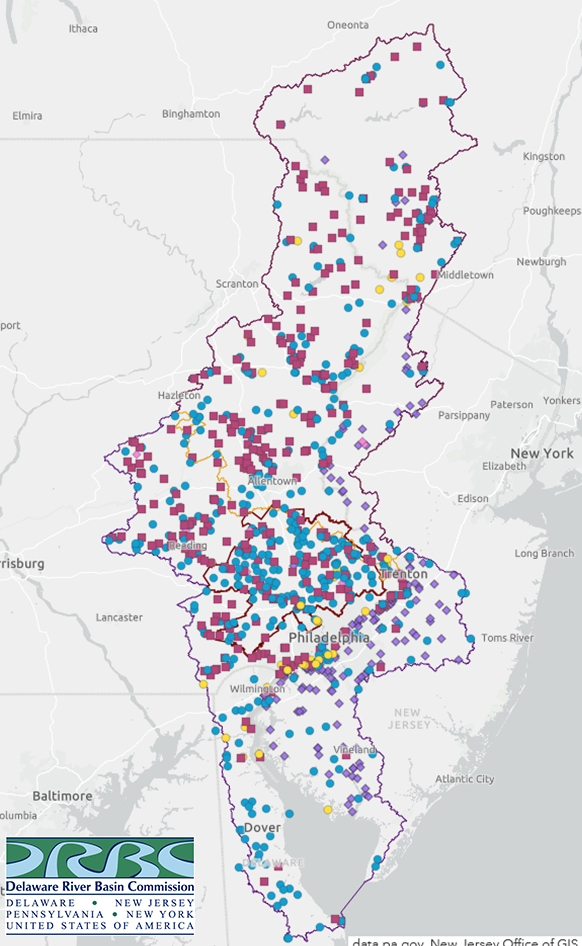 |
This map (click on the image to view) shows the location of projects having a current approval from DRBC or those currently engaged in the renewal or one process/one permit process.
A single location is used for each project regardless of how many specific withdrawal or discharge locations the project may have. When you select a project, a pop-up menu will provide you with a list of key attributes and a link to a pdf file of the DRBC approval.
Please note that only projects approved since 1/1/2005 are available for display on the map.
The map is currently updated to include projects approved at the December 10, 2025, DRBC Business Meeting.
• Learn more about DRBC's project review program
Featured Application: Projecting Extreme Precipitation in the Delaware River Basin
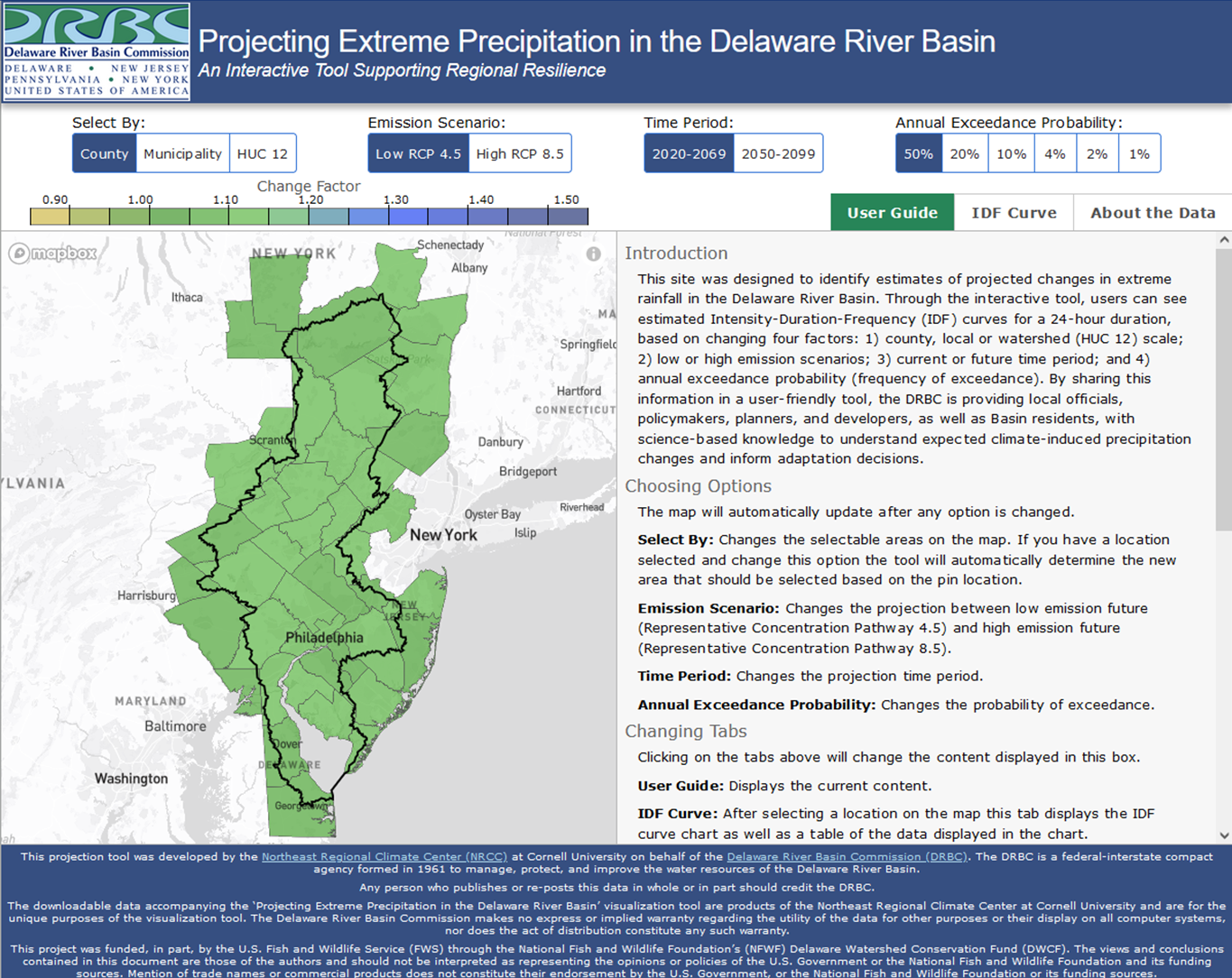 |
The Projecting Extreme Precipitation in the Delaware River Basin tool (click image to view) released by the DRBC allows users to obtain estimates of future changes in rainfall patterns using intensity, duration and frequency (IDF) curves.
All are archived PDFs, except those marked otherwise.
 |
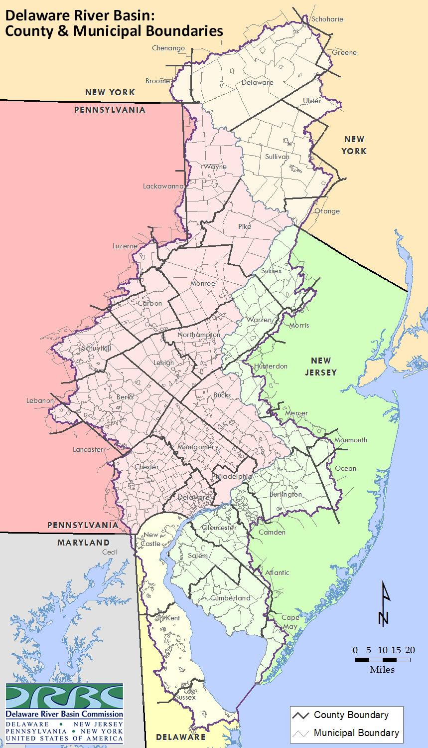
Delaware River Basin
• Basin: select reservoirs/cities/tributaries
• Basin: county boundaries & select cities
• Basin: county boundaries & select reservoirs/cities/tributaries
• Basin: county & tidal boundaries, with select reservoirs & cities
Delaware River Basin w/Major Reservoir Call-out Boxes
• Basin without county boundaries
• Basin with county boundaries
• Basin with county boundaries & additional info
• Basin without county boundaries & with storage info (incl. drought emergency storage availability)
• Basin with county boundaries & storage info (incl. drought emergency storage availability)
Delaware River Basin: Shaded Relief
• Basin without county boundaries
• Basin with county boundaries
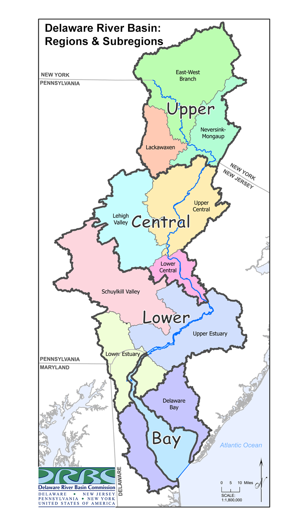
Delaware River Basin: SubWatersheds/SubRegions
• HUC 8 Watersheds within the Delaware River Basin
• Watersheds of the Delaware River Basin
• Regions & Sub-regions of the Delaware River Basin (PNG)
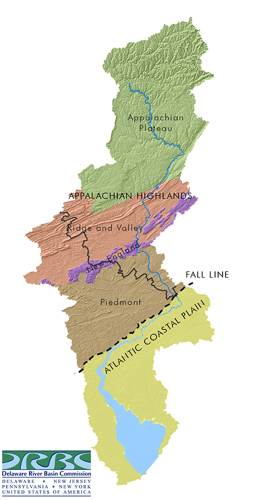
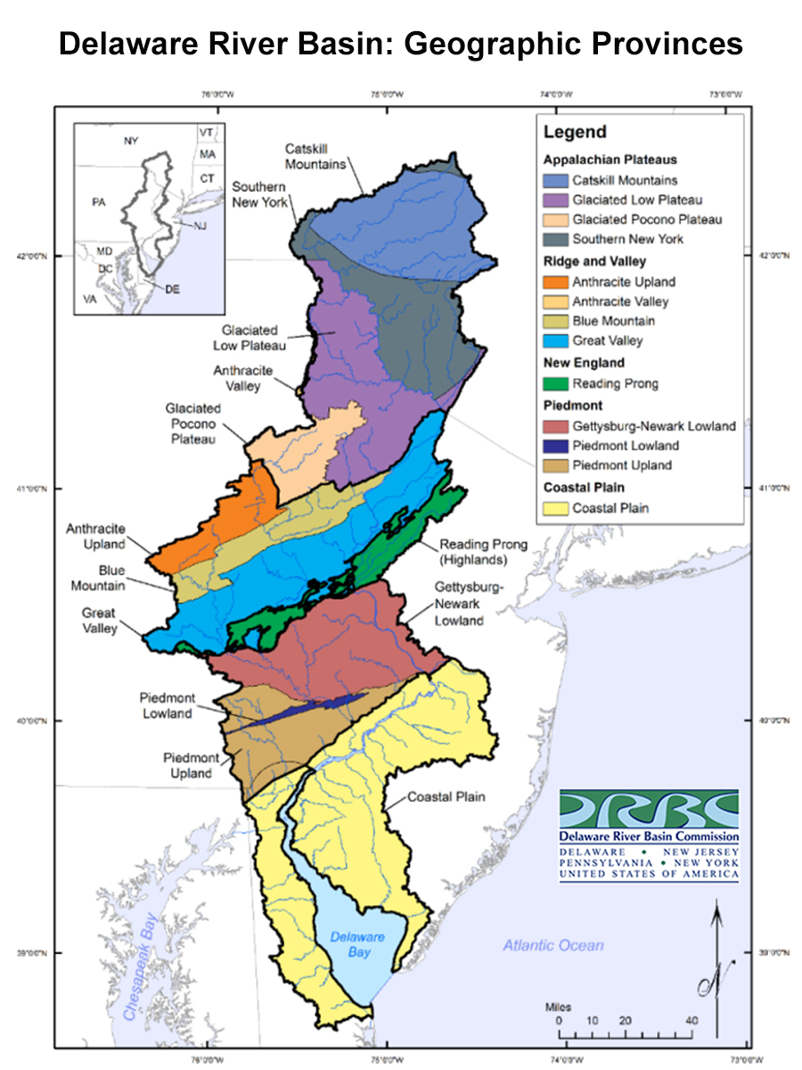
• Physiographic Regions of the Delaware River Basin (JPG)
All are archived PDFs, except those marked otherwise.
 |
Water Quality
• Special Protection Waters Drainage Area
• Special Protection Waters Drainage Area, with Wild & Scenic River sections
• DRBC Biomonitoring Program Site Location Map
• DRBC Water Quality Zones by river mileage
• DRBC Water Quality Zones with county boundaries & select cities
• DRBC Delaware Estuary Water Quality Zones
• Delaware Estuary Water Quality Monitoring Program Locations & DRBC Water Quality Zones
• DRBC Water Quality Monitoring Sites
Water Supply/Planning
• Southeastern Pennsylvania Groundwater Protected Area within the DRB
• Southeastern Pennsylvania Groundwater Protected Area: included counties/municipalities
Project Review/Permitting
• DRBC Map of NPDES Permitted Discharge Sites in the Delaware River Basin
• DRBC Map of Surface Water Withdrawals in the Delaware River Basin
Hydrology/Flow Management
• Furthest Upstream Location of the Salt Front during the 1960s Drought of Record
Others by the DRBC
• Native Territories in the Delaware River Basin
• National Wild & Scenic River Stretches within the Delaware River Basin
• U.S. Congressional Districts & Representation in the Delaware River Basin
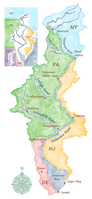 |
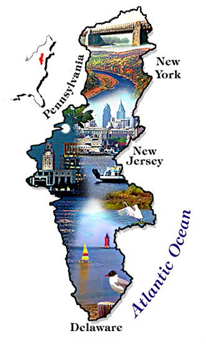
• Illustration/Tourist Map: A Look at the Delaware River Basin (JPG)
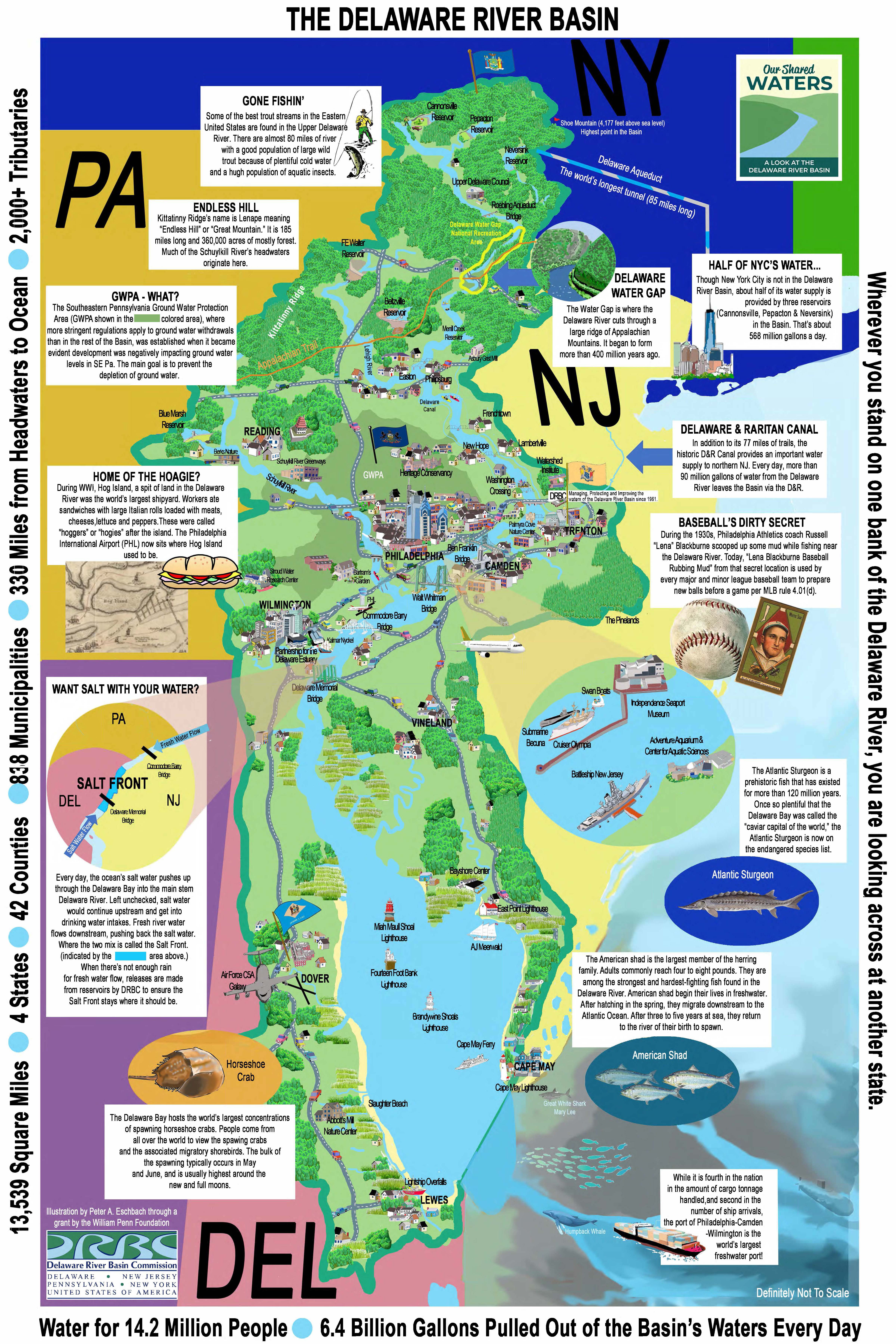
• Population Served by the Delaware River Basin, 2020 (JPG)
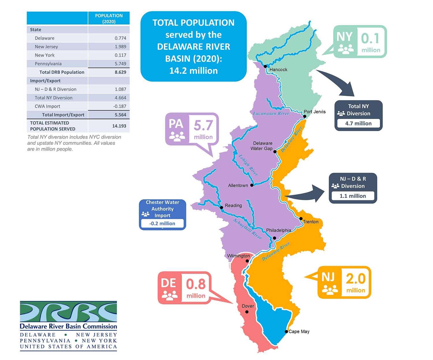
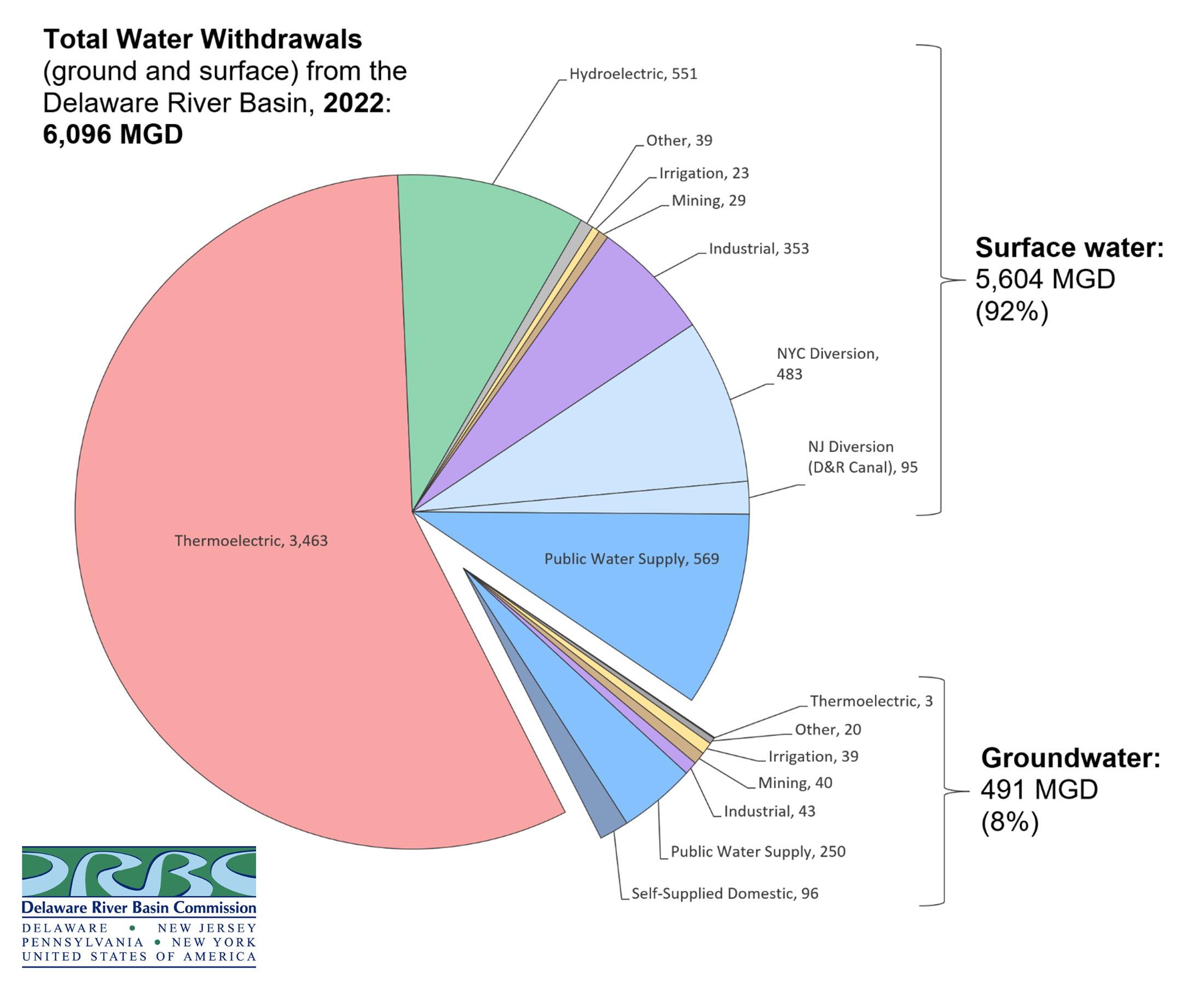
• Total Water Withdrawals in the Delaware River Basin by Sector, 2022 (PNG)
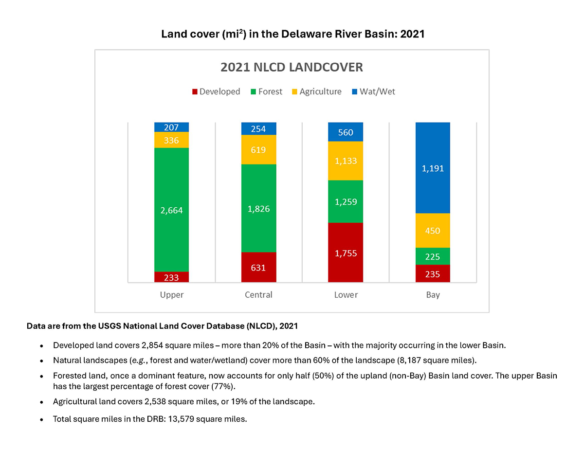
• DRB Land Cover (2021 data; JPG)
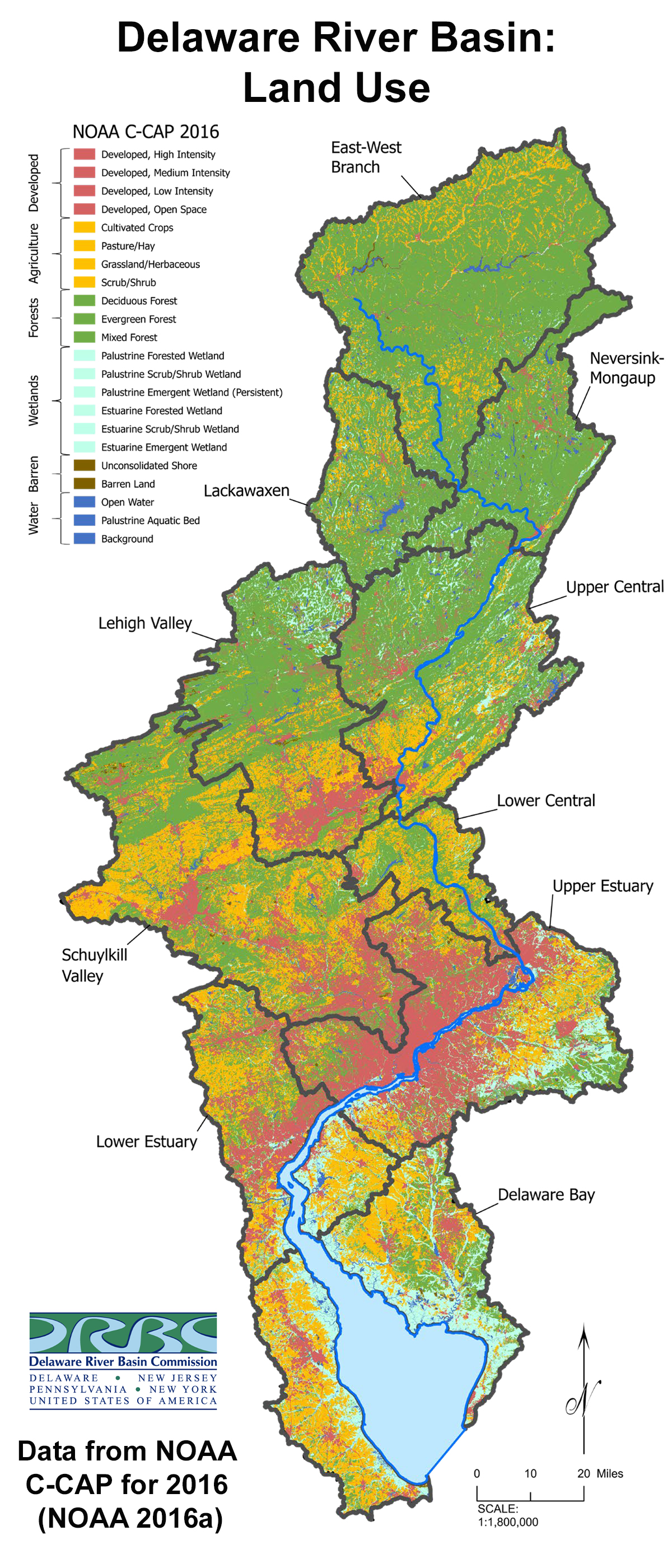
• DRB Land Cover (2016 map; JPG)
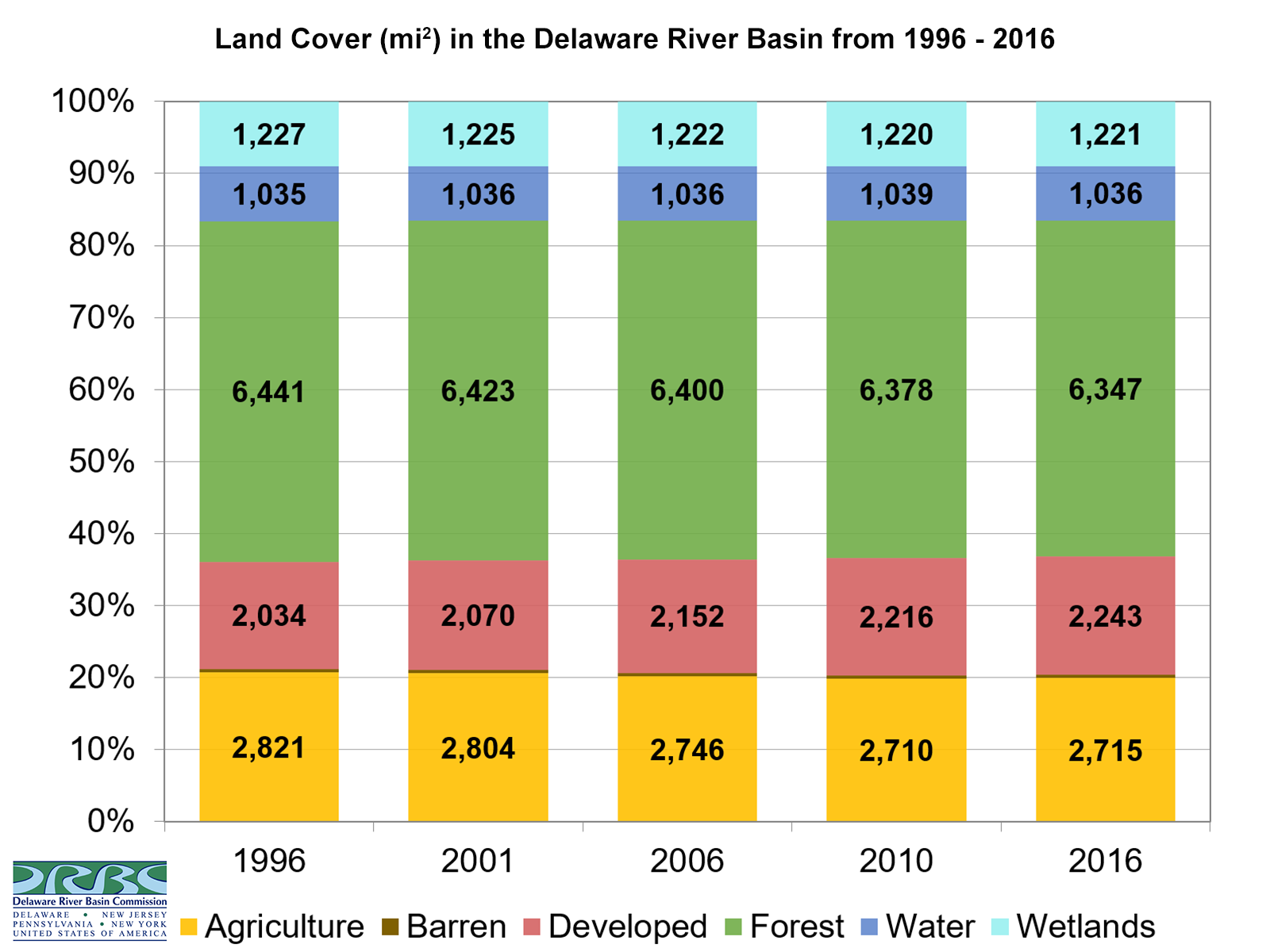
• DRB Land Cover Changes in Distribution (1996-2016; PNG)
• Map of Impervious Cover in the DRB (2021; PNG)
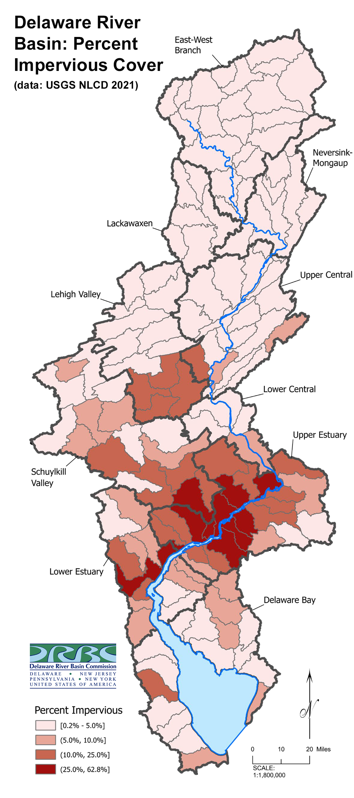
• Water Management Schematic for the Delaware River Basin (archived PDF)
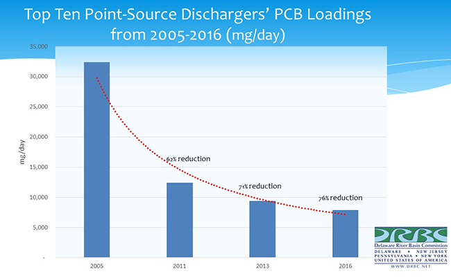
• Reductions in Top 10 Point Source Dischargers' PCB Loadings 2005-2016 (JPG)
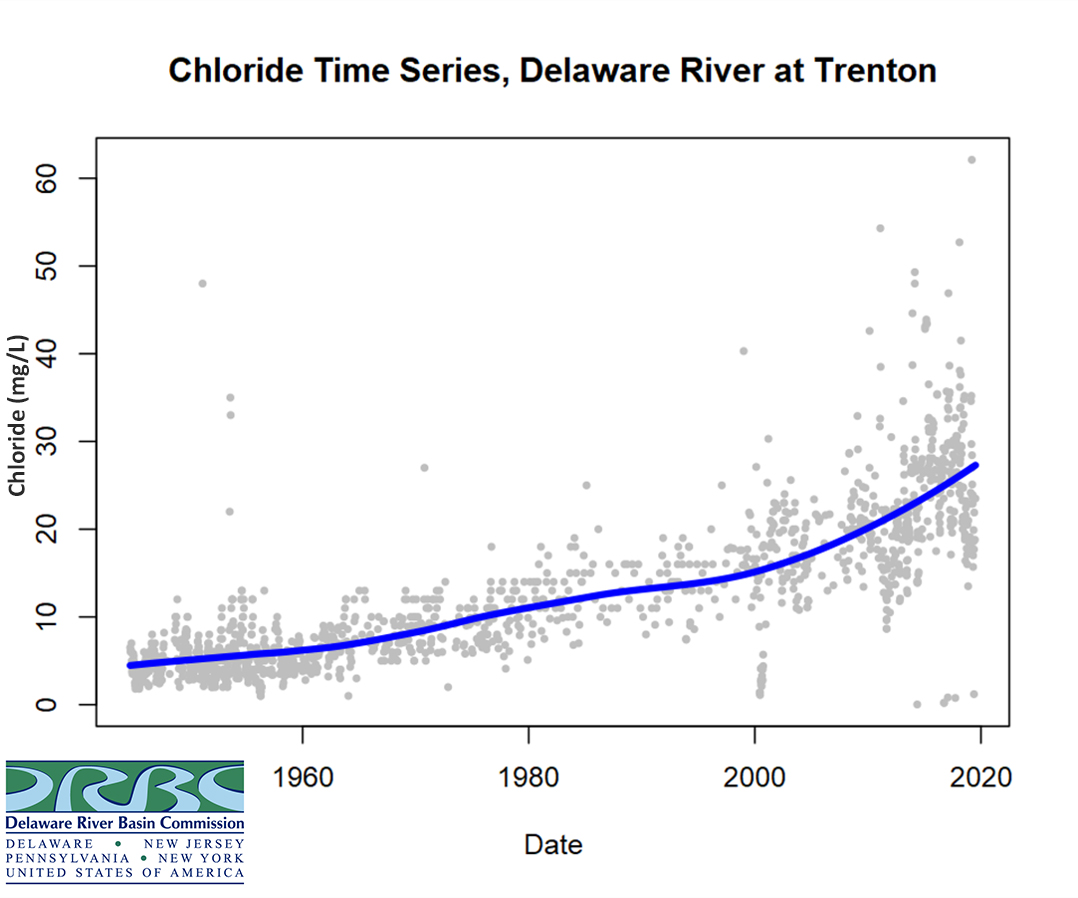
• Chlorides at the Delaware River at Trenton - a timeseries (JPG)
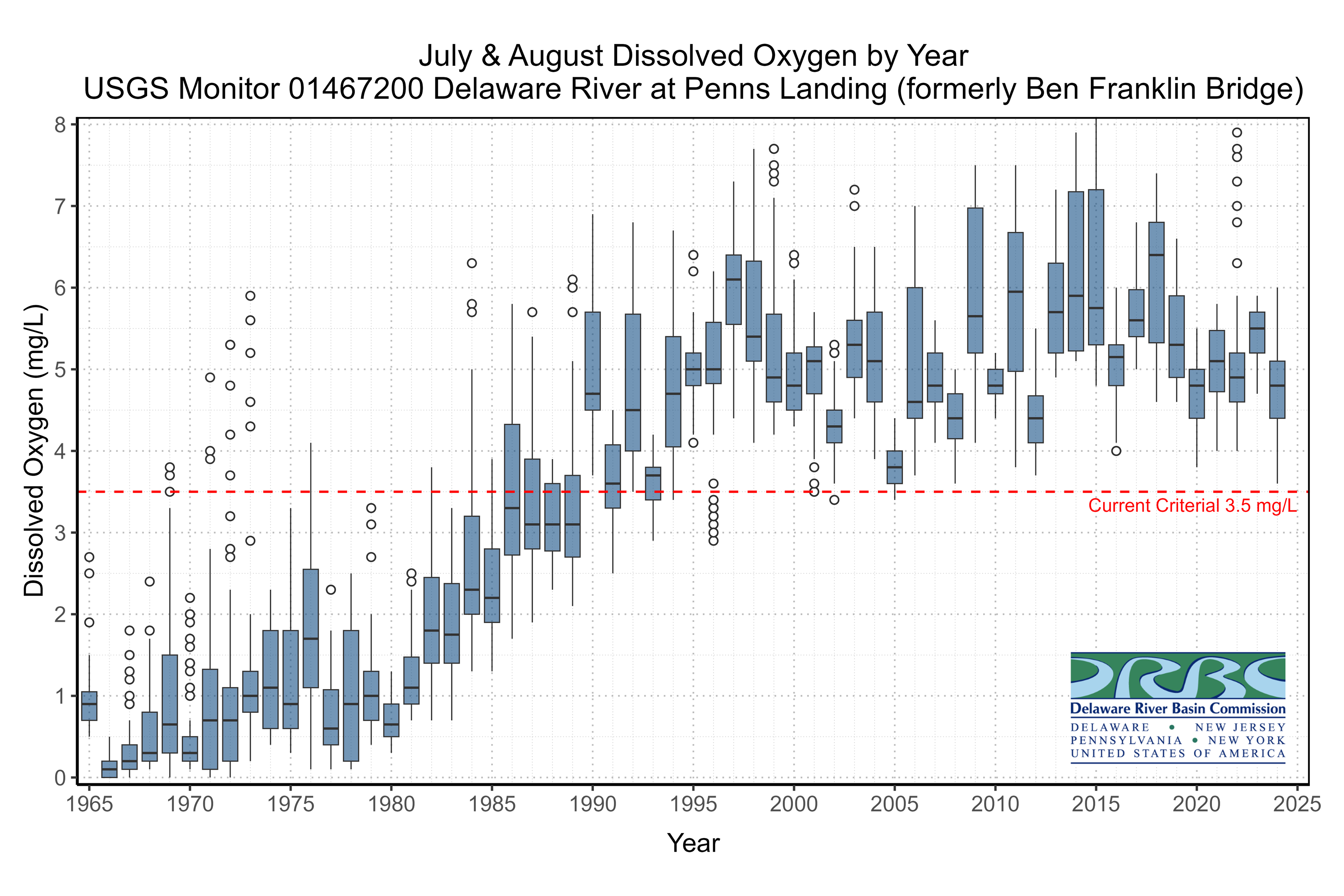
• Average DO July & August at USGS Penn's Landing Gage: 1964-2024 (JPG)
• Average Salt Front Location in the Delaware River Estuary (JPG)
• Flow Data Bar Charts for select locations, showing 2018 as record year (webpage)
• Flow Data Bar Chart for the Delaware River at Trenton, updated for 2023 (JPG)
• Flow Data: visualized using R scripts (webpage)
• Water Quality Data: visualized using R scripts (webpage)
• Groundwater Well Data for Southeastern Pa. Groundwater Protected Area: visualized using R scripts (webpage)
• DRBC Delaware Estuary Monitoring: Dissolved Oxygen Improvements 1967-2024 (YouTube)
• Percent of Groundwater Use in the Delaware River Basin: 1997-2017 (YouTube)
• Schuylkill River Discharge per Drainage Area: September 1-5, 2021 (YouTube)
• Schuylkill River Discharge Profile: Watch the River Rise & Fall, 8/12/21 - 9/5/21 (YouTube)
• Delaware River Discharge Profile: Watch the Non-Tidal River Rise & Fall, 8/12/21 - 9/5/21 (YouTube)
From the DRBC
• Geographic Information System (GIS) Data
• Recreation Maps for the Delaware & Schuylkill Rivers
• Mapping Water Resource Landscapes in the DRB
From Outside Sources
• U.S. Geological Survey: How We Monitor & Model Stream Temperature in the Delaware River Basin and Water Science and Management in the Delaware River Basin
• Shippensburg University: Delaware River Basin Project
• River Runner: this application by web visualization/developer Sam Learner allows you to click on the map anywhere in the U.S. and follow the "drop of water" as it flows through its watershed. This is a great way to visualize a watershed and how rivers and streams are connected.
• Big Eddy Narrows: this map by Lisa Glover shows the deepest and narrowest points of the Delaware River (PDF)
• Native Land Digital: Native Populations in the Delaware River Basin