|
|
New Jersey Coastal Atlas
Interactive Mapping and Planning Tools |
The New Jersey Coastal Atlas provides online interactive maps, photos, videos, and data downloads for the exploration of New Jersey’s ocean and coastal zones. Themes presented include: 1) Coastal Hazards, 2) Coastal Restoration and 3) Ocean and Coastal Planning.
| Coastal Hazards |
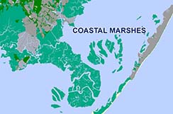
Coastal Restoration and Living Shorelines |
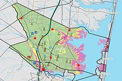
Ocean and Coastal Planning |
 |
 |
 |
The interactive maps in this section provide flood hazard spatial information. |
The interactive maps in this section provide spatial information on living shoreline and ecological solutions. |
The interactive maps in this section contain ocean and coastal planning spatial information. |
| |
|
|
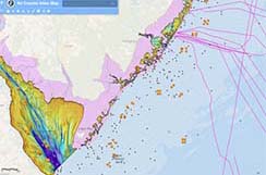
| Drone Coastal Mapping and Monitoring |
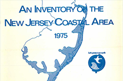
An Inventory of the New Jersey Coastal Area |
GIS Data Downloads |
 |
 |
 |
New Jersey Coastal Management Drone field photos, videos and maps. |
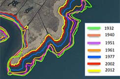
Historical maps and spatial information from New Jersey Coastal Management archives. |
|
| |
|
|
Spatial information presented here was developed at regional scales and is not for regulatory purposes.
Refer to the source data descriptions for attribute and spatial extent limitations. |
|
|