 Official Site of The State of New Jersey
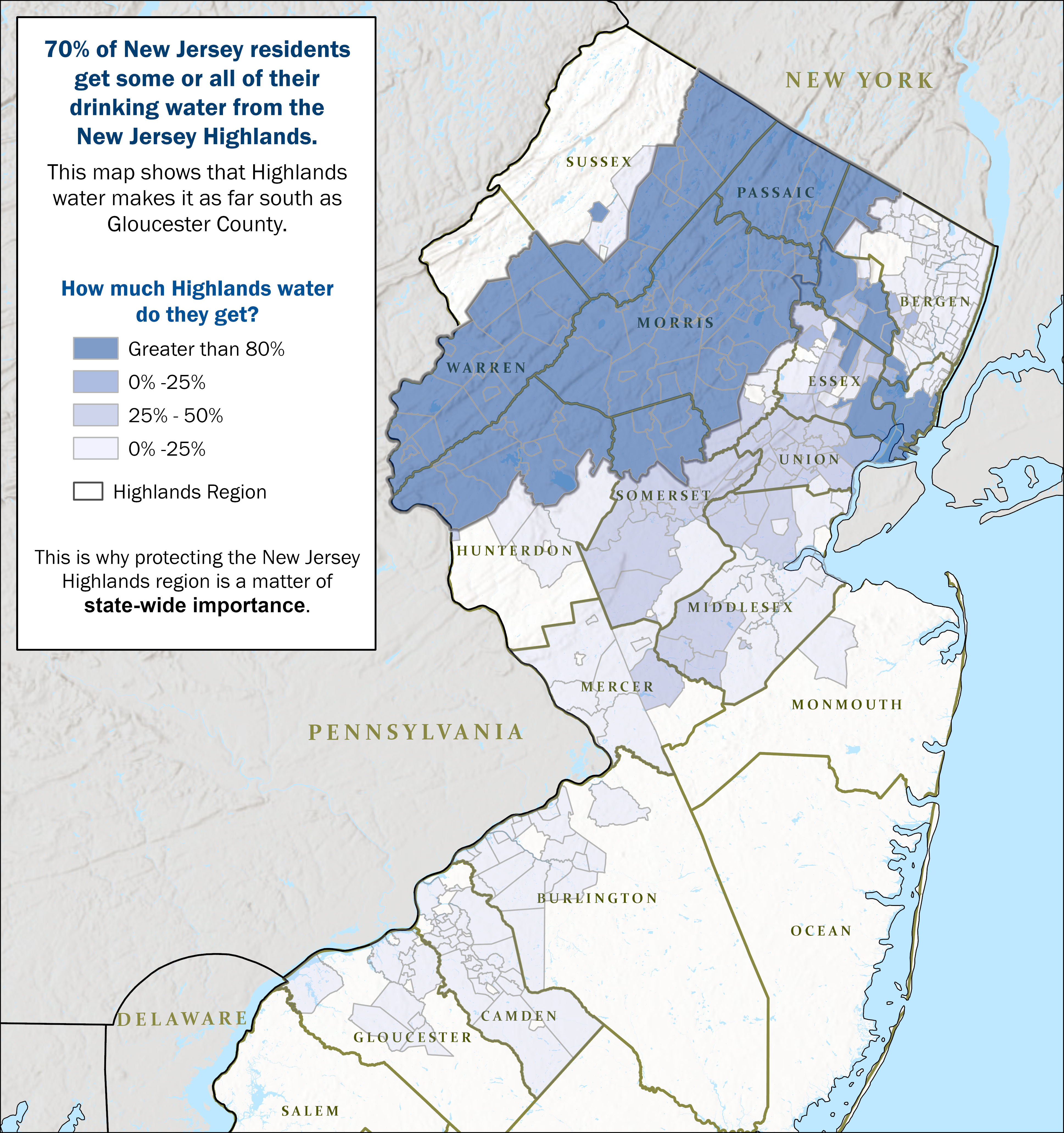
The New Jersey Highlands region stretches from the banks of the Delaware River in Warren and Hunterdon counties to the New York State border along northern Sussex, Passaic, and Bergen counties. The Highlands Region covers approximately 1,300 square miles and includes 88 municipalities and portions of seven counties (Bergen, Hunterdon, Morris, Passaic, Somerset, Sussex, and Warren).
Noted for its scenic beauty and environmental significance, the region displays myriad geographic and geologic features, including rolling hills, pastoral valleys, steep ridges, diverse forests, and critical wildlife habitats. The boundaries of the region as established in the 2004 Highlands Water Protection and Planning Act align closely with those of the physiographic province of the same name. The New Jersey Highlands is also rich with historic, cultural, and archaeological resources due to its place in American Revolutionary War era history, iron mining, canal building, agrarian settlements and early industry.
Although the region covers less than 15% of the state’s land area, 70% of the state’s residents get some or all of their drinking water from the Highlands (see graphic), including 8 out of every 10 people living in a designated Overburdened Community. For this reason, the New Jersey Highlands Region requires special protection.
Federal Highlands Region
New Jersey is part of the four-state federal Highlands Region. The federal Highlands Region extends from Southeastern Pennsylvania through parts of New Jersey, New York, and into Connecticut. Recognizing the significance and value of the resources within this region, the United States Congress enacted the Highlands Conservation Act (HCA) in 2004. The HCA authorizes funding to protect lands with the highest conservation value in the four-state region.