Delaware • New Jersey • Pennsylvania
New York • United States of America
- All About the Delaware River
- The Delaware River Basin
- Video: Our Shared Waters: A Flight Along the Delaware
- Resource Archives
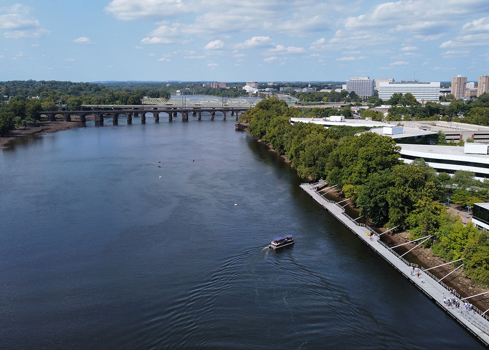 The Delaware River at Trenton, N.J. Photo courtesy of The Watershed Institute. |
Free Flowing
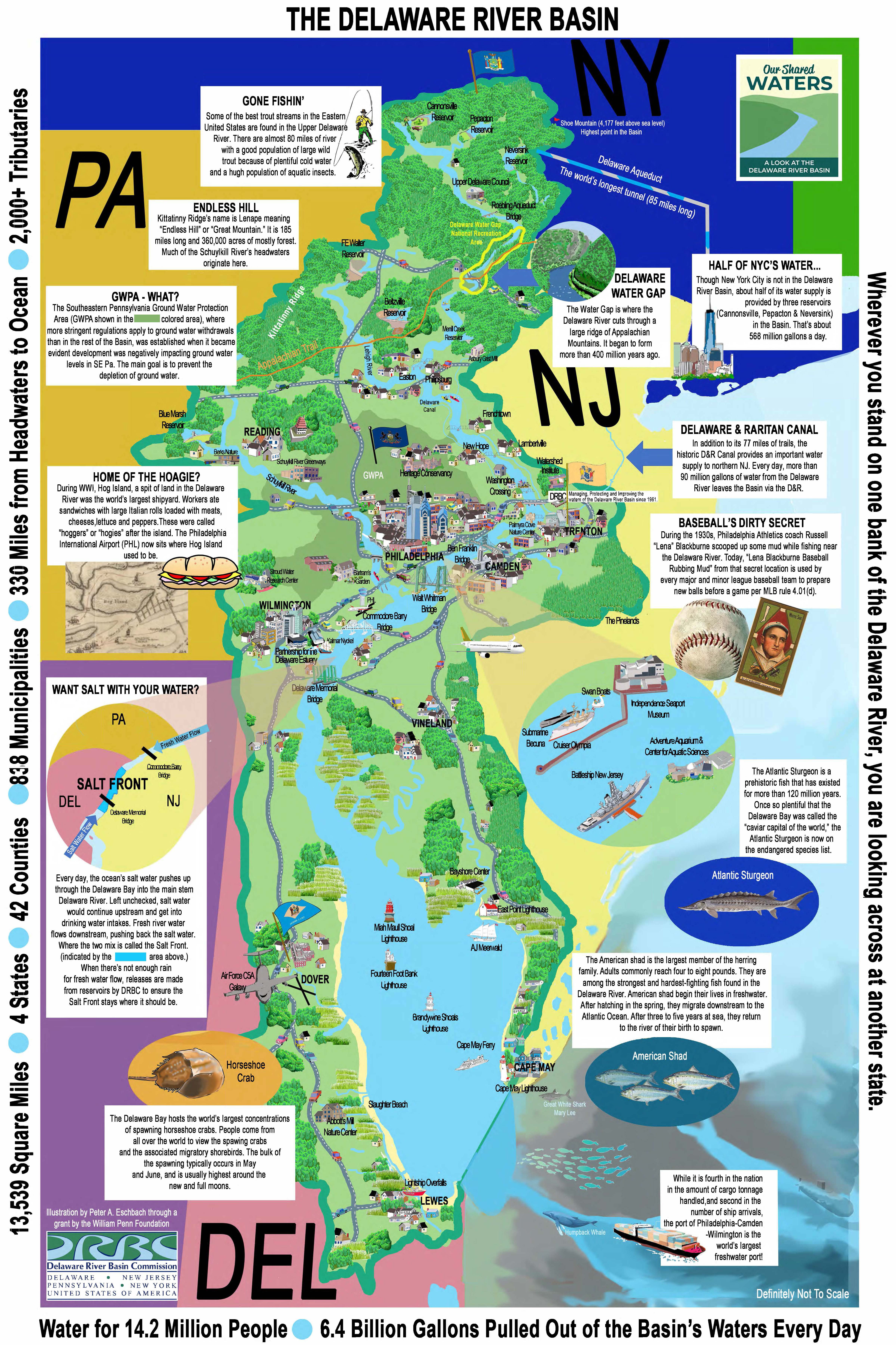
The Delaware River is the longest undammed river east of the Mississippi River.
Border/Boundary
The Delaware is an interstate river its entire length; whenever you stand on one bank, you look across at another state
Length
The river flows for 330 miles; ~197 miles are non-tidal; ~133 miles are tidal
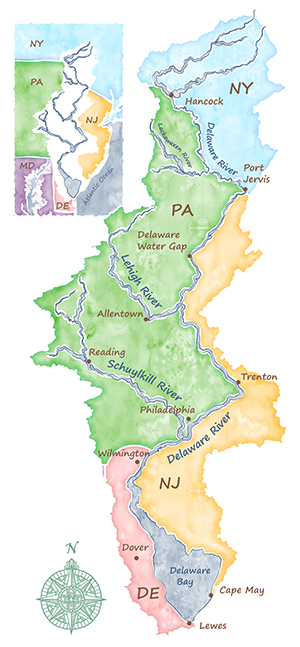
Headwaters
The river's headwaters are the East Branch Delaware River and West Branch Delaware River; they meet at Hancock, N.Y. to form the Delaware River.
Mouth
The mouth of the Delaware River is located at Cape May, N.J./Lewes, Del., where the Delaware Bay meets the Atlantic Ocean.
Non-Tidal River
The non-tidal Delaware River flows for 197 miles from its headwaters in N.Y. south to Trenton, N.J.; clean, high-quality waters
• Part of DRBC's Special Protection Waters Program
• 75% in the National Wild & Scenic Rivers System
Tidal River
The tidal Delaware River flows for 133 miles from Trenton, N.J. south to the Delaware Bay; aka the Delaware River Estuary, where the river's freshwater mixes with the ocean's saltwater
• The Delaware River Estuary is part of the National Estuary Program, which protects estuaries of national significance; managed by the Partnership for the Delaware Estuary
• While the entire tidal river is part of the estuary, salinity levels vary from the Delaware Bay (saltwater) to Wilmington, Del. (brackish) to Philadelphia, Pa. and Trenton, N.J. (mostly freshwater).
• The tidal change also varies; in the Delaware Bay, the tidal change is about six feet, but in Trenton, it is about ten feet.
• Map of Head of Tide Locations for Tributaries in the Delaware Estuary
Tributaries
The Delaware River has more than 2,000, including 216 major ones. The largest tributaries are the Schuylkill and Lehigh rivers, both in Pennsylvania.
A Clean Water Success Story
The Delaware River has come a long way from its polluted past in the late 1800s to mid 1900s, and its clean-up is hailed as one of the world's top water quality success stories.
- Historic Dissolved Oxygen Levels & Recovery
- The Clean Water Act: 50th Anniversary
- Delaware River: American Rivers' 2020 River of the Year
- Delaware River: Pennsylvania's 2025 River of the Year
Today, the Delaware River is cleaner and healthier, supporting numerous species of wildlife and millions of people. It supports a robust recreation/tourism economy and is home to the largest freshwater port in the world. It is proof that a living and a working river can coexist.
Migratory fish - for example, the American shad and the endangered Atlantic sturgeon - and resident fish are supported by the river; the upper Delaware is also a world-class trout fishery.
Bald eagles reside or overwinter all along the river, surviving on fish as their primary food source.
Horseshoe crabs breed on the shores of the Delaware Bay more than any other place in the world.
Recreation & Tourism opportunities include boating/paddling, fishing, biking and birding. The Basin has numerous land and water trails, in addition to marinas, greenways and parks.
Delaware River Port Complex
The Delaware River Port Complex that includes docking facilities in Pennsylvania, New Jersey and Delaware is the largest freshwater port in the world.
- Port Activity (2024): the regional port exports were valued at $13.5 billion and came in at over 1.2 millions tons. Imports were valued at $128.3 billion, including 34.9 million metric tons of goods (from the Winter 2025 edition of The Beacon, published by the Maritime Exchange for the Delaware River and Bay)
- Port Cargo: Includes petroleum and petrochemical products, container cargo, forest products and automobiles. It is the largest North American port for steel, paper and meat imports, as well as the largest importer of cocoa beans and fruit on the East Coast. Over 65% of Chilean and other South American fruits imported into the United States arrive at terminal facilities in the tri-state port complex. Wilmington, Delaware is home to the largest U.S. banana importing port, handling over one million tons of this cargo annually from Central America.
 |
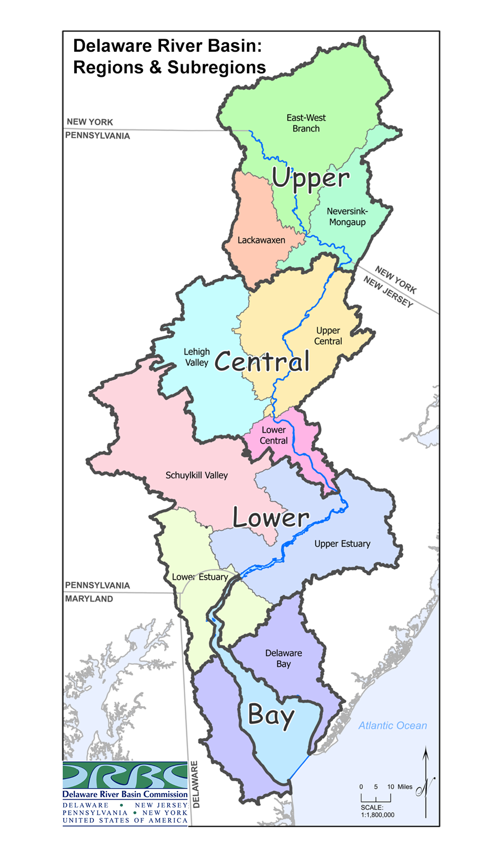
What is a Basin? What is a Watershed?
A watershed is the area of land draining to a particular stream. When it rains, the rain will absorb into the ground or run-off the land directly or via a storm drain into a waterway; both the waterway and the surrounding land make up the watershed.
A basin is a large watershed; it is made up of smaller sub-watersheds.
All watersheds that drain to the Delaware River make up the Delaware River Basin (DRB).
Native Populations
Indigenous Peoples have lived in the Delaware River Basin for more than 12,000 years; the largest group was the Lenape. Others include the Nanticoke, Mohawk & Oneida.
• Map of Native Territories (PDF, archive)
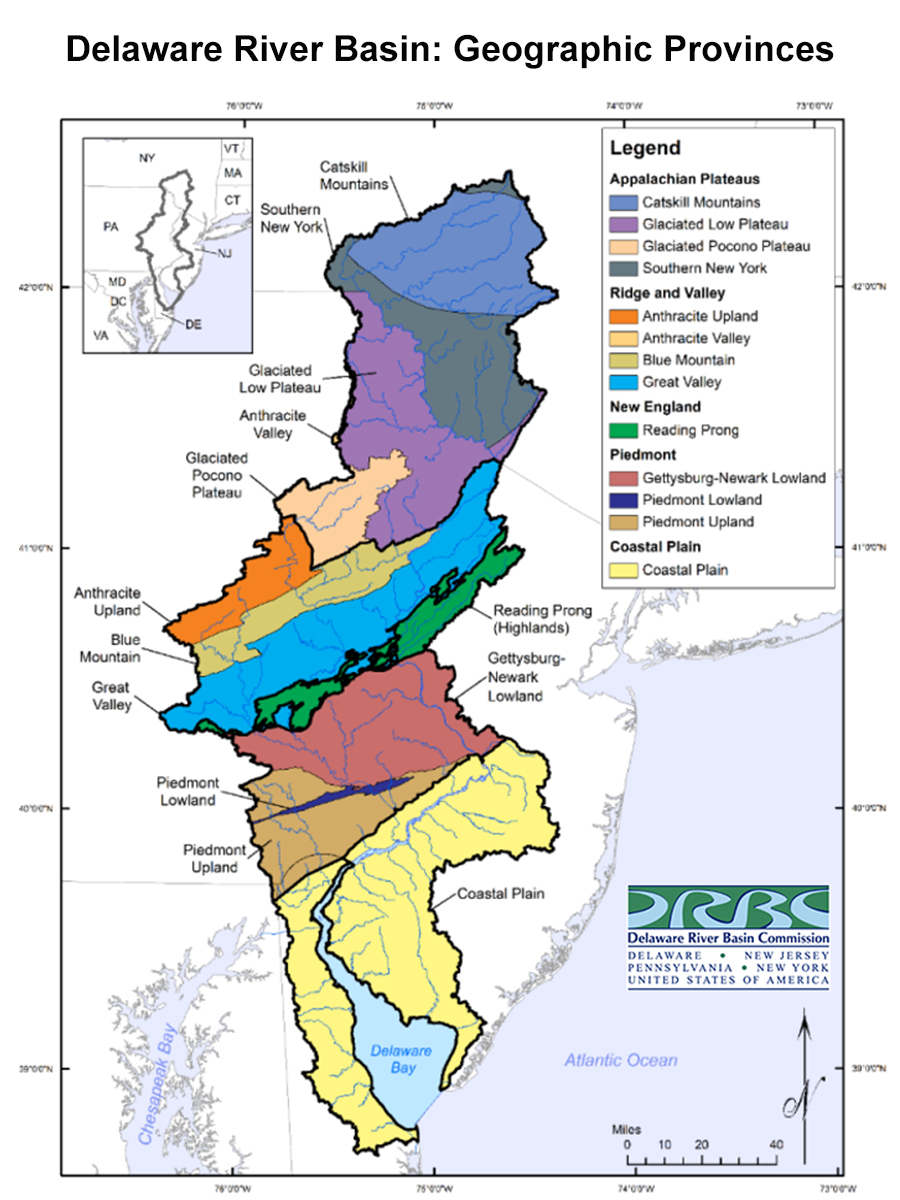
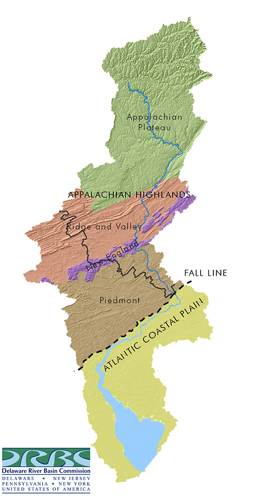
Physical Geography
DRB Area
The DRB spans 13,539 square miles in four states, plus the 782 square-mile Delaware Bay.
• Pennsylvania (6,454 square miles or 47.67 percent of the basin's total land area);
• New Jersey (3,009.5 square miles, or 22.23%);
• New York (2,395 square miles, 17.69%); and
• Delaware (979 square miles, 7.23%)
DRB Counties & Municipalities
The DRB includes 42 counties & 836 municipalities
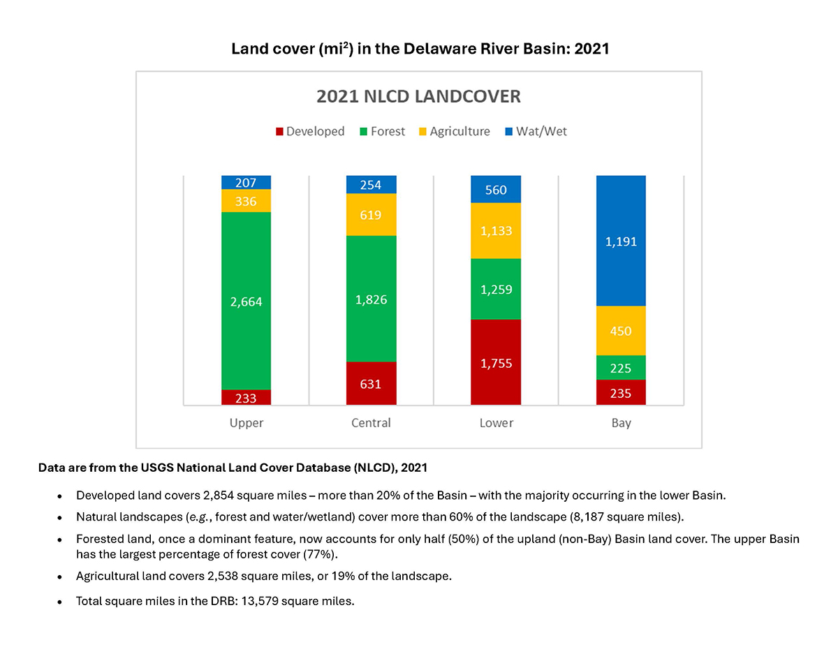
Land Cover
The northern part of the Basin is mostly tree canopy. The southern portion of the Basin includes more urban areas and farmland. As expected, more impervious surface (for example, paved roads) occurs in the more developed/urbanized sections of the Basin. Roughly 11% is wetlands - tidal and freshwater.
• DRB Land Cover (2021 data)
• DRB Land Cover (2016 map)
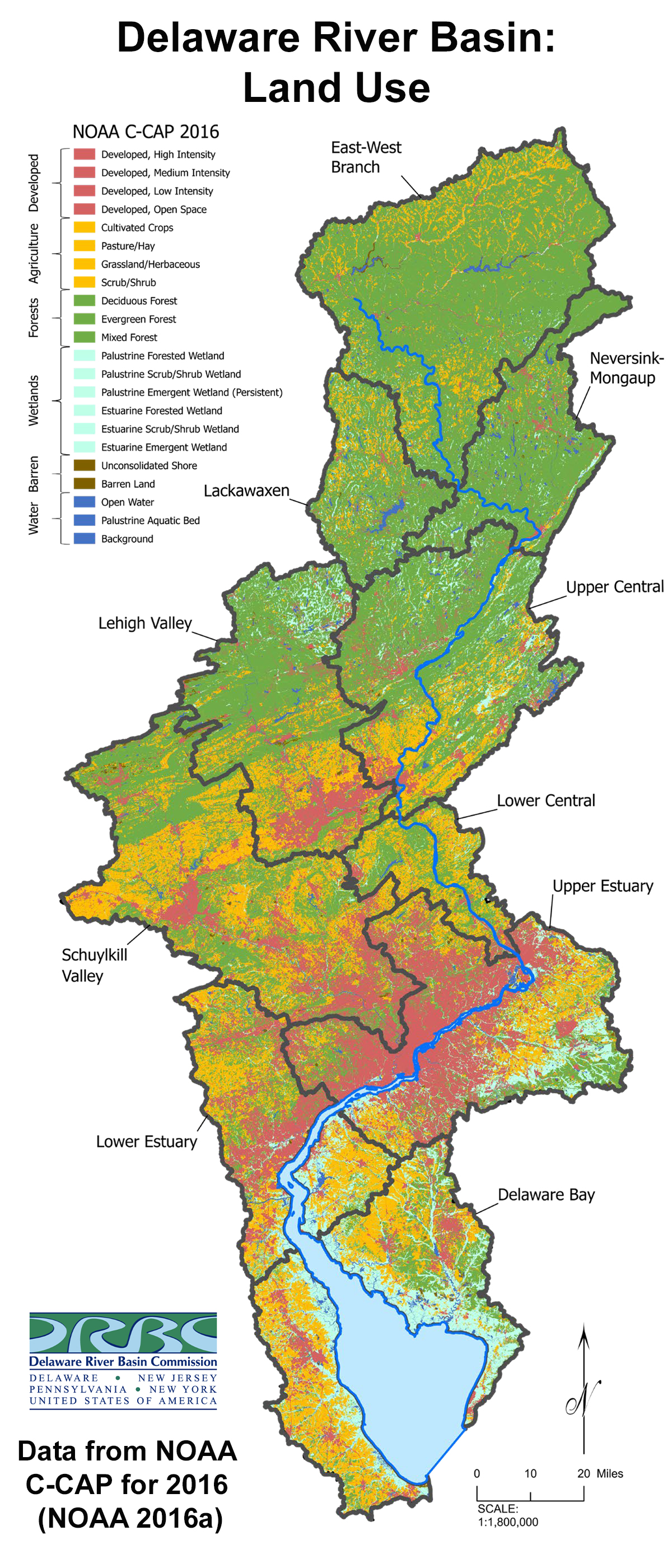
• DRB Land Cover Changes in Distribution (1996-2016)
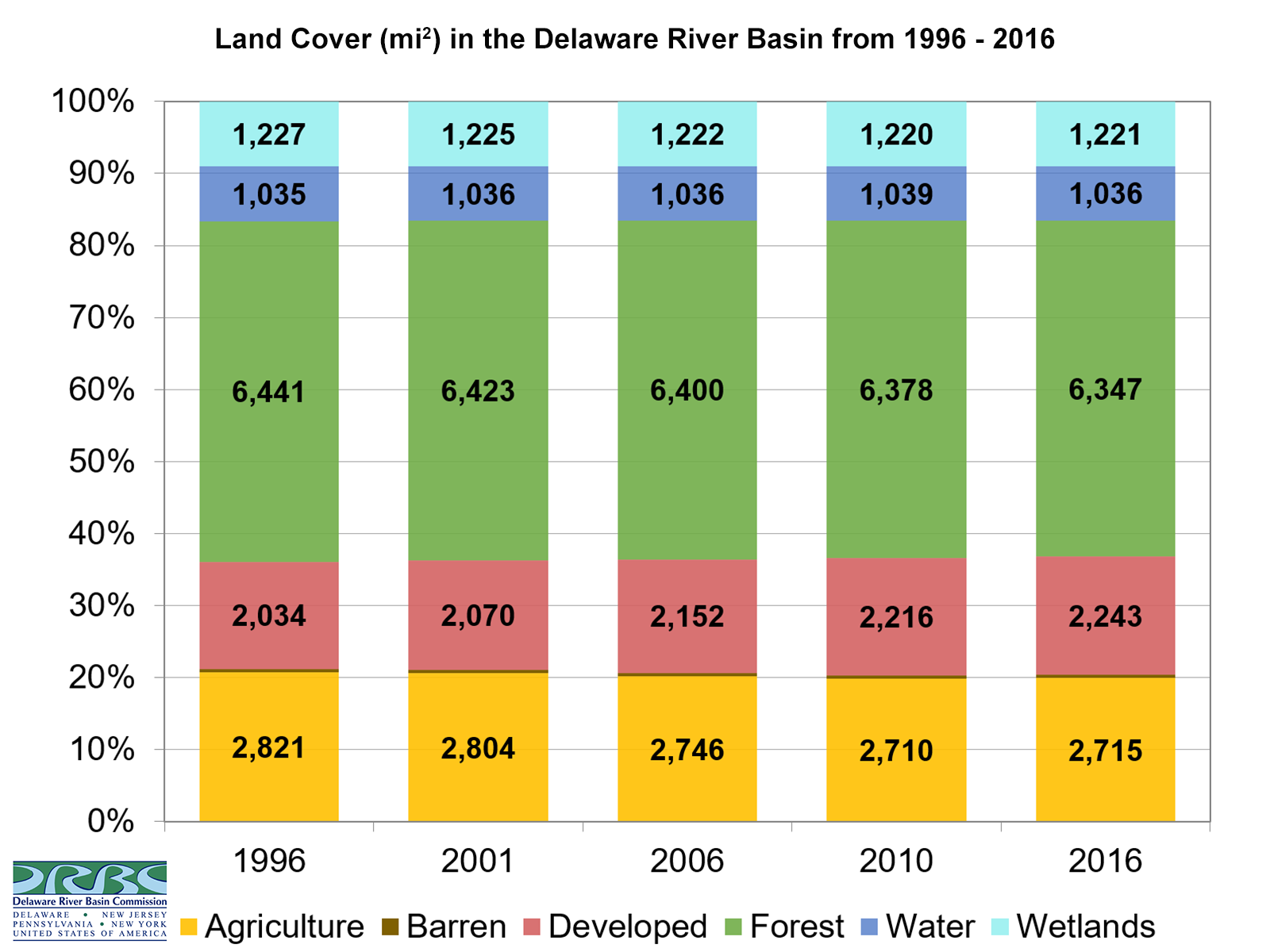
• Impervious Cover in the DRB (2021)
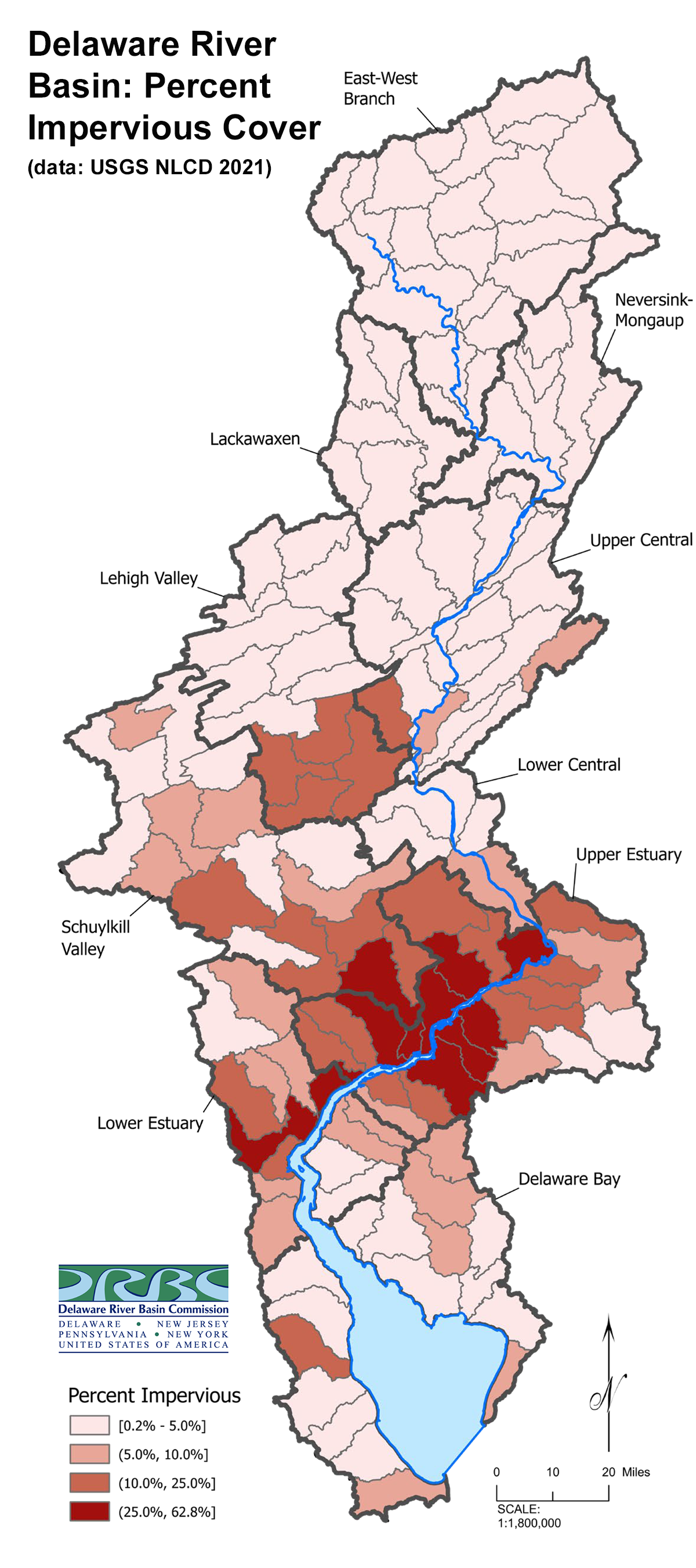
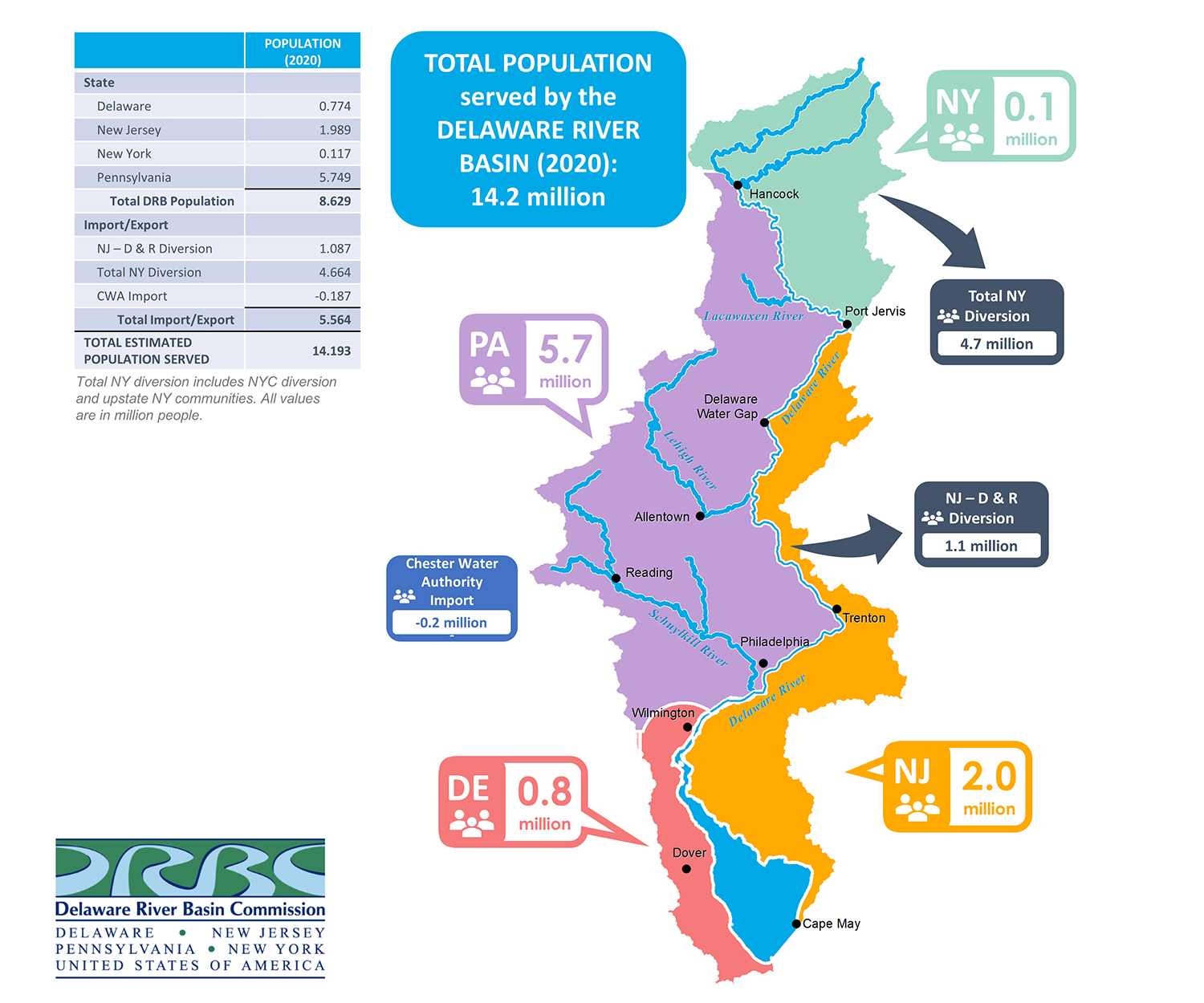
Population Served
The DRB has a large size-to-service ratio; the Basin drains only four-tenths of one percent of the total continental U.S. land area, but 14.2 million people (~4% of the U.S. population; jpg) rely on its waters for drinking, agricultural and industrial use.
• Population Served by the Delaware River Basin (PDF; presented by DRBC staff, June 2023, archive)
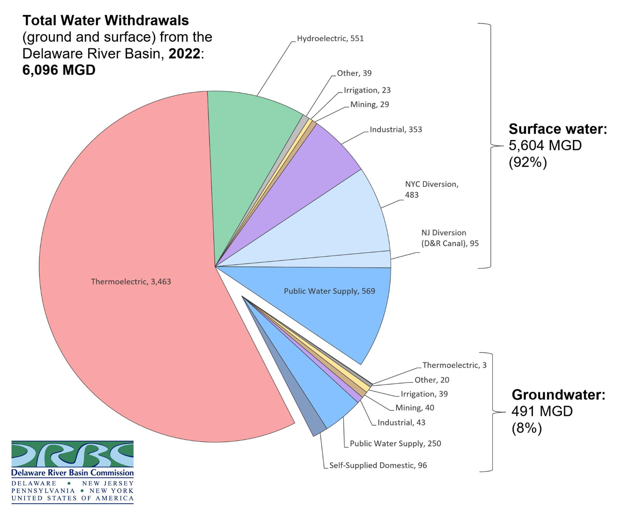
Basin Water Use
Nearly 6.1 billion gallons of water are withdrawn from the Basin each day (2022 data); this includes ground and surface water withdrawals for a variety of uses, the main three being thermoelectric power generation, public water supply and industry.
• The DRB supports the water needs of two of the nation's largest cities: Philadelphia and New York City, as well as ~one million people in northern New Jersey.
• Nearly 850 million gallons of water a day is used consumptively; this is water withdrawn from the Basin but not returned. The biggest consumptive users are out of Basin diversions for NYC and northern N.J., which total almost 2/3 of all water in the Basin that is used consumptively.
• While most water used in the Basin is from surface waters (~92%), of the 8% groundwater used, 71% is used to support drinking water needs (public & private).
The Basin as an Economic Engine
Supports a water-based economy of over $22 billion dollars annually, from recreation, water quality, water supply, hunting/fishing, ecotourism, forest, agriculture, open space and port benefits; supports ~600,000 jobs.
Learn more about the Delaware River and Basin through this video, brought to you by Delaware Currents, with special contributions from the DRBC and the Partnership for the Delaware Estuary. Aerial footage was provided by Light Hawk, with funding from The Lenfest Institute & the William Penn Foundation.