| NJ Home | | | Services A to Z | | | Departments/Agencies | | | FAQs |

|
||||||||||||
|
| ||||||||||||
|
|
|
|
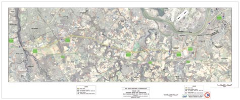
MapsThe project is located in the townships of Westampton, Burlington, Florence, Mansfield, Springfield and Bordentown in Burlington County from milepost 44.9 to milepost 56.8. The construction area extends from Rancocas-Mount Holly Road (Exit 45) to Route 130 (Exit 57). The files below are in Portable Document Format (PDF). You will need Adobe Acrobat Reader, which is available free from the state Adobe Access page, to view the files. Project Location
map
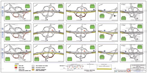
Stages
2a, 2b and 2c maps for
Interchanges 45, 47, 52,
56 and 57
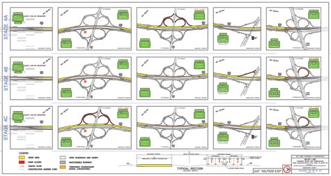
Stages
4a, 4b and 4c maps for
Interchanges 45, 47, 52,
56 and 57
|
 |
Contact Us | Privacy Notice | Legal Statement | Accessibility Statement |  |
| department: home | about | NJ commuter | in the works | business | engineering | freight, air & water | capital | community | data | links | index | ||
| statewide: NJ Home | about NJ | business | government | state services A to Z | departments |
||
| Copyright ©
State of New Jersey, 2002-2020 Department of Transportation P.O. Box 600 Trenton, NJ 08625-0600 |
|
|
Last Updated: March 29, 2010 |
||